
Dubuque County Conservation
Comprehensive Parks, Trails
and Open Spaces Plan
Update
INTRODUCTION
Overview & Process
Introduction
In 2020, Dubuque County Conservation adopted its first Comprehensive Parks, Trails, and Open Spaces Plan, serving as a strategic guide and roadmap for the county's programming, recreation, education, and management efforts. The plan has been a huge success—park usage has increased, the community is visiting more frequently, and educational programming has grown tremendously.
In response to this success, and as the board looks ahead to the next 5 years (with insights beyond that), Dubuque County Conservation commissioned a comprehensive plan update focused on receiving public input to help prioritize the next set of projects, reposition projects that are not feasible (e.g., changing financial, environmental, or management capabilities), and identify new opportunities that may be emerging.
To assist with this effort, the Conservation Board worked with RDG Planning & Design to help lead the master plan update. The process included a series of park visits, public open houses, staff work sessions, public input surveys, and Board work sessions. The findings from these efforts, along with the strategic framework and recommendations in the existing 2020 plan, directly informed the proposed improvements.
Notable differences between this update and the existing master plan include scaling back the proposed Swiss Valley Nature Center renovations and remaining neutral on the paving or not paving of Heritage Trail (this continues to be a divisive topic). Within this plan, a greater proportion of the funding is being allocated towards deferred maintenance, invasive species removal and ecological restoration, improving waterways and ponds, determining the feasibility of an ATV park, and land protection and acquisition.
Community Feedback
Community engagement was a central element of the planning process. Four community engagement events were held throughout Dubuque County to provide community members with opportunities to share their feedback and ideas for the future of the park system.
- Peosta: Swiss Valley Nature Center, March 19, 2026
- Asbury: Asbury Public Library, March 31, 2026
- Dubuque: Backpocket Events Space, Millwork District, April 2, 2026
- Cascade: Cascade Public Library, April 2, 2026
More than 200 people attended the open houses and provided feedback on the Dubuque County park system. In addition, an online public input survey was promoted on social media and other outreach channels. 586 respondents took the survey, a 270% increase from those who took the survey in 2020! Additionally, 97.2% of survey respondents strongly agree or somewhat agree that 'Funding County parks is a good use of my tax dollars,' indicating strong support for Dubuque County Conservation.
Key findings identified through the open houses and survey:
- Overall satisfaction with the park system remains high. 85% of respondents rated the quality of Dubuque County Parks as "Excellent" or "Good," indicating that the system is generally well-maintained and valued by the community. The plan builds on these strengths by maintaining existing assets while identifying improvements that address unmet needs.
- Some amenity needs are well met, while others are seen as limited. Respondents felt that open lawn spaces and unpaved gravel trails are the most
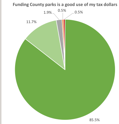
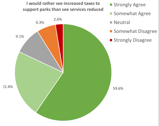
FIGURE 1: SURVEY QUESTION #5 PLEASE RATE YOUR LEVEL OF AGREEMENT WITH EACH OF THE FOLLOWING STATEMENTS.
Fully met needs within the park system. In contrast, rock climbing, cabins, and archery facilities were identified as the least met needs. In response, the plan includes recommendations to evaluate the feasibility of rock climbing opportunities and potential locations for rental cabins at select parks.
- Infrequent users are generally satisfied with park maintenance but seek additional reasons to visit. Among respondents who visit parks once per month or less, the most common reasons for limited use were using other city, state, or private properties and a lack of desired features. The plan focuses on adding or evaluating new amenities and programming opportunities that fulfill unmet needs that may encourage more frequent visitation.
- Trail Improvements, Habitat Preservation, and Land Protection/Acquisition remain the County's highest priorities. The top three priorities in the 2026 survey were the same as those identified in 2020, highlighting the importance of recommendations that reflect these: trail improvements, habitat preservation, and land protection/acquisition. Numerous recommendations in the update include trail maintenance and expansion, ecological restoration and habitat management projects, and future opportunities for potential land acquisition and park system expansion.
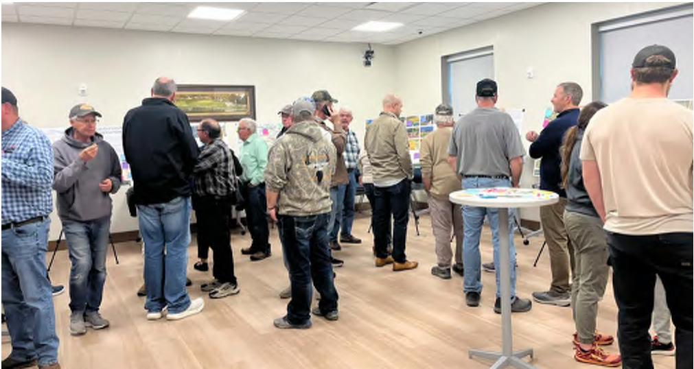
Community members provided feedback at the Cascade Public Library Open House on April 2, 2026.
- Heritage Trail paving remains a divisive issue. As in 2020, the future of Heritage Trail paving was one of the most divisive topics raised through the survey and open houses. While the issue remains important to many residents, this update does not make a recommendation regarding whether the Heritage Trail should be paved or remain unpaved. The topic may be considered through a future planning process.
The park system should serve a broad range of ages and household types. Survey respondents in both 2020 and 2026 were most commonly ages 35–44, and 389 respondents indicated that children age 19 or younger live in their household, with most households including children age 14 or younger. At the same time, respondents ages 55–64 increased by 14 percent compared to 2020. These findings reinforce the need for parks that serve families, older adults, and visitors of varying abilities. The plan includes recommendations for improved accessibility, restrooms, shelters, benches, sidewalks, and other amenities that support an inclusive visitor experience. The update includes recommendations for new trail opportunities, trail maintenance, and feasibility studies for additional trail connections.
- Hiking trails and connectivity remain the most important amenity for households. 59% of respondents identified hiking trails as the most important park amenity for their household. This finding supports the continued emphasis on trails from the 2020 plan.
- Rental cabins are a recurring interest. Rental cabins emerged as a consistent theme across the survey and open house feedback, reflecting interest in more overnight and destination-oriented recreation opportunities. The plan identifies potential locations where cabins may be considered and recommends further evaluation of their feasibility.
- Water access and water-based recreation are desired across the system. Open house participants frequently requested kayak and canoe launches, improved fishing access, water trails, and better access to waterfront areas. The plan addresses these needs through recommendations for improved water access and expanded water-based recreation opportunities at parks where conditions are appropriate.
- Ecological restoration and conservation are strongly supported. Community members consistently expressed support for habitat preservation, native vegetation, invasive species management, wetland and prairie restoration, and protection of natural resources. This feedback aligns with habitat preservation and land protection being among the highest survey priorities. The plan includes ecological restoration and conservation efforts.
resource management recommendations at multiple parks throughout the system.
Accessibility and Basic Amenities Remain Important to the Visitor
Accessibility and basic amenities remain important to the visitor experience. Open house participants identified needs for ADA improvements, sidewalk connections, restrooms, parking, buffering, and other basic park amenities. These improvements are integrated into park-specific recommendations to make parks more accessible and welcoming for visitors of all ages and abilities.
- Residents want expanded outdoor recreation opportunities. Requests for additional mountain biking, rock climbing, camping, cabins, and other outdoor recreation opportunities were common across the engagement process. These interests are generally
consistent with the unmet amenity
needs identified in the survey. The plan
includes recommendations and feasibility
studies for these uses at locations
where they could be accommodated.
Park Visitation Analysis
While community engagement provided insight into people's priorities and perceptions of the park system, visitation analysis was used to better understand how parks are currently used. The park visitation analysis was conducted using Placer.ai to better understand visitation patterns across the park system. The analysis found that total visitation of the park system has nearly doubled since 2019, demonstrating the importance of these facilities to both residents and visitors. Approximately 66% of visitors come from
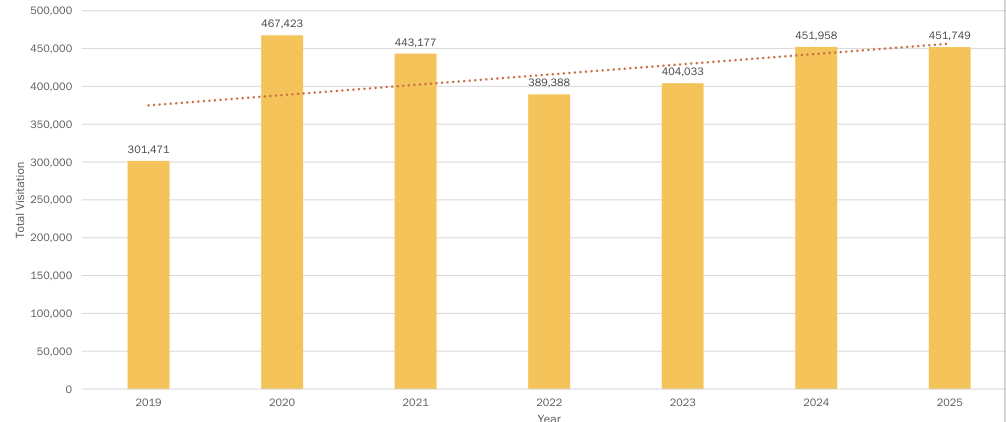
FIGURE 2: Total park system visitation for 2019-2025 year-over-year shows a growing trend.
family households, and most users are from Dubuque County – particularly the City of Dubuque – demonstrating strong local use. Lastly, parks with campgrounds and waterfront access tend to have higher overall visitation along with more non-local visitation. Full findings are included in the appendix.
The visitation analysis is a valuable planning tool for existing and future parks because it can identify and compare park use, understand visitor demographics, and other trends across the park system. This information can help identify amenities and experiences that are well used by the community, as well as gaps in facilities, programming, or geographic access.
All of this can also inform future investment decisions by helping the County prioritize improvements, evaluate opportunities for new amenities, and determine locations for future parks that will best serve the community.
Classifying Parks
In addition to understanding visitation patterns, it is important to understand the different types of parks within the system to develop recommendations that reflect each property's purpose, character, and primary use. Dubuque County Conservation offers a diverse array of park types. These park types, or classifications, host a variety of programming and recreation opportunities. The park classifications identified below were developed to better understand the purpose and intended use of each park. Understanding the different park types can help guide the planning for future improvements and expansion. The following classifications are influenced by the National Recreation and Park Association (NRPA) and the Iowa DNR but have been tailored to best suit Dubuque County Conservation. The classifications are intended to be flexible, and some properties may have characteristics of more than one category. Additionally, the principal use of a park was also considered when classifying it and may differ from its name. For example, Interstate Power Preserve is identified as a Recreation Park and not a Preserve because it primarily functions as a place for mountain biking and hiking.
The park classifications are characterized below:
Nature Preserves
- Prioritize protection of ecosystems and wildlife habitats
- Serve as refuges for species
- Minimize human interference
- Aim to conserve biodiversity
- Allow for scientific study and observation
- Heavily emphasize conservation over human recreation
Wildlife Areas
- Support wildlife habitat and natural communities
- Typically host nature-based recreation (e.g., fishing, hunting, trapping, hiking)
- Limit recreation that is more disruptive to wildlife
Marinas
- Center around prominent water features like rivers and lakes
- Typically feature water-based recreation (e.g., kayaking, boating, fishing, etc.)
- Offer additional forms of recreation
Regional Trails
- Offer trails as the sole feature, sometimes include supporting amenities like restrooms and water fountains
- Are off-street linear connectors intended to support regional recreation
Recreation Parks
- Offer diverse opportunities for recreation
- Developed for human recreation
- Typically offer amenities like park shelters, playgrounds, etc.
- May include areas for organized sports and informal natural areas for recreation
- Vary in size
Special Use Parks/Facilities
- Encompass a broad range of park and facility types
- Designed for a single type of use, purpose, attraction, or activity
Together, the community engagement findings, visitation analysis, and park classification system provide a foundation for evaluating and prioritizing future investments in the county park system. By combining community priorities with an understanding of current park use, the recommendations on the following pages identify opportunities to enhance recreation, conservation, and visitor experience across the park system.
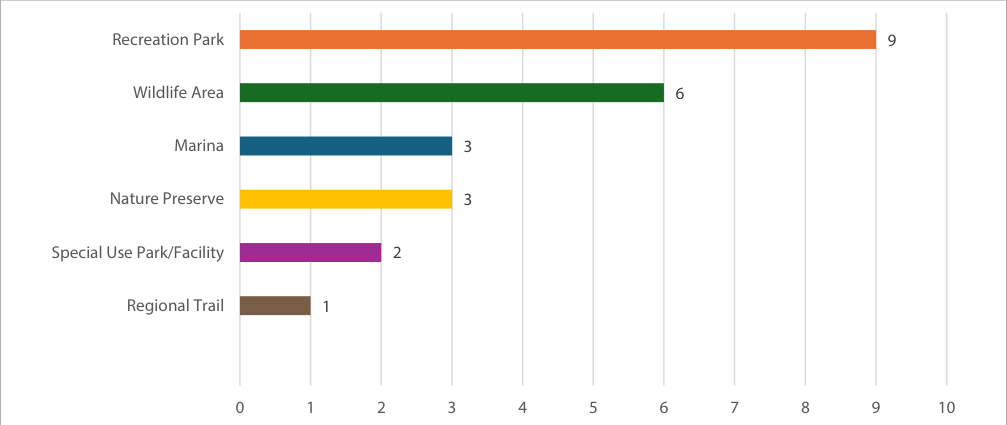
FIGURE 3: NUMBER OF PROPERTIES WITHIN EACH PARK CLASSIFICATION MANAGED BY DUBUQUE COUNTY CONSERVATION.
PARK PLAN UPDATES
Park Plan Legend
Refer to this general legend when reviewing the park master plans on the following pages. Icons with a black background indicate existing elements, while icons with an orange background indicate proposed elements. Each improvement recommendation is also categorized by the type of improvement it represents and its project type. See the abbreviation key below.
TR = Trail Improvements
HP = Habitat Preservation & Restoration
LP = Land Protection & Acquisition of Sensitive Natural Areas / Hunting and Fishing Land Access
WQ = Water Quality Enhancements / Floodplain Management
PK = Park Infrastructure Enhancements
N = New Improvement
D = Deferred Maintenance / Code Compliance Improvements
L = Park & Preserve Land Acquisition
Existing | Proposed

Campsite
Existing | Proposed


Water Hookup


Electrical Hookup


Trash Disposal

Picnic Area

Information


Picnic Shelter

Interpretive Signage / Exhibit


RV Campground


Viewing Area

Sewer Hookup

Cabins
Existing Proposed
Fishing
Fishing Pier
Kayaking/Kayak Launch
Marina
Drinking Water
Food Service
Pit Toilet
Restrooms
Showers
Parking
Benches/Seating
Ecological Restoration
Bridge
$ Existing $ Proposed

Shelter

Scenic Viewpoint


Hiking/Trailhead


Dog Park


Caving

Disc Golf

Playground
Golfing

Golfing
☆☆☆☆☆☆☆☆☆

Rock Climbing

Biking/Parking

Mountain Biking
Bike Repair Station

Boat Launch
Bridge
County Park Locations
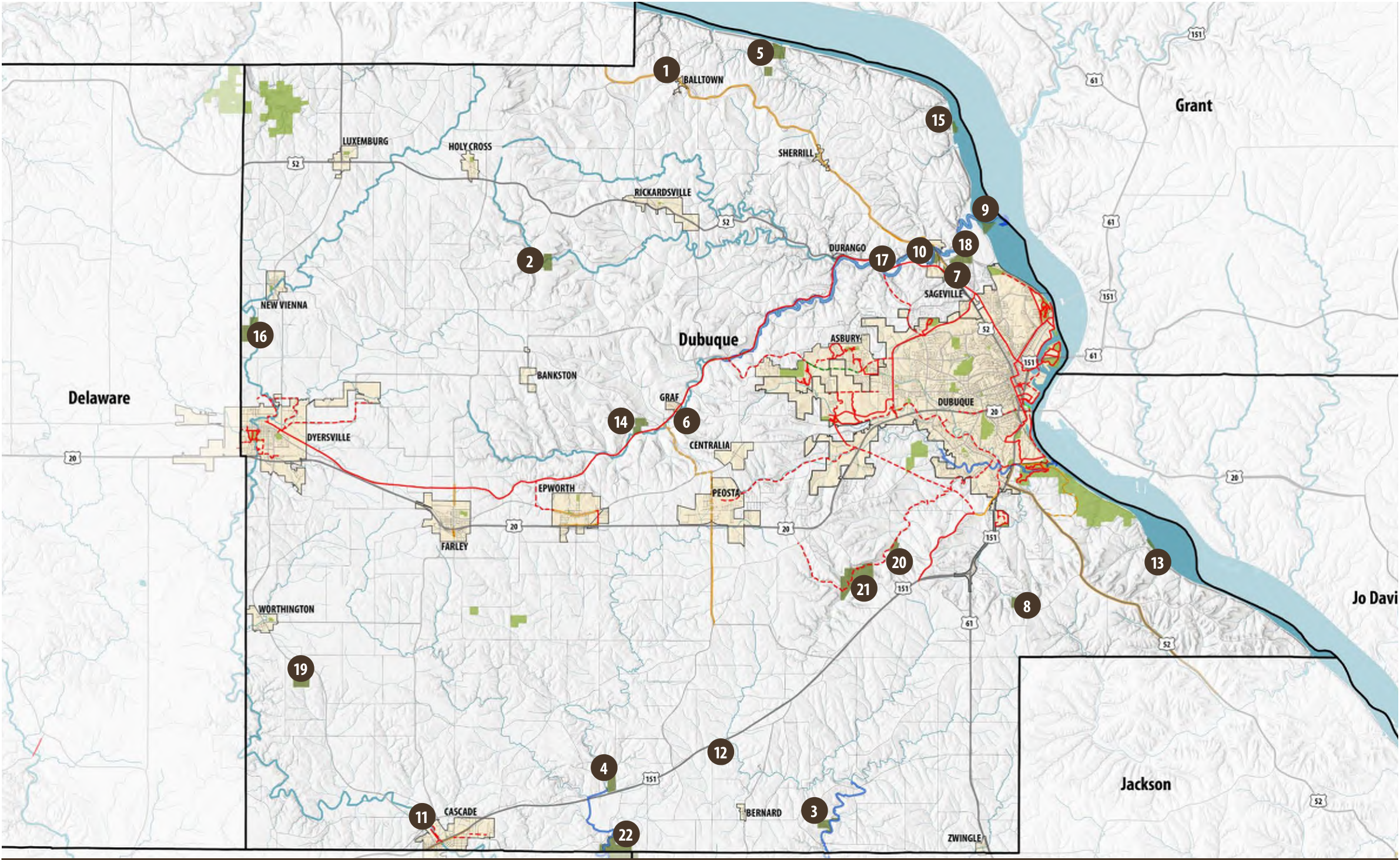
This map provides an overview of the Dubuque County Conservation park locations. In addition, a table of recommendations for general county-wide improvements is below. These pertain to items such as future land acquisition, development of additional cabins, and other maintenance items.
1 Balltown Overlook 12 McCarthy Wildlife Area
2 Bankston Park 13 Massey Marina
3 Bowstring Wildlife Area 14 Miller McGrath Wildlife Area
4 Fillmore Recreation Area 15 Mud Lake Park
5 Finley's Landing 16 New Wine Park
6 Graf Park 17 Pohlman Prairie
7 Heritage Pond/Campground 18 Proving Grounds
8 Interstate Power Preserve 19 Ringneck Ridge Wildlife Area
9 John Deere Marsh 20 Swiss Valley Park/Campground
10 Little Maquoketa River Mounds 21 Swiss Valley Nature Preserve
11 Locher Recreation Area 22 Whitewater Canyon
| Project Description | Project Type | Improvement Category | Prioritization (in years) | Remarks | |||
|---|---|---|---|---|---|---|---|
| 0-5 | 6-10 | 11+ | Total Cost | ||||
| County Wide Improvements (Not Park Specific) | $6,000,000.00 | $9,000,000.00 | $3,000,000.00 | $18,000,000.00 | |||
| ATV park development & land acquisition. | N | PK | $3,000,000.00 | Repurpose degraded lands (avoid sensitive areas). | |||
| Park & preserve land acquisition. | L | LP | $3,000,000.00 | ||||
| Park & preserve land acquisition. | L | LP | $3,000,000.00 | ||||
| Park & preserve land acquisition. | L | LP | $3,000,000.00 | ||||
| Maintenance facility relocation. | D | PK | $3,000,000.00 | ||||
| Cabins. | N | PK | $3,000,000.00 | ||||
Delaware
Jo Daviess
Heritage Trail
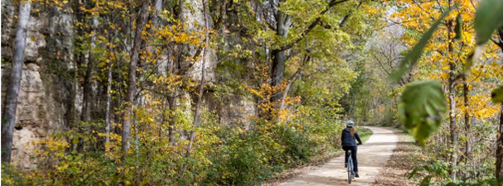
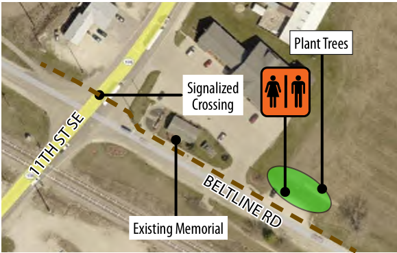
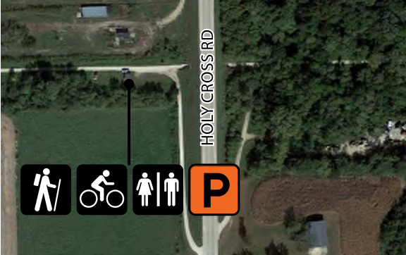
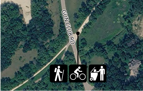
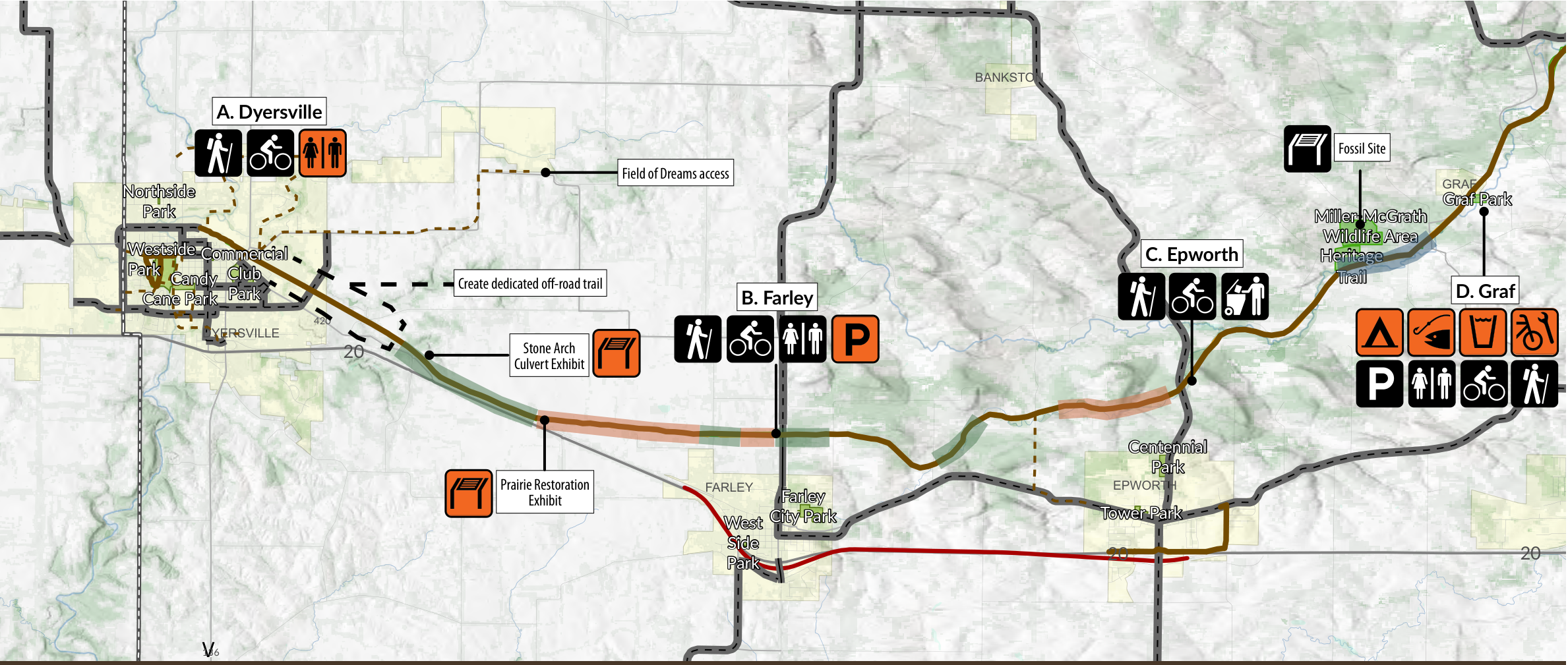
The following pages provide improvement recommendations for each of the eight Heritage Trail trailheads and access points based on community and staff feedback. Note: at this time, the plan update does not make recommendations for the future of Heritage Trail regarding paving. More detailed sets of recommendations for Graf and Sageville trailheads are located on the Graf Park and Heritage Pond & Campground park pages.
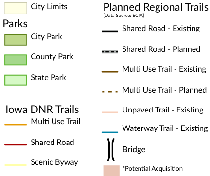
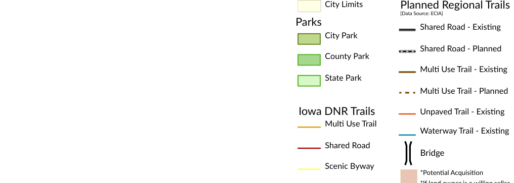
Potential Acquisition
If landowner is a willing seller
| Project Description | Project Type | Improvement Category | Prioritization (in years) | Remarks | |||
|---|---|---|---|---|---|---|---|
| 0-5 | 6-10 | 11+ | Total Cost | ||||
| Heritage Trail | $105,000.00 | $6,445,000.00 | $- | $6,550,000.00 | |||
| Dyersville Trailhead - Add restrooms. | N | PK | $35,000.00 | ||||
| Dyersville Trailhead - Plant shade trees. | N | TR | $5,000.00 | ||||
| Farley Access Point - Add parking lot. | N | PK | $20,000.00 | ||||
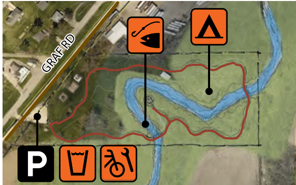
| Graf Trailhead - Install public water supply and drinking fountain. | N | TR | $- | Graf Trailhead line item costs included in Graf Park section. | |||
| Graf Trailhead - Install a bike repair station. | N | TR | $- | Graf Trailhead line item costs included in Graf Park section. | |||
| Graf Trailhead - Enhance fishing access. | D | PK | $- | Graf Trailhead line item costs included in Graf Park section. | |||
| Graf Trailhead - Add a ride/hike-in camping area with tent platforms. | N | PK | $- | Graf Trailhead line item costs included in Graf Park section. | |||
Heritage Trail
Potential Acquisition
If landowner is a willing seller
| Project Description | Project Type | Improvement Category | Prioritization (in years) | Remarks | |||
|---|---|---|---|---|---|---|---|
| 0-5 | 6-10 | 11+ | Total Cost | ||||
| Heritage Trail | $105,000.00 | $6,445,000.00 | $- | $6,550,000.00 | |||
| Twin Springs Trailhead - Enhance kayak launch. | D | PK | $15,000.00 | ||||
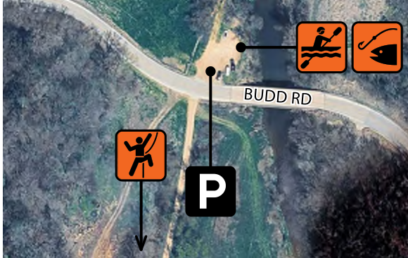
| Budd Road Trailhead - Enhance kayak launch. | D | PK | $15,000.00 | ||||
| Budd Road Trailhead - Enhance fishing access. | D | PK | $5,000.00 | ||||
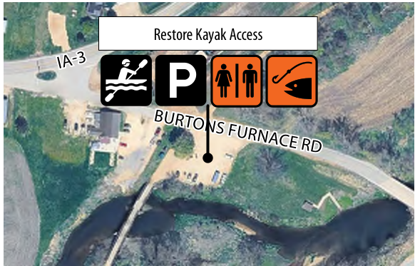
| Durango Trailhead - Add restrooms. | N | PK | $35,000.00 | ||||
| Durango Trailhead - Restore kayak access. | $15,000.00 | ||||||
| Durango Trailhead - Enhance fishing access. | D | PK | $5,000.00 | ||||
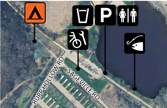
| Sageville Trailhead - Add primitive camping with tent platforms. | N | PK | $- | Sageville Trailhead improvement costs included in Heritage Pond & Campground section. | |||
| Streambank Restoration. | D | HP | $1,000,000.00 | ||||
| Replace bridges #3 and #6. | D | TR | $4,000,000.00 | ||||
| Replace bridge #11. | D | TR | $700,000.00 | ||||
| Replace bridges #20 and #24. | D | TR | $700,000.00 | ||||
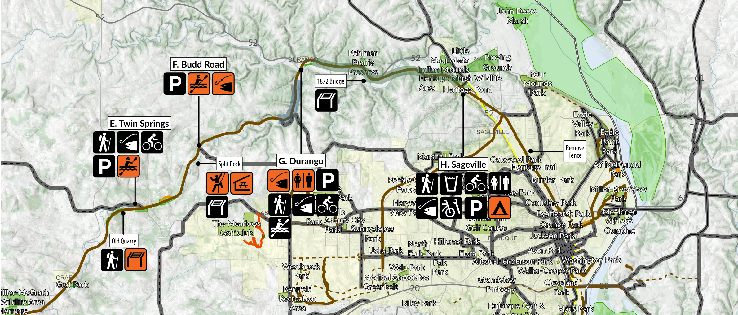

E. Twin Springs Trailhead
F. Budd Road Trailhead
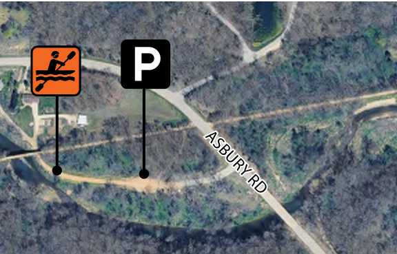
G. Durango Trailhead
H. Sageville Trailhead
Balltown Overlook
600 Balltown Road | 0.06 Acres
Special Use Park
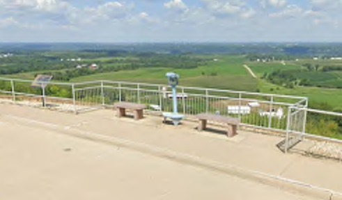
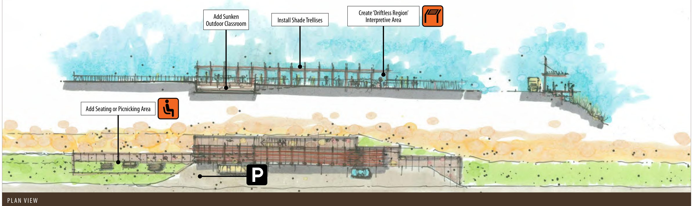
The Balltown Overlook is situated in Balltown in northwest Dubuque County. This scenic overlook provides viewers with a vast view of the Driftless Region. The overlook includes amphitheater-style seating, a telescope for viewing, and a picnic area. It's a frequent stop for residents and visitors who want to check out the vista at all times of year. Nearby local businesses benefit from the site's popularity.
Recent Progress:
- Completed railing maintenance
- Performed sidewalk leveling
| Project Description | Project Type | Improvement Category | Prioritization (in years) | Remarks | |||
|---|---|---|---|---|---|---|---|
| 0-5 | 6-10 | 11+ | Total Cost | ||||
| Balltown Overlook | $25,000.00 | $213,640.00 | $25,000.00 | $263,640.00 | |||
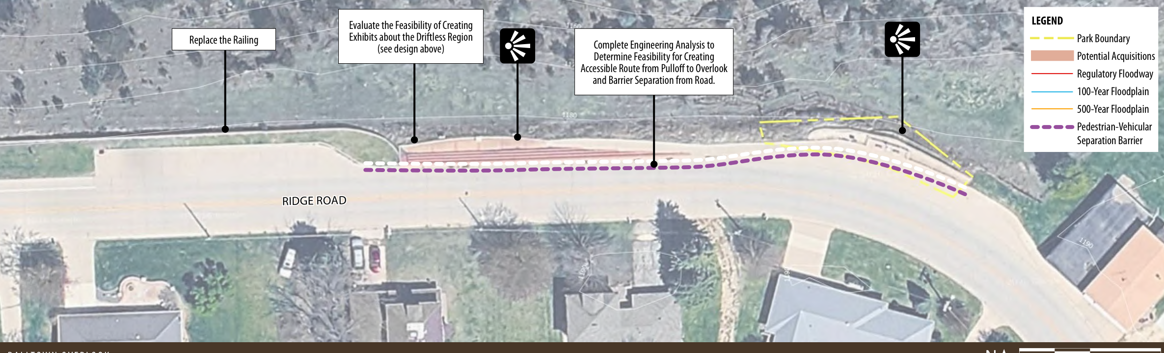
| Complete engineering analysis to determine feasibility for creating accessible route from pulloff to overlook and barrier separation from road. | D | PK | $25,000.00 | Evaluate roadway changes to accommodate vertical separation and sidewalk. | |||
| Replace barrier railings. | D | PK | $75,000.00 | ||||
| Create an accessible route from the vehicular pulloff to the overlook | D | TR | $38,640.00 | ||||
| Create a pedestrian-vehicular barrier wall. | D | PK | $100,000.00 | ||||
| Evaluate the feasibility of creating interpretive exhibits about the Driftless Region. | N | PK | $25,000.00 | Interpretive area, shade trellises, and sunken outdoor classroom. | |||
Bankston Park
17826 Bankston Park Road | 142 Acres
Recreation Park
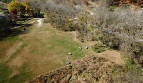
Bankston Park is a rural woodland and meadow in northwest Dubuque County that offers an isolated getaway for primitive campers. The park also maintains a network of hiking trails with stream access for trout fishing. The wooded hilltop on the south side of Bankston Park has a high concentration of karst depressions, a sinkhole feature of the local geology, which feeds underground water reserves and cools the ground temperature. These unique conditions support a population of the endangered Pleistocene snail.
Recent Progress:
- Trail construction
- Installed a group campfire at the north side of the park
- Raised outlet structure to improve the pond
| Project Description | Project Type | Improvement Category | Prioritization (in years) | Remarks | |||
|---|---|---|---|---|---|---|---|
| 0-5 | 6-10 | 11+ | Total Cost | ||||
| Bankston Park | $651,556.47 | $60,000.00 | $888,000.00 | $1,599,556.47 | |||
| Install a pedestrian bridge. | N | PK | $225,000.00 | Pre-engineered steel bridge over stream. | |||
| Add a new shower house. | N | PK | $600,000.00 | ||||
| Add primitive group camping area and crushed stone on the east end of the park. | N | PK | $75,000.00 | ||||
| Improve existing primitive campground. | D | PK | $288,000.00 | Add gravel drives, formalize the camping area. | |||
| Land acquisition - to be determined. | L | LP | To be determined if adjacent landowner is willing to sell. | ||||
| Forest restoration. | D | HP | $44,077.13 | ||||
| Retire picnic area; maintain access to pump pit. | D | PK | $5,000.00 | ||||
| Establish oak savanna interior to primitive camping area. | D | HP | $2,479.34 | Shade and reduce mowing at campsite. | |||
| Connect trail system. | N | TR | $60,000.00 | ||||
| Stream stabilization, fishing improvements. | D | WQ | $300,000.00 | ||||

Legend
Park Boundary
Potential Acquisitions
Regulatory Floodway
100-Year Floodplain
500-Year Floodplain
Retire Picnic Area;
Maintain Access to Pump Pit
Establish Proposed Trail Loops
Stabilize Stream
Add Primitive Group Camping
& Crushed Stone

Create Oxbow Interpretive Area

Add Gravel Campground Drives
Primitive Group Camping

Establish a Savanna at
Campsite
Preservation Area
Bowstring Wildlife Area
727 Creekbranch Lane | 88 Acres
Wildlife Area
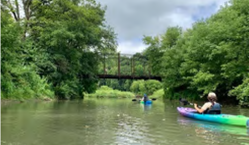
Bowstring Wildlife Area is one of Dubuque County Conservation’s newest park areas, a rugged hunting and hiking area in southern Dubuque County between Bernard and Zwingle, with Lytle Creek meandering along the edge of the property. The park entrance is home to a unique "bowstring," historic tied arch bridge which sits at its original location over Lytle Creek.
Recent Progress
- Created gravel parking lot
| Project Description | Project Type | Improvement Category | Prioritization (in years) | Remarks | |||
|---|---|---|---|---|---|---|---|
| 0-5 | 6-10 | 11+ | Total Cost | ||||
| Bowstring Wildlife Area | $458,402.20 | $100,000.00 | $- | $558,402.20 | |||
| Install primitive toilet. Add a small shelter. Improve kayak launch site. | N N D | PK PK PK | $35,000.00 $50,000.00 $15,000.00 | ||||
| Restore historic bridge for pedestrian access. | D | TR | $225,000.00 | Evaluation underway at time of publication. | |||
| Remove trash from the park. Ecological restoration. | D D | PK HP | $75,000.00 $158,402.20 | ||||
Remove Trash

Improve Kayak Launch Site
Restore Historic Bridge
for Pedestrian Access

Fillmore Recreation Area
21655 Highway 151 | 105 Acres
Recreation Park
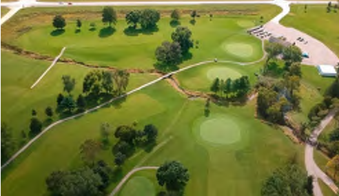
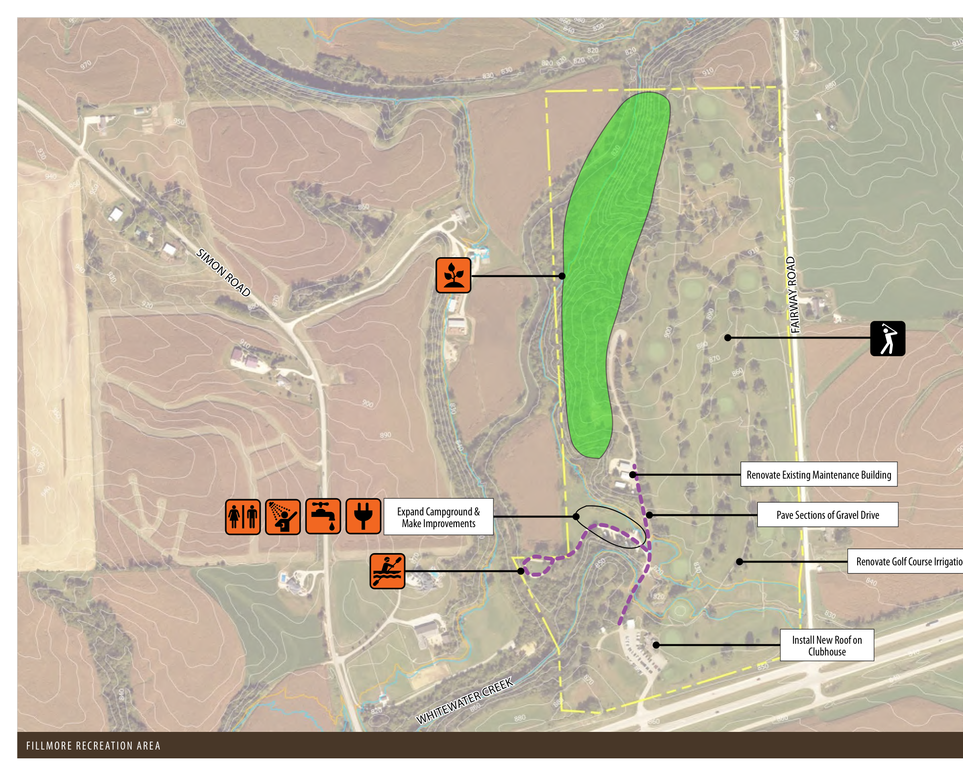
This recreation area offers a nine-hole golf course. The clubhouse supports golfing and serves food and drinks as well as provides showers and restrooms. In addition to the golf course, park amenities like a playground, campground, and kayak launch area along White Water Creek provide a pleasant recreation experience.
| Project Description | Project Type | Improvement Category | Prioritization (in years) | Remarks | |||
|---|---|---|---|---|---|---|---|
| 0-5 | 6-10 | 11+ | Total Cost | ||||
| Fillmore Recreation Area | $225,000.00 | $1,862,220.39 | $350,000.00 | $2,437,220.39 | |||
| Expand and make campground improvements. | D | PK | $350,000.00 | Upgrade electrical service, water, add restroom and shower house. | |||
| Ecological restoration. | D | HP | $90,220.39 | Woodland/stream bank on bluff west of the golf course; handwork only. | |||
| Pave gravel drive and pads within campground. | D | PK | $192,000.00 | ||||
| Install kayak access point and create water trails. | N | TR | $25,000.00 | ||||
| Install a new roof for the clubhouse. | D | PK | $80,000.00 | Evaluate replacing with a steel roof in the future. | |||
| Irrigation system renovation. | D | PK | $1,500,000.00 | ||||
| Renovate existing golf course maintenance building. | D | PK | $200,000.00 | ||||

Park Boundary
Potential Acquisitions
Regulatory Floodway
100-Year Floodplain
500-Year Floodplain
Paved Drive
HIGHWAY 151
Finley's Landing Park
24709 Finley's Landing Road | 107 Acres
Marina
Finley's Landing is a remote park, beach, and marina located on the north end of Dubuque County. Its primary attraction is a large sandbar which offers close-up, immersive views of the Mississippi River. The park also hosts a small marina and boat ramp, making it a popular launching point for boats and fishermen. The campground, equipped with restrooms and electric sites, is an excellent addition for boaters and beachgoers alike, allowing for an extended stay at the isolated park. Additionally, an archaeological site exists at the northwest side of the park, providing opportunity for a future interpretive exhibit.
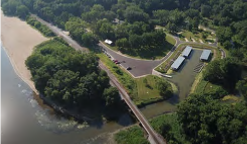
Recent Progress:
- Installed new bridge and bridge lighting
- Updated electric lines
- Repaved the roads
| Project Description | Project Type | Improvement Category | Prioritization (in years) | Remarks | |||
|---|---|---|---|---|---|---|---|
| 0-5 | 6-10 | 11+ | Total Cost | ||||
| Finley's Landing Park | $391,500.00 | $75,000.00 | $780,000.00 | $1,246,500.00 | |||
| Ecological restoration. | D | HP | $60,000.00 | Remove invasive species. | |||
| Land acquisition - to be determined. | L | LP | To be determined if adjacent landowner is willing to sell. Explore land protection for threatened and endangered species through private and/or public means. | ||||
| Stabilize primitive trail system. | D | TR | $98,000.00 | Trail maintenance; add wood chips. | |||
| Add primitive trails. | N | TR | $196,000.00 | ||||
| Add ADA route for beach access. | D | TR | $19,500.00 | Mobi-mat system - two 6.5' x 100' mats, plus staple extractor, plus shipping. | |||
| Add ADA parking for sandbar access. | D | PK | $18,000.00 | ||||
| Add tent platforms at the hike-in campsite. | N | PK | $15,000.00 | ||||
| Stream restoration. | D | WQ | $180,000.00 | ||||
| Replace the showerhouse. | D | PK | $600,000.00 | ||||
| Habitat improvements, restoration. | D | HP | $60,000.00 | Ruffed grouse and woodland habitat. | |||
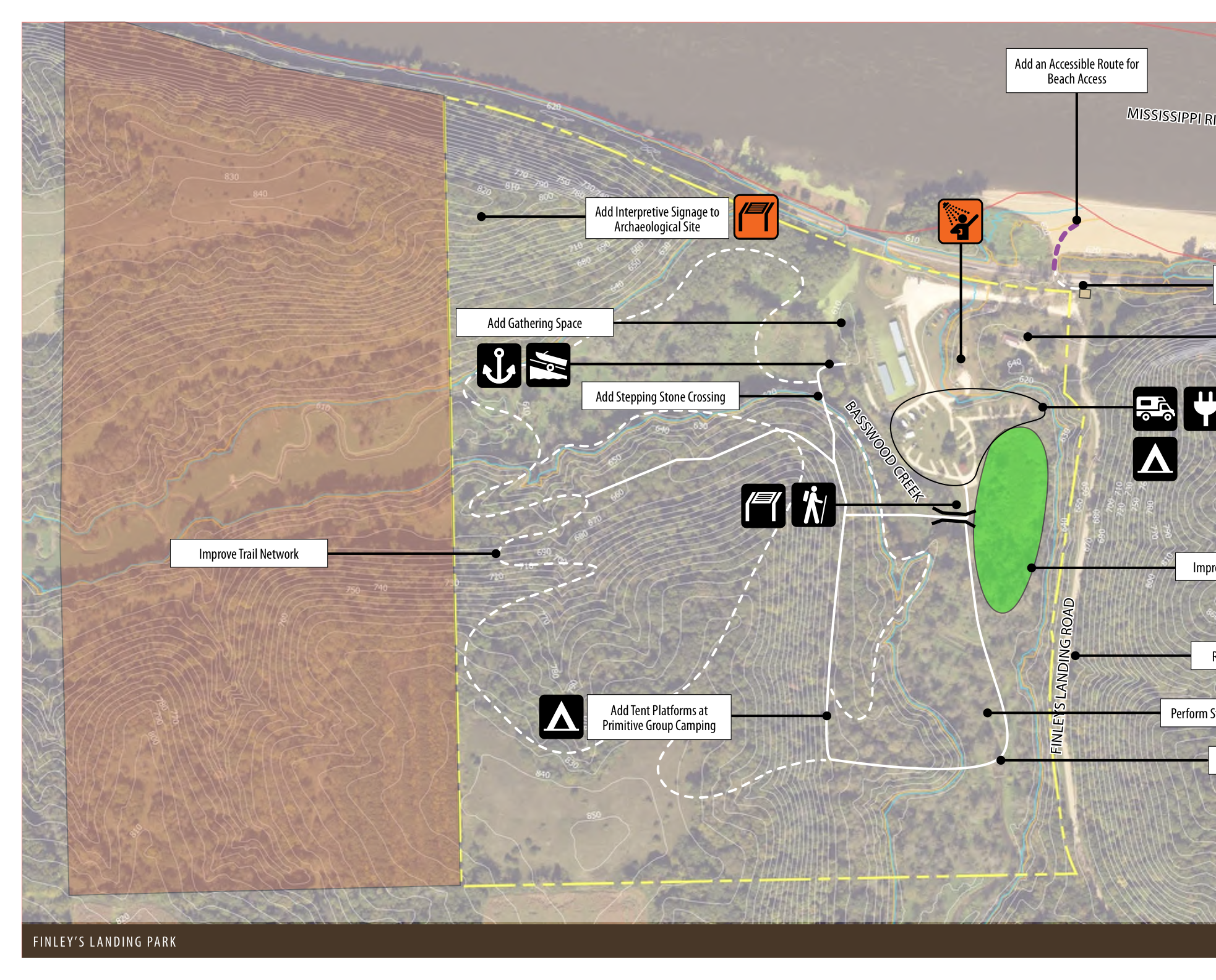
Add an Accessible Route for Beach Access
Add Interpretive Signage to Archaeological Site
Add Gathering Space
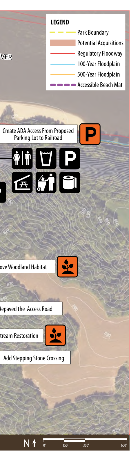
Create ADA Access from Proposed Parking Lot to Railroad
Add Stepping Stone Crossing
Improve Trail Network
Improve Woodland Habitat
Repave the Access Road
Add Tent Platforms at Primitive Group Camping
Perform Stream Restoration

Add Stepping Stone Crossing
Graf Park
490 Graf Road | 8 Acres
Recreation Park
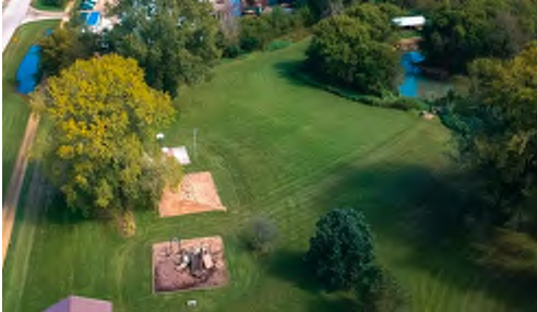
Graf Park is situated along the midpoint of Heritage Trail. The general-use park includes a playground, restrooms, rentable pavilion, and open space along the Little Maquoketa River.
| Project Description | Project Type | Improvement Category | Prioritization (in years) | Remarks | |||
|---|---|---|---|---|---|---|---|
| 0-5 | 6-10 | 11+ | Total Cost | ||||
| Graf Park | $600,000.00 | $5,000.00 | $- | $605,000.00 | |||
| Enhance fishing access. | D | PK | $5,000.00 | ||||
| Expand access throughout the park by adding trails. | N | TR | $20,000.00 | ||||
| Add a ride/hike-in camping area with tent platforms. | N | PK | $15,000.00 | ||||
| Install public water supply and drinking fountain. | N | PK | $250,000.00 | Enhance regional appeal of Heritage Trail. | |||
| Install a bike repair station. | N | PK | $15,000.00 | ||||
| Stream restoration. | D | WQ | $300,000.00 | ||||
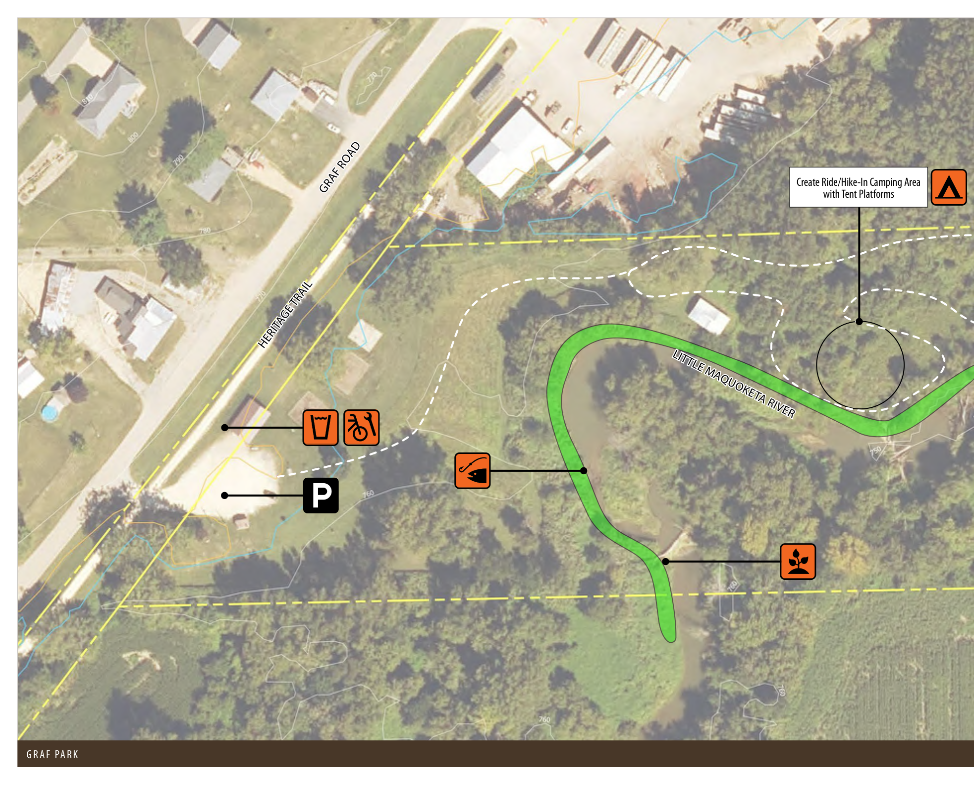
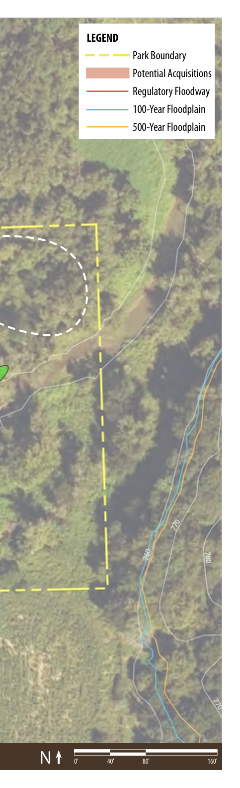
Create Ride/Hike-In Camping Area with Tent Platforms
Heritage Pond & Campground
11330 Rupp Hollow Road | 16 Acres
Recreation Park
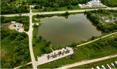
Located north of Dubuque in Sageville, Heritage Pond is the most highly frequented trailhead of the Heritage Trail, with easy access from Dubuque. This is where the Heritage Trail transitions from pavement to crushed limestone, moving from a more urban to a more rural feel. The pond is a popular fishing spot and offers easy waters for kayakers or stand-up paddleboarders. The campground and picnic pavilions make extended stays and long rides on the trail a breeze for locals and visitors. As a trailhead, Heritage Pond is a central hub connecting to other parks in this region of the county, including Sageville Marsh, Proving Grounds Recreation Area, John Deere Marsh, and The Little Maquoketa River Mounds.
| Project Description | Project Type | Improvement Category | Prioritization (in years) | Remarks | |||
|---|---|---|---|---|---|---|---|
| 0-5 | 6-10 | 11+ | Total Cost | ||||
| Heritage Pond & Campground | $1,135,000.00 | $975,000.00 | $- | $2,110,000.00 | |||
| Plant trees, buffer campground and pond. | N | HP | $50,000.00 | Overstory and understory trees for campground and highway buffering. | |||
| Improve campground, renovate drive lanes, parking areas. | D | PK | $750,000.00 | Repave/Redo individual sites (gravel or new concrete), add shower house. | |||
| Install a nature playground. | N | PK | $225,000.00 | ||||
| Expand and renovate the existing parking lot. | D | PK | $455,000.00 | ||||
| Perform shoreline restoration and erosion control along the south side of the pond. | D | WQ | $86,000.00 | ||||
| Add pedestrian pathway along south and west side of pond. | N | TR | $168,000.00 | ||||
| Evaluate the feasibility of rock climbing at the west side | N | PK | $- | ||||
| Re-route trail around parking area. | N | TR | $42,000.00 | ||||
| Add tent platforms, steps and formalize bike/hike and camping. | N | TR | $60,000.00 | Camping around the base of the west side bluff, facing Sageville Marsh. | |||
| Add parking at tent platform area, remove shelter that is in disrepair. | N | PK | $49,000.00 | ||||
| Create "Gateway to Heritage Trail" & interpretive exhibits. | N | TR | $225,000.00 | Work with local partner to re-evaluate; create an immersive experience that explores the history of the former railroad. | |||
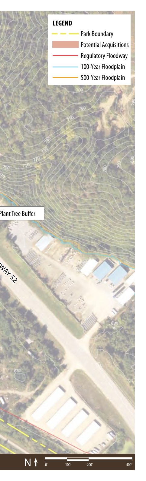
Legend

Expand & Renovate the Parking Lot
P↑
Improve the Gateway to the Heritage Trail


Plant Tree Buffer
Refurbish & Relocate Interpretive Signage Along Heritage Trail

Add Primitive Group Camping & Tent Platforms

Pull back parking area; Remove the Existing Shelter; Add Tent Platform Parking
Heritage Pond
Renovate & Repave Campsites

Shower Facility
Plant Tree Buffer
INTERSTATE POWER PRESERVE
7523 Olde Davenport Road | 83 acres
Recreation Park
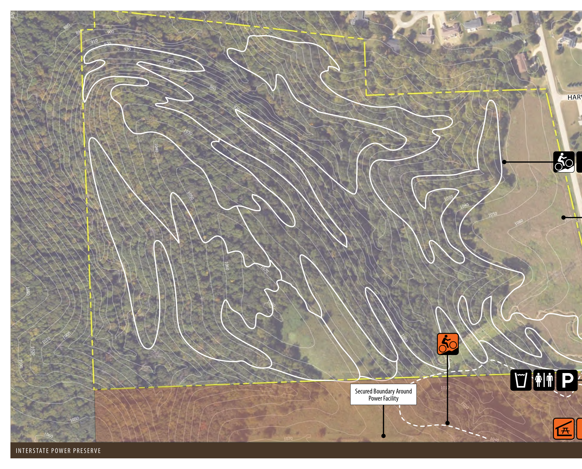
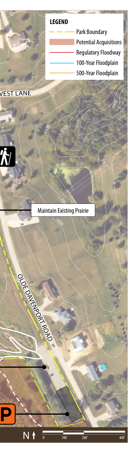
Interstate Power Company (IPC) Forest Preserve is in southeast Dubuque County between Highway 61 and Highway 52. Hiking trails have been used locally since the property was donated by the Interstate Power Company in 1988. More recently, a network of mountain biking trails has been built by the Tri-State Mountain Bike Riders and immensely increased use of the park. As a forest preserve, woodland management is a key priority, and installing bat houses would also be a positive improvement at this park. The county also maintains an 8-acre swath of restored prairie here.
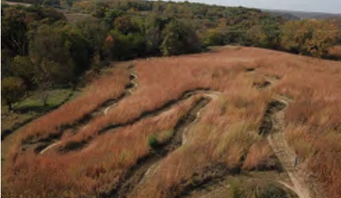
Recent Progress:
- Installed a restroom
| Project Description | Project Type | Improvement Category | Prioritization (in years) | Remarks | |||
|---|---|---|---|---|---|---|---|
| 0-5 | 6-10 | 11+ | Total Cost | ||||
| Interstate Power Preserve | $154,435.26 | - | $530,200.00 | $684,635.26 | |||
| Land acquisition - to be determined. | L | LP | To be determined if adjacent landowner is willing to sell. | ||||
| Expand parking lot. | N | PK | $130,200.00 | ||||
| Add more mountain bike trails as park expands. | N | TR | $320,000.00 | ||||
| Add shade shelter. | N | PK | $80,000.00 | ||||
| Woodland restoration. | D | HP | $120,000.00 | Remove invasive species. | |||
| Maintain existing prairie. | D | HP | $34,435.26 | ||||
Legend
50 Ft
Maintain Existing Prairie
Olde Davenport Road
Secured Boundary Around Power Facility
Parking
John Deere Marsh
18714 Riverside Road | 81 Acres
Wildlife Area
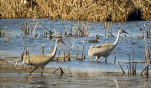
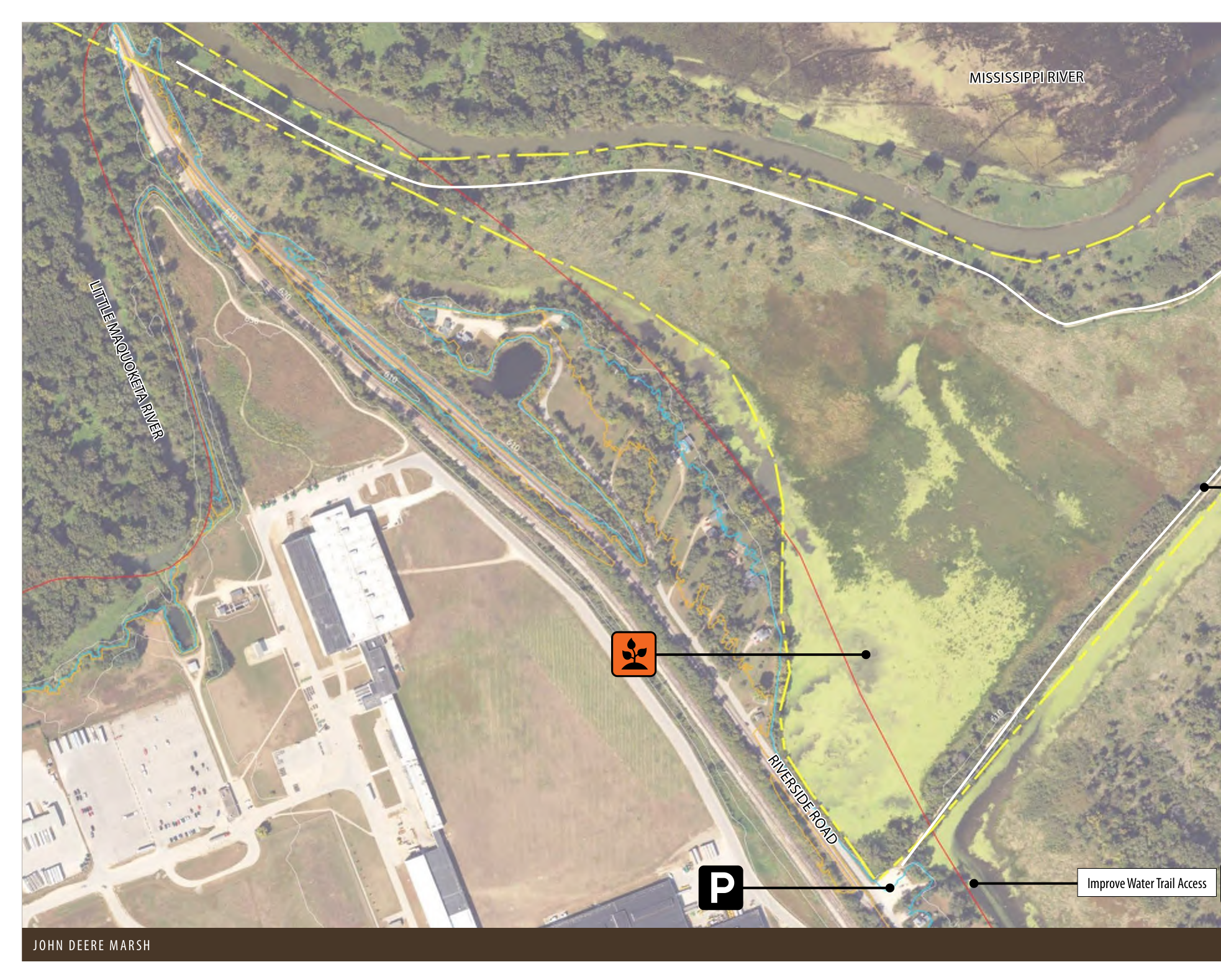
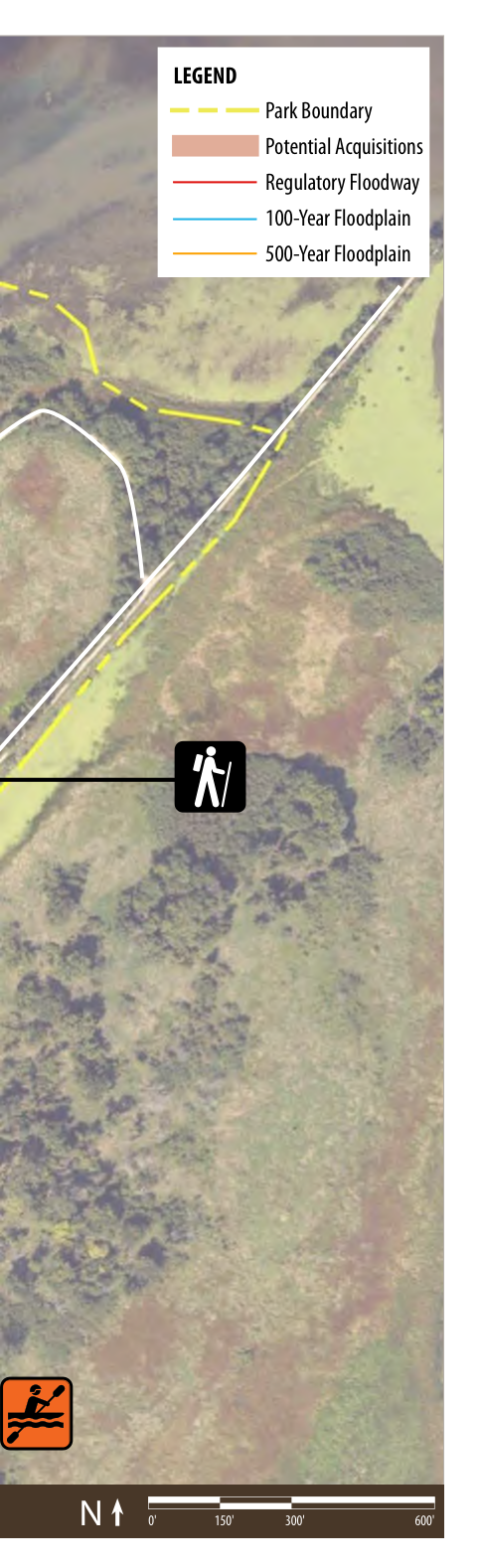
John Deere Marsh is managed by the US Fish and Wildlife Service and assisted by the Dubuque County Conservation Board. The marsh attracts many bird and waterfowl species, making it a prime location for birding. Additionally, there is a hiking trail that goes through the area and a gravel boat ramp that allows small watercraft to access the Mississippi River.
| Project Description | Project Type | Improvement Category | Prioritization (in years) | Remarks | |||
|---|---|---|---|---|---|---|---|
| 0-5 | 6-10 | 11+ | Total Cost | ||||
| John Deere Marsh | $- | 22,000.00 | $- | 22,000.00 | |||
| Ecological restoration. Improve water trail access. | D D | HP TR | $18,000.00 $4,000.00 | ||||
LITTLE MAQUOKETA RIVER
A
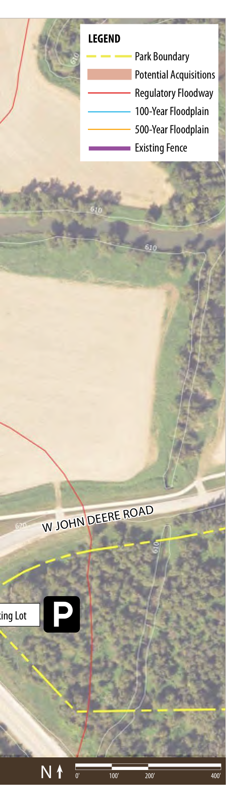
Little Maquoketa River Mounds
18062 Walking Way | 41 Acres
Nature Preserve
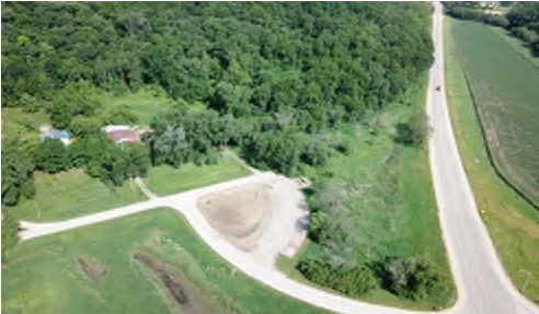
Protection of the Little Maquoketa River Mounds represents an effort to preserve and conserve the extraordinarily beautiful lands along the Little Maquoketa River, stretching from Durango to the Mississippi River, and to help connect the Heritage Trail to additional significant historical, cultural, and natural areas.
| Project Description | Project Type | Improvement Category | Prioritization (in years) | Remarks | |||
|---|---|---|---|---|---|---|---|
| 0-5 | 6-10 | 11+ | Total Cost | ||||
| Little Maquoketa River Mounds | $603,000.00 | $288,000.00 | $- | $891,000.00 | |||
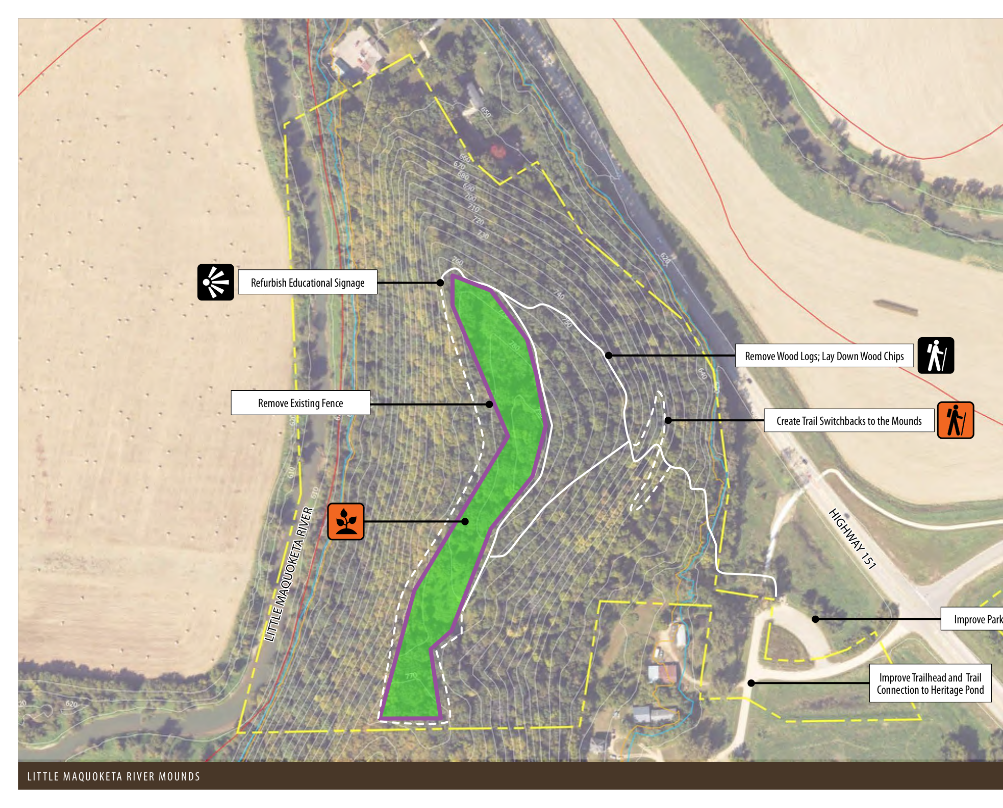
| Ecological restoration. | D | HP | $72,000.00 | Anticipate hand removal, spot spray, etc. over mounds; remove invasive species and woody vegetation; put on a cycle of prescribed burning; restore prairie. | |||
| Refurbish educational signage about the cultural significance and history of the mounds. | D | PK | $4,000.00 | ||||
| Remove the fencing. | D | PK | $87,000.00 | ||||
| Improve parking lot. | D | PK | $66,000.00 | ||||
| Re-align trail to mounds. | D | TR | $28,000.00 | Minimize structural/steps to mounds. | |||
| Create a trail loop that goes around the mounds. | N | TR | $72,000.00 | ||||
| Remove the wood timbers along the trail, stabilize grade with wood chips. | D | TR | $112,000.00 | ||||
| Improve the trailhead and connection to Heritage Pond & Trail. | D | TR | $450,000.00 | ||||
LITTLE MAQUOKETA RIVER
Locher Recreation Area
116 Acres
Recreation Park
Locher Recreation Area is a 116-acre parcel of land that has recently been acquired by Dubuque County Conservation, who was the benefactor of Eastern Iowa Conservation Foundation's efforts, as well as Pheasants Forever and the Department of Natural Resources. The area will become a new park space for the public featuring more nature-based recreation and activities.
| Project Description | Project Type | Improvement Category | Prioritization (in years) | Remarks | |||
|---|---|---|---|---|---|---|---|
| 0-5 | 6-10 | 11+ | Total Cost | ||||
| Locher Recreation Area | $6,684,355.37 | $280,000.00 | $395,000.00 | $7,359,355.37 | |||
| Add parking lots. | N | PK | $672,000.00 | ||||
| Add paved access drives. | N | PK | $546,000.00 | ||||
| Establish prairie. | N | HP | $42,355.37 | ||||
| Add a large pavilion with restrooms and fire pits. | N | PK | $1,050,000.00 | ||||
| Add public water supply. | N | PK | $225,000.00 | ||||
| Add a small shelter. | N | PK | $80,000.00 | ||||
| Add riprap fishing nodes/fish habitat. | N | WQ | $180,000.00 | ||||
| Perform shoreline restoration around Locher Lake. | N | WQ | $2,100,000.00 | ||||
| Perform shoreline restoration at the North Fork Maquoketa River. | N | WQ | $300,000.00 | ||||
| Install bird blinds. | N | HP | $20,000.00 | ||||
| Install boardwalk overlook. | N | PK | $150,000.00 | ||||
| Add a pedestrian bridge across the river. | N | PK | $225,000.00 | ||||
| Establish a self-serve kayak rental stand. | N | PK | $50,000.00 | ||||
| Add a boat launch. | N | PK | $125,000.00 | ||||
| Add an ADA-accessible kayak launch. | N | PK | $60,000.00 | ||||
| Add pit toilets near the boat launch. | N | PK | $35,000.00 | ||||
| Add a 10' wide path around Locher Lake. | N | TR | $1,120,000.00 | ||||
| Add a single-track companion trail around lake. | N | TR | $80,000.00 | ||||
| Create walking trails to the south of the lake. | N | TR | $124,000.00 | ||||
| Create an additional access drive on the southwest side of the property off HWY 136. | N | PK | $150,000.00 | ||||
| Evaluate and study alternative routes, future trail connection to Cascade. | N | TR | $25,000.00 | ||||

100-Year Floodplain
500-Year Floodplain
Self-Serve Kayak Rental
Add Additional Access Drive
Install Bird Blinds
Add Trail Connection to Cascade
LOCHER RECREATION AREA
116 acres
Several potential trail routes to connect to Cascade are presented on the following page. Specifically, a trail that connects to the Cascade Riverfront Trail would create a connection into town. As the park is developed, a more thorough feasibility study to evaluate a connection should be completed to understand the potential costs, strengths, and weaknesses of each route.
Massey Marina
9526 Massey Station Road | 36 acres
Marina
Massey Marina is a riverfront park on the eastern edge of Dubuque County. The park is primarily used as a marina and has many amenities for boats including two harbors and a gas dock. The expansive campground makes it easy for tent and RV campers to spend a night on the river. Fishing accommodations include piers and a fish cleaning station. A concession stand and shelter make Massey Marina the ideal spot for a picnic on the river.
| Project Description | Project Type | Improvement Category | Prioritization (in years) | Remarks | |||
|---|---|---|---|---|---|---|---|
| 0-5 | 6-10 | 11+ | Total Cost | ||||
| Massey Marina | $292,330.58 | $62,000.00 | $264,000.00 | $618,330.58 | |||
| Stream restoration. | D | WQ | $102,000.00 | ||||
| Conduct trail feasibility study to link Massey Marina to Mines of Spain. | N | TR | $25,000.00 | Conduct a study with State of Iowa to create a trail connection to Mines of Spain. | |||
| Install more inland trails at bottomland hardwood forest. | N | TR | $62,000.00 | ||||
| Campground improvements. | D | PK | $155,000.00 | Paving, upgrade electrical service, fix water lines, add tent platforms, reconfigure the dump station. | |||
| New parking lot and boat ramp. | D | PK | $264,000.00 | ||||
| Land acquisition - to be determined. | L | LP | To be determined if adjacent landowner is willing to sell. | ||||
| Woodland restoration. | D | HP | $10,330.58 | At the bottomland hardwood site. | |||


Park Boundary
Potential Acquisitions
Regulatory Floodway
100-Year Floodplain
500-Year Floodplain
Make Campground Improvements
Remove Flood Debris and Trash
Conduct Trail Feasibility Study for a Trail Connection to Mines of Spain
MASSEY STATION ROAD
MISSISSIPPI RIVER
McCarthy Wildlife Area
100 Acres
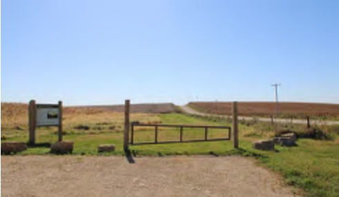
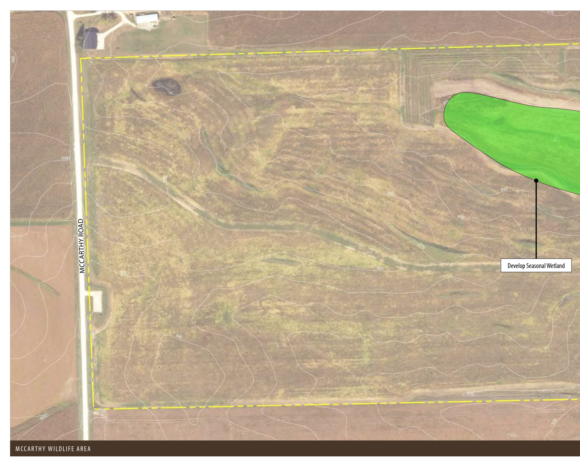
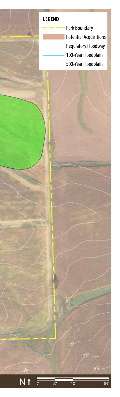
This wildlife area is open to public hunting during state hunting seasons. The area was a former crop field and was recently planted with native prairie. Additionally, there is a shelterbelt to prevent wind erosion. Future goals include planting trees and establishing wetlands.
| Project Description | Project Type | Improvement Category | Prioritization (in years) | Remarks | |||
|---|---|---|---|---|---|---|---|
| 0-5 | 6-10 | 11+ | Total Cost | ||||
| McCarthy Wildlife Area | $25,000.00 | $160,000.00 | $- | $185,000.00 | |||
| Wetland design & permitting. | N | WQ | $25,000.00 | ||||
| Wetland development. | N | WQ | $160,000.00 | ||||
MCCARTHY ROAD
Develop Seasonal Wetland
Miller McGrath Wildlife Area
20909 Millville Road | 93 acres
Wildlife Area
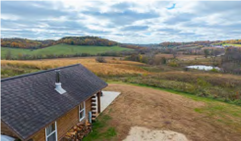
This wildlife area is adjacent to the Heritage Trail and is comprised of prairies and wooded ravines. The pond is stocked with game fish and provides good opportunities for anglers. Additionally, the area is open to public hunting during designated hunting seasons.
Recent Progress:
- Installed an ADA-accessible path to the cabin
| Project Description | Project Type | Improvement Category | Prioritization (in years) | Remarks | |||
|---|---|---|---|---|---|---|---|
| 0-5 | 6-10 | 11+ | Total Cost | ||||
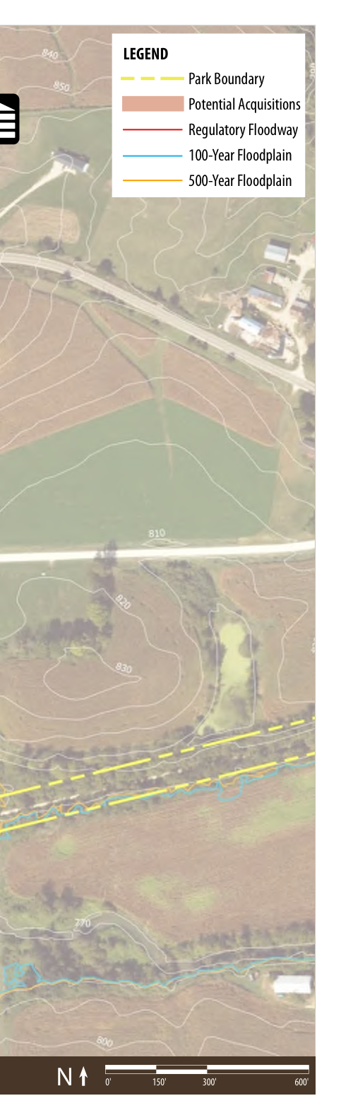
| Miller McGrath Wildlife Area | $925,000.00 | $133,200.00 | $- | $1,058,200.00 | |||
| Land acquisition - to be determined. | L | LP | To be determined if adjacent landowner is willing to sell. | ||||
| Develop trails throughout the park. | N | TR | $83,200.00 | ||||
| Evaluate feasibility for more cabins. | N | PK | $10,000.00 | ||||
| Evaluate trail connections to Heritage Trail. | N | TR | $10,000.00 | ||||
| Evaluate feasibility of adding public water supply. | N | PK | $5,000.00 | ||||
| Add additional cabins. | N | PK | $900,000.00 | ||||
| Forest restoration. Prairie restoration. | D D | HP HP | $20,000.00 $30,000.00 | ||||

Forest Restoration
Evaluate Feasibility for More Cabins & Public Water Supply
LEGEND
Park Boundary
Potential Acquisitions
Regulatory Floodway
100-Year Floodplain
500-Year Floodplain
Dubuque County Law
Enforcement Shooting Range
MILLVILLE ROAD

Prairie Restoration
Evaluate Connections to Heritage Trail
HERITAGE TRAIL
010
Mud Lake Park
22312 Golf Lake Road | 30 acres
Marina
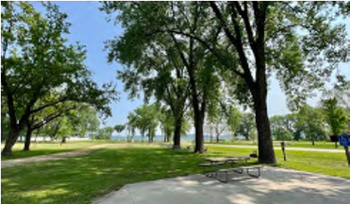
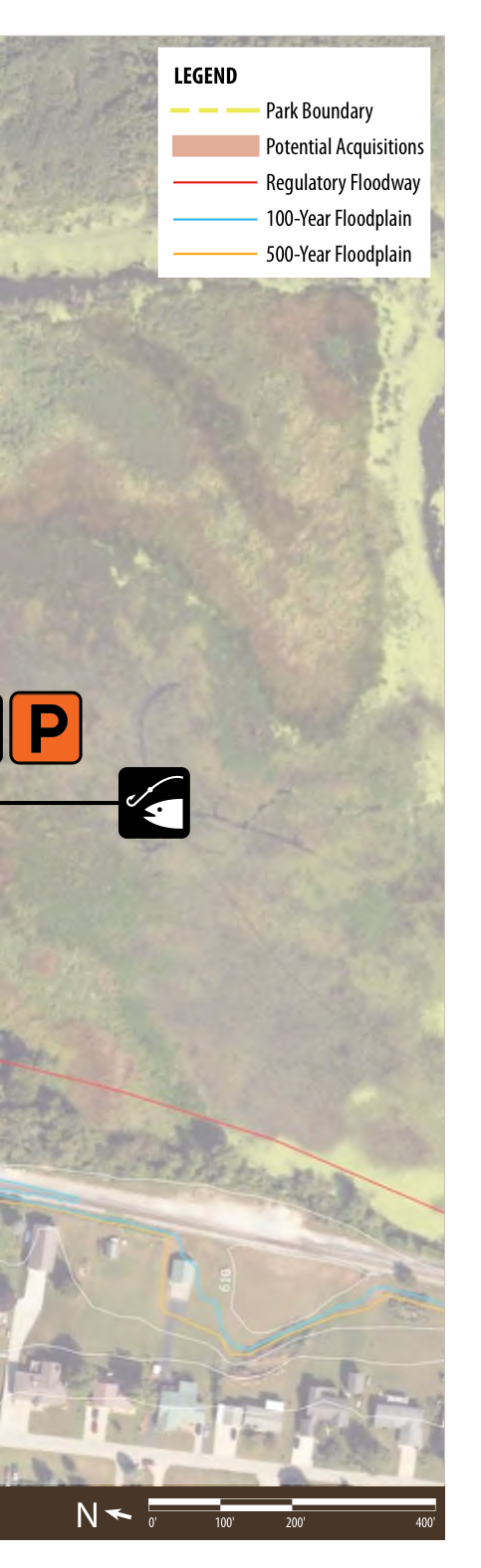
Mud Lake Park is a popular riverside campground and marina in northwest Dubuque County, with grand views of the Mississippi. Several shelters and a playground make it a wonderful location to picnic and camp right next to the river. Boat ramps and fishing piers also offer opportunities for anglers. The View Bar & Grill, located within the park, helps make the marina a lively destination during the boating season, and the parking lot and boat slips are often full of RV campers and leisure boats. A long dike paralleling the Mississippi River holds back Mud Lake, the park's namesake, which becomes a popular destination for ice fishing in the winter.
| Project Description | Project Type | Improvement Category | Prioritization (in years) | Remarks | |||
|---|---|---|---|---|---|---|---|
| 0-5 | 6-10 | 11+ | Total Cost | ||||
| Mud Lake Park | $- | $699,000.00 | $- | $699,000.00 | |||
| Replace the old tower. | D | PK | $325,000.00 | ||||
| Convert the former park ranger house into a rentable cabin. | D | PK | $300,000.00 | ||||
| Dredge at fishing access pier to remove sediment. | D | WQ | $50,000.00 | ||||
| Add a parking lot at Playground. | N | PK | $24,000.00 | ||||


Dredge to Remove Sediment
Replace the Old Tower
LEGEND
Park Boundary
Potential Acquisitions
Regulatory Floodway
100-Year Floodplain
500-Year Floodplain
Picnic Area
P
الله
الحمدلله
GOLF LAKE ROAD
MUD LAKE ROAD
♠ 🌳 🌳 🌳
Convert Former Ranger House to Cabin
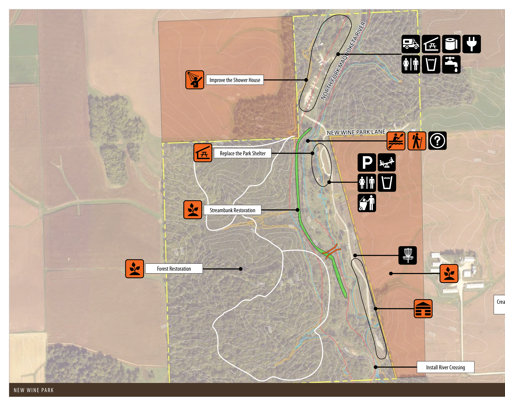
New Wine Park
15971 New Wine Park Lane | 170 acres
Recreation Park
Just north of Dyersville on the western end of the county is New Wine Park. This park has a diverse program that attracts campers, picnickers, hikers, and more. An expansive mown lawn area with several shelters and playgrounds provides plenty of room for family picnics. A network of trails guides hikers over the North Fork Little Maquoketa River and up into the dense, wooded slopes. The large campground is fully equipped with restrooms, showers, and RV hookups. Disc golfers also frequent the course located at the park.
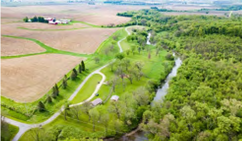
Recent Progress:
- Installed additional campsites
- New road paving is underway
- Added an ADA-accessible pavilion
| Project Description | Project Type | Improvement Category | Prioritization (in years) | Remarks | |||
|---|---|---|---|---|---|---|---|
| 0-5 | 6-10 | 11+ | Total Cost | ||||
| New Wine Park | $1,332,000.00 | $2,580,000.00 | $- | $3,912,000.00 | |||
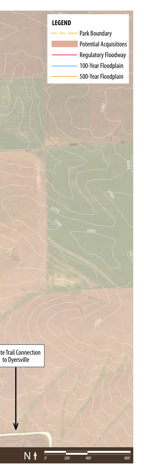
| Evaluate a trail connection into Dyersville and Field of Dreams. | N | TR | $100,000.00 | Planning only. | |||
| Install a bridge. | N | PK | $225,000.00 | ||||
| Develop water trails and hiking trailhead. | N | TR | $10,000.00 | ||||
| Install a river crossing. | N | TR | $25,000.00 | ||||
| Replace turf with native ground cover. | N | HP | $2,000.00 | ||||
| Replace the shelter. | D | PK | $80,000.00 | ||||
| Install cabins. | N | PK | $2,250,000.00 | ||||
| Land acquisition - to be determined. | L | LP | To be determined if adjacent landowner is willing to sell. | ||||
| Improve the shower house. | D | PK | $600,000.00 | ||||
| Forest restoration. | D | HP | $80,000.00 | ||||
| Stream restoration. | D | WQ | $540,000.00 | ||||
Pohlman Prairie Preserve
13 Acres
Nature Preserve
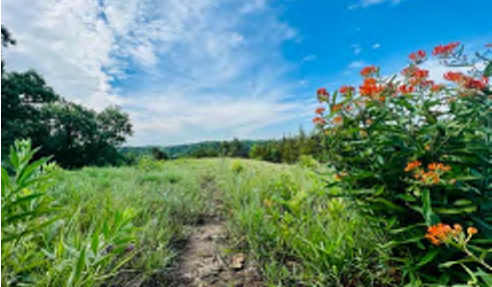
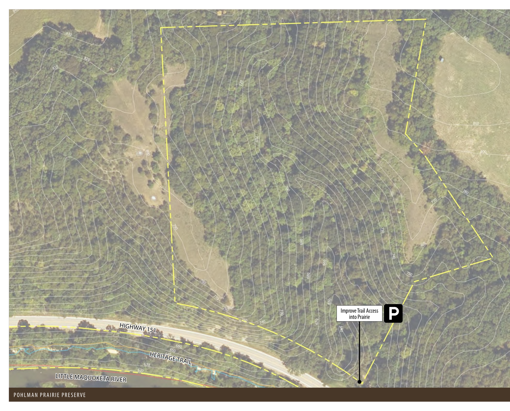
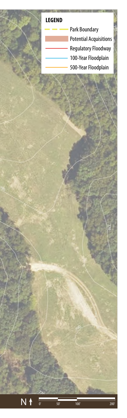
Pohlman Prairie Preserve contains native prairie remnants, bottomland forest, and it overlooks the Little Maquoketa River Valley. Additionally, there is a 0.4 mile trail that leads to the top of the limestone bluffs. Hunting is prohibited at the preserve.
| Project Description | Project Type | Improvement Category | Prioritization (in years) | Remarks | |||
|---|---|---|---|---|---|---|---|
| 0-5 | 6-10 | 11+ | Total Cost | ||||
| Pohlman Prairie Preserve | $15,000.00 | $- | $- | $15,000.00 | |||
| Improve trail access into prairie. | N | TR | $15,000.00 | Widen or improve the surface of the trail. | |||
| Land acquisition - to be determined. | L | LP | To be determined if adjacent landowner is willing to sell. | ||||

LEGEND
Park Boundary
Potential Acquisitions
Regulatory Floodway
100-Year Floodplain
500-Year Floodplain
Improve Trail Access
into Prairie

LITTLE MAQUOKETA RIVER
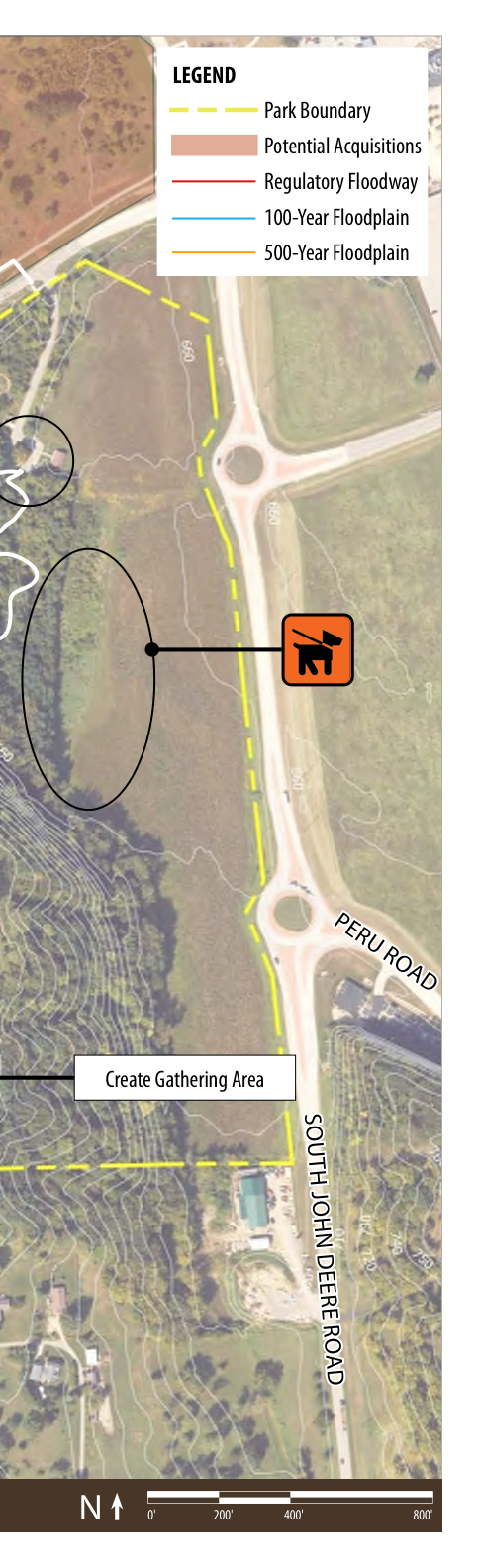
Proving Grounds
10616 West John Deere Road | 145 Acres
Recreation Park
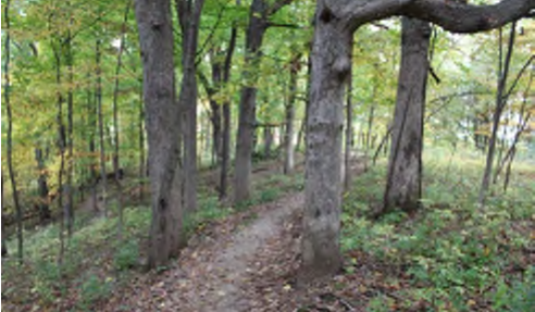
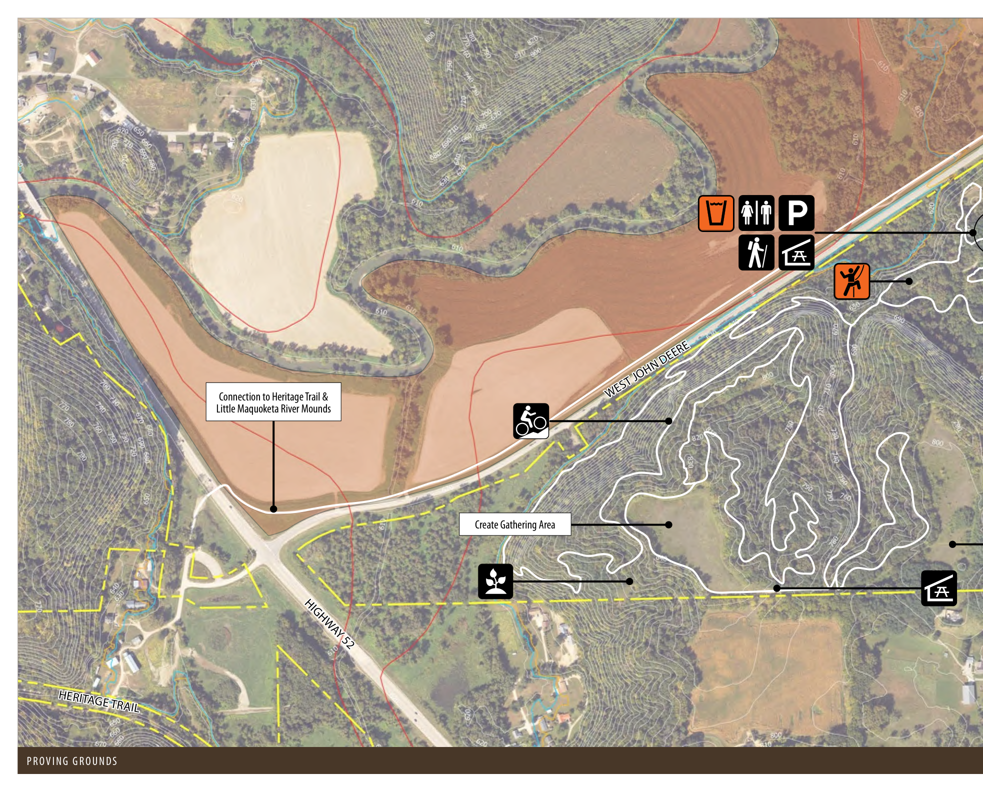
The Proving Grounds is located north of Dubuque between Heritage Pond and John Deere Marsh. Trails take park goers from the lowland prairies up the wooded slopes to a restored upland prairie where walking trails guide hikers across the ridge of the bluff. Single track trails built by the Tri-State Mountain Bike Riders have made this park a popular destination for mountain bikers. Established on land donated by John Deere corporation, the 145-acre Proving Grounds area will eventually be a contributor to the Little Maquoketa Greenway.
Recent Progress:
- Installed a new park shelter
- Performed prairie restoration
- Created mountain biking trails
- Added connection to Heritage Trail via West John Deere Road
| Project Description | Project Type | Improvement Category | Prioritization (in years) | Remarks | |||
|---|---|---|---|---|---|---|---|
| 0-5 | 6-10 | 11+ | Total Cost | ||||
| Proving Grounds | $110,000.00 | $75,000.00 | $200,000.00 | $385,000.00 | |||
| Add public water supply. | N | PK | $200,000.00 | ||||
| Create a dog park. | N | PK | $50,000.00 | ||||
| Create gathering areas on the hilltops. | N | PK | $60,000.00 | ||||
| Evaluate the feasibility of rock climbing. | N | PK | $– | ||||
| Ecological restoration. | D | HP | $75,000.00 | ||||
Park Boundary
Potential Acquisitions
Regulatory Floodway
100-Year Floodplain
500-Year Floodplain
Vision Plan
Connection to Heritage Trail & Little Maquoketa River Mounds
Create Gathering Area
HERITAGE TRAIL
Create Gathering Area
SOUTH JOHN DEERE ROAD
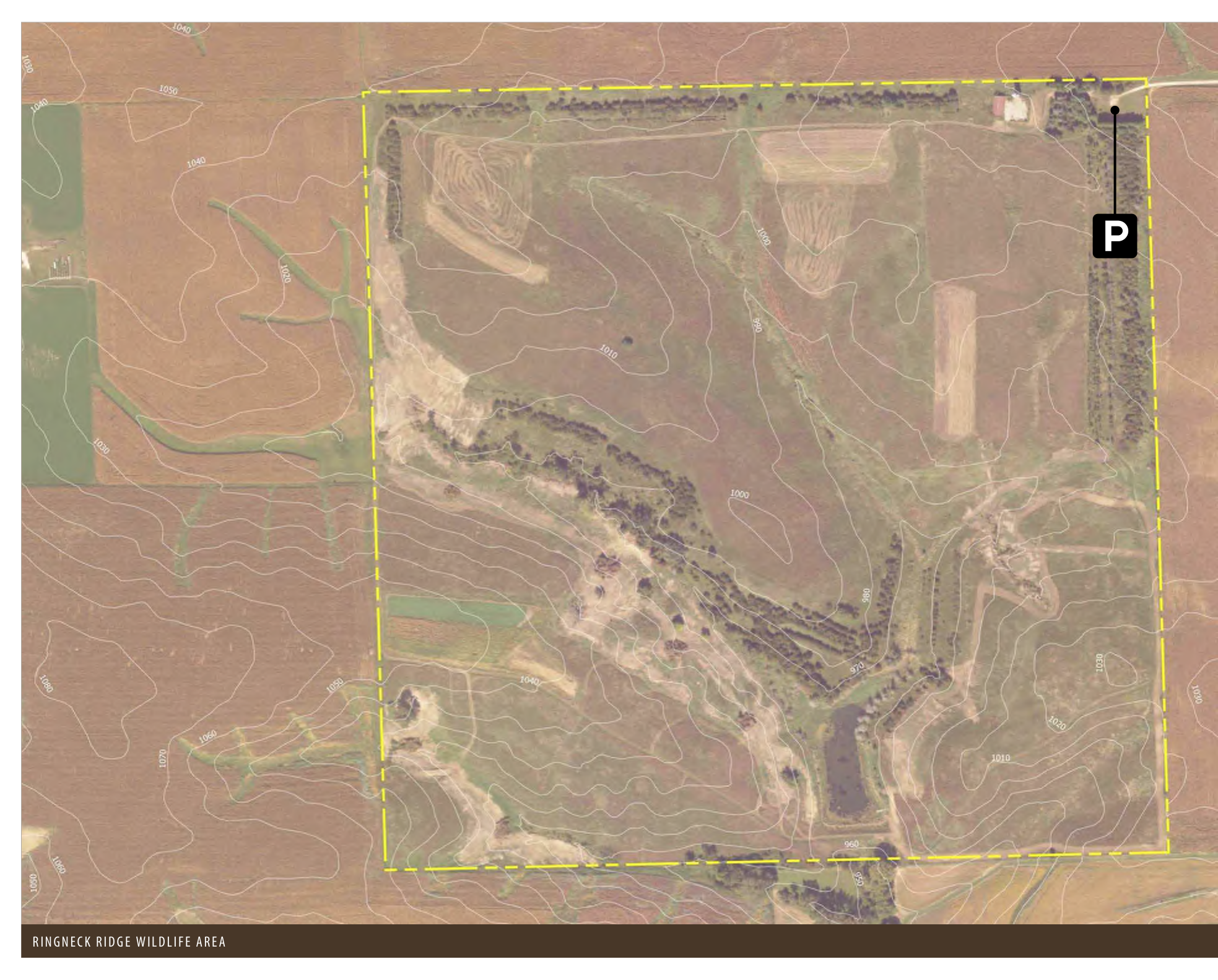
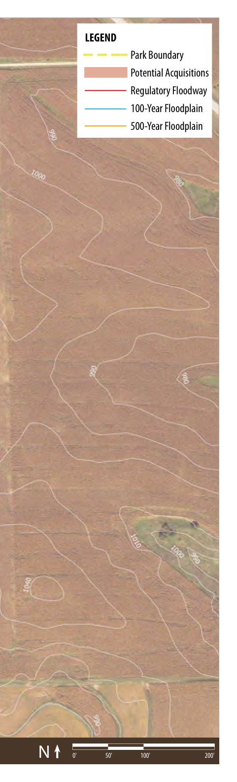
Ringneck Ridge Wildlife Area
158 Acres
Wildlife Area
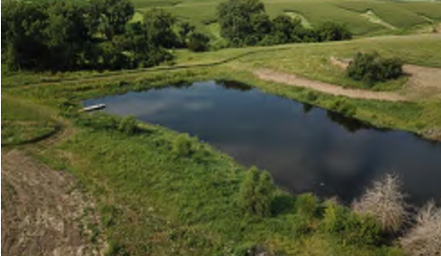
This wildlife area contains vast restored prairie. The pond on the south side of the area offers fishing access, and it attracts waterfowl. The area is open to public hunting during designated hunting seasons.
| Project Description | Project Type | Improvement Category | Prioritization (in years) | Remarks | |||
|---|---|---|---|---|---|---|---|
| 0-5 | 6-10 | 11+ | Total Cost | ||||
| Ringneck Ridge Wildlife Area | $ - | $60,000.00 | $ - | $60,000.00 | |||
| Ecological restoration. | D | HP | $60,000.00 | ||||
Swiss Valley Park / Campgrounds
13069 Swiss Valley Road | 66 Acres
Recreation Park
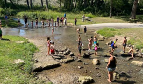
Most Dubuque area people know Swiss Valley. In fact, the Swiss Valley complex is often the one place residents think of when considering Dubuque County Conservation. It is in many ways the gateway to the county's park system: people often come first as one of the 2,000 school children who visit annually on field trips. Swiss Valley includes miles of hiking trails and includes one of the top five destination trout fisheries in Iowa. Swiss Valley Park is located just down the road from Swiss Valley Nature Center and Preserve. While the Preserve focuses on conservation, Swiss Valley Park provides more opportunity for recreation. Across the park there are several shelters, picnic areas, playgrounds, and plenty of flexible lawn space. Disc golfers often come to play the nine-hole course on site. The north side of the park has a sizeable, highly popular campground.
| Project Description | Project Type | Improvement Category | Prioritization (in years) | Remarks | |||
|---|---|---|---|---|---|---|---|
| 0-5 | 6-10 | 11+ | Total Cost | ||||
| Swiss Valley Park/Campgrounds | $2,450,000.00 | $1,050,000.00 | $1,300,000.00 | $4,800,000.00 | |||
| Land acquisition - to be determined. | L | LP | To be determined if adjacent landowner is willing to sell. | ||||
| Add a 10' wide recreation trail connecting the park, nature preserve, and nature center. | N | TR | $960,000.00 | ||||
| Add a natural playscape. | N | PK | $350,000.00 | ||||
| Add benches. | N | PK | $15,000.00 | ||||
| Update the shower house. | D | PK | $1,200,000.00 | ||||
| Add landscape and buffering around campground. | N | HP | $50,000.00 | ||||
| Campground expansion. | N | PK | $800,000.00 | ||||
| Reconfigure the dump station. | D | PK | $100,000.00 | Relocate to accommodate expansion and improved turning radius. | |||
| Install an underpass for connecting recreation trail. | N | TR | $1,000,000.00 | ||||
| Replace / Install pedestrian bridge. | N | PK | $325,000.00 | ||||
---
Potential Acquisitions
Reconfigure Dump Station & Update Shower House
Connect Park, Nature Preserve & Nature Center with 10' Wide Recreation Trail
Swiss Valley Nature Preserve
13606 Swiss Valley Road | 418 Acres
Nature Preserve
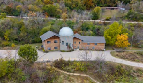
Swiss Valley Nature Preserve is Dubuque County Conservation's premiere attraction and the front door to the county park system. Its 10 miles of hiking trails provide endless entertainment for the hikers who frequent the park. Trails are groomed for cross-country skis in the winter to provide year-round appeal. The spring-fed Catfish Creek, which runs through the preserve, is a favorite spot for trout fishing and is regularly stocked. To improve the park system, this plan proposes to link the preserve with Swiss Valley Park, a half mile down the road, with an accessible paved trail. This link will make the resources in both parks easier to access and help promote the idea of a unified park system. Additional improvements in the preserve include addressing parking issues, replacing bridges to minimize flood washouts, and offering opportunities for backcountry hike-in camping.
| Project Description | Project Type | Improvement Category | Prioritization (in years) | Remarks | |||
|---|---|---|---|---|---|---|---|
| 0-5 | 6-10 | 11+ | Total Cost | ||||
| Swiss Valley Nature Preserve | $450,000.00 | $735,000.00 | $0.00 | $1,185,000.00 | |||
| Streambank restoration. | D | HP | $550,000.00 | Remove invasive species. | |||
| Prairie restoration. Forest restoration. Create outdoor learning lab. | D D N | HP HP PK | $60,000.00 $100,000.00 $25,000.00 | ||||
| Replace pedestrian bridges in the preserve. | D | TR | $450,000.00 | ||||
P
SWISS VALLEY ROAD
Pond
Create Outdoor Learning Lab

LEGEND
---
Potential Acquisitions
Replace the Bridge
Forest Restoration


Existing Fen
Streambank Restoration

Prairie Restoration

Replace the Bridge
Whitewater Canyon
29912 9th Avenue | 557 acres
Wildlife Area
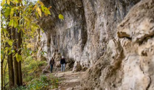
Whitewater Canyon is at the convergence of Dubuque, Jackson, and Jones Counties and is home to some of the grandest views in the region. It is one of three true canyons in the state of Iowa. Hiking trails guide parkgoers through the upland prairie, onto the wooded slopes, and down into the canyon where one can find a historic Civilian Conservation Corps dam, unique landforms, several caves, and Whitewater Creek, which carves through the base of the valley. Most of the park is undeveloped and will stay that way – it remains one of the last great escapes from civilization in Dubuque County. Currently, it is a popular spot for hunting, fishing, and wildlife observation.
Recent Progress:
- Installed a restroom
- Developed a new forestry management plan
| Project Description | Project Type | Improvement Category | Prioritization (in years) | Remarks | |||
|---|---|---|---|---|---|---|---|
| 0-5 | 6-10 | 11+ | Total Cost | ||||
| Whitewater Canyon | $122,000.00 | $320,000.00 | $- | $442,000.00 | |||
| Prairie restoration. | D | HP | $60,000.00 | ||||
| Woodland restoration. | D | HP | $240,000.00 | Remove invasive species. | |||
| Improve the road and entry signage. | D | PK | $20,000.00 | ||||
| Add rock climbing access. | N | PK | $- | ||||
| Land acquisition - to be determined. | N | LP | To be determined if adjacent landowner is willing to sell. | ||||
| Perform trail maintenance. | D | TR | $60,000.00 | Repair / reroute trails in erodible areas. | |||
| Fix the drainage at the entry road to prevent washing out. | D | WQ | $50,000.00 | ||||
| Add switchbacks to the trail system to overlook (reduce trail maintenance, erosion). | D | TR | $12,000.00 | ||||
Wetland Mitigation
LEGEND
Park Boundary
Potential Acquisitions

Perform Woodland Savanna Restoration

Perform Woodland Savanna Restoration
天
天
Improve the Road,
Drainage & Entry Signage
CUROE ROAD
Whitewater Canyon Road
Add Trail Switchbacks to Prevent Erosion
Revitalize the Prairie
LEGEND
Park Boundary
Potential Acquisitions
Potential Land Acquisition
Existing Historic CCC Spillway
Lost Canyon; Valley of 13 Caves

PROPOSED BUDGET
Budget Process
Several factors drove the budget and prioritization process. These included:
- Public Input: Feedback from both the public input survey and community open houses offered insight into what community members want and value most in the park system. Additionally, it identified need gaps and opportunities for new amenities.
- Visitation Analysis: The analysis using Placer.ai helped to determine which parks have high visitation and therefore might warrant more investment in amenities and routine maintenance.
- State of Repair: Park visits and conversations with the Conservation Board gave insight into current park conditions and provided an understanding of necessary maintenance and amenity lifecycles.
- Sequence: Certain improvement recommendations, especially those that are larger and more costly, were separated into phases. This helps to make large projects more manageable and realistic to undertake, doing so in a way that makes chronological sense for a park's development.
Investment by Park Classification
The majority of infrastructure and capital expenditures occur at properties classified as Recreation Parks, Regional Trails, and Marinas. More expensive recommendations include campground improvements, nature center renovations, trail improvements, and new cabins. Additionally, countywide improvements were allocated a large portion of the budget to encompass items like short-, medium-, and long-term land acquisition, new cabins, and a new maintenance facility.
Investment by Project Type
Improvement recommendations were also identified as either a New Improvement (N), a Deferred Maintenance/Code Compliance Improvement (D), or a Park and Preserve Land Acquisition (L) improvement. This resulted in a relatively even split between New and Deferred Improvements (both totaled 42%), and 16% of costs designated to Park and Preserve Land Acquisition.
Investment by Improvement Category
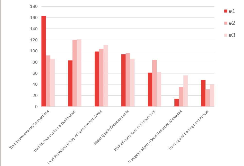
The budget priorities generally align well with the public’s priorities as confirmed in the 2026 and 2020 surveys. The survey asked respondents to rank their priorities for the future. Figure 4 above shows the results of the survey in 2026, revealing the top three priorities to be Trail Improvements/Connections, Habitat Preservation & Restoration, and Land Protection & Acquisition of Sensitive Natural Areas.
Each improvement was categorized based on which priority it responds to as a way to generally understand how public input corresponds with the budget*. However, these categories do not factor in that different categories will inherently differ in cost. For example, Park Infrastructure Enhancements received the largest portion of funding, but ranked lower in the public input. This is because improvements within this category generally are more costly than improvements within some of the other categories. Additionally, the
Figure 4: Survey Question 4 - What are your priorities for the future? Please rank the following from 1-7 (most to least important).
categories do not factor in that opportunities for certain improvements will differ across the park system. For example, there is less opportunity for Water Quality Enhancements across the park system than there is for Trail Improvements. Given this, the budget priorities overall align with the public's priorities.
See corresponding figures on pgs. 77-79.
| Project Description | Project Type | Improvement Category | Prioritization (in years) | Remarks | |||
|---|---|---|---|---|---|---|---|
| 0-5 | 6-10 | 11+ | Total Cost | ||||
| Baltown Overlook | $25,000.00 | $213,640.00 | $25,000.00 | $263,640.00 | |||
| Complete engineering analysis to determine feasibility for creating accessible route from pulloff to overlook and barrier separation from road. | D | PK | $25,000.00 | Evaluate roadway changes to accommodate vertical separation and sidewalk. | |||
| Replace barrier railings. | D | PK | $75,000.00 | ||||
| Create an accessible route from the vehicular pulloff to the overlook | D | TR | $38,640.00 | ||||
| Create a pedestrian-vehicular barrier wall. | D | PK | $100,000.00 | ||||
| Evaluate the feasibility of creating interpretive exhibits about the Driftless Region. | N | PK | $25,000.00 | Interpretive area, shade trellises, and sunken outdoor classroom. | |||
| Bankston Park | $651,556.47 | $60,000.00 | $888,000.00 | $1,599,556.47 | |||
| Install a pedestrian bridge. | N | PK | $225,000.00 | Pre-engineered steel bridge over stream. | |||
| Add a new shower house. | N | PK | $600,000.00 | ||||
| Add primitive group camping area and crushed stone on the East end of the park. | N | PK | $75,000.00 | ||||
| Improve existing primitive campground. | D | PK | $288,000.00 | Add gravel drives, formalize the camping area. | |||
| Land acquisition - to be determined. | L | LP | To be determined if adjacent landowner is willing to sell. | ||||
| Forest restoration. | D | HP | $44,077.13 | ||||
| Retire picnic area; maintain access to pump pit. | D PK | $5,000.00 | |||||
| Establish oak savanna interior to primitive camping area. | D | HP | $2,479.34 | Shade and reduce mowing at campsite. | |||
| Connect trail system. | N | TR | $60,000.00 | ||||
| Stream stabilization, fishing improvements. | D | WQ | $300,000.00 | ||||
| Bowstring Wildlife Area | $458,402.20 | $100,000.00 | $- | $558,402.20 | |||
| Install primitive toilet. | N | PK | $35,000.00 | ||||
| Add a small shelter. | N | PK | $50,000.00 | ||||
| Improve kayak launch site. | D | PK | $15,000.00 | ||||
| Restore historic bridge for pedestrian access. | D | TR | $225,000.00 | Evaluation underway at time of the sale | |||
| Remove trash from the park. | D | PK | $75,000.00 | ||||
| Ecological Restoration. | D | HP | $158,402.20 | ||||
| Fillmore Recreation Area | $225,000.00 | $1,862,220.39 | $350,000.00 | $2,437,220.39 | |||
| Expand and make campground improvements. | D | PK | $350,000.00 | Upgrade electrical service, water, add restroom and shower house. | |||
| Ecological restoration. | D | HP | $90,220.39 | Woodland/stream bank on bluff west of the golf course; handwork only. | |||
| Pave gravel drive and pads within campground. | D | PK | $192,000.00 | ||||
| Install kayak access point and create water trails. | N | TR | $25,000.00 | ||||
| Install a new roof for the clubhouse. | D | PK | $80,000.00 | Evaluate replacing with a steel roof in the future. | |||
| Project Description | Project Type | Improvement Category | Prioritization (in years) | Remarks | |||
|---|---|---|---|---|---|---|---|
| 0-5 | 6-10 | 11+ | Total Cost | ||||
| Irrigation system renovation. | D | PK | 1,500,000.00 | ||||
| Renovate existing golf course maintenance building. | D | PK | 200,000.00 | ||||
| Finley's Landing Park | 391,500.00 | 75,000.00 | 780,000.00 | 1,246,500.00 | |||
| Ecological restoration. | D | HP | 60,000.00 | Remove invasive species. | |||
| Land acquisition - to be determined. | L | LP | To be determined if adjacent landowner is willing to sell. Explore land protection for threatened and endangered species through private and/or public means. | ||||
| Stabilize primitive trail system. | D | TR | 98,000.00 | Trail maintenance; add wood chips. | |||
| Add primitive trails. | N | TR | 196,000.00 | ||||
| Add ADA route for beach access. | D | TR | 19,500.00 | Mobi-mat system - two 6.5' × 100' mats, plus staple extractor, plus shipping. | |||
| Add ADA parking for sand bar access. | D | PK | 18,000.00 | ||||
| Add tent platforms at the hike-in campsite. | N | PK | 15,000.00 | ||||
| Stream restoration. | D | WQ | 180,000.00 | ||||
| Replace the showerhouse. | D | PK | 600,000.00 | ||||
| Habitat improvements, restoration. | D | HP | 60,000.00 | Ruffed grouse and woodland habitat. | |||
| Graf Park | 600,000.00 | 5,000.00 | - | 605,000.00 | |||
| Enhance fishing access. | D | PK | 5,000.00 | ||||
| Expand access throughout the park by adding trails. | N | TR | 20,000.00 | ||||
| Add a ride/hike-in camping area with tent platforms. | N | PK | 15,000.00 | ||||
| Install public water supply and drinking fountain. | N | PK | 250,000.00 | Enhance regional appeal of Heritage Trail. | |||
| Install a bike repair station. | N | PK | 15,000.00 | ||||
| Stream restoration. | D | WQ | 300,000.00 | ||||
| Heritage Pond & Campground | 1,135,000.00 | 975,000.00 | - | 2,110,000.00 | |||
| Plant trees, buffer campground and pond. | N | HP | 50,000.00 | Overstory and understory trees for campground and highway buffering. | |||
| Improve campground, renovate drive lanes, parking areas. | D | PK | 750,000.00 | Repave/Redo individual sites (gravel or new concrete), add shower house. | |||
| Install a nature playground. | N | PK | 225,000.00 | ||||
| Expand and renovate the existing parking lot. | D | PK | 455,000.00 | ||||
| Perform shoreline restoration and erosion control along the south side of the pond. | D | WQ | 86,000.00 | ||||
| Add pedestrian pathway along south and west side of pond. | N | TR | 168,000.00 | ||||
| Evaluate the feasibility of rock climbing at the west side | N | PK | - | ||||
| Project Description | Project Type | Improvement Category | Prioritization (in years) | Remarks | |||
|---|---|---|---|---|---|---|---|
| 0-5 | 6-10 | 11+ | Total Cost | ||||
| Re-route trail around parking area. | N | TR | $42,000.00 | ||||
| Add tent platforms, steps and formalize bike/hike and camping. | N | TR | $60,000.00 | Camping around the base of the west side bluff, facing Sageville Marsh. | |||
| Add parking at tent platform area, remove shelter that is in disrepair. | N | PK | $49,000.00 | ||||
| Create "Gateway to Heritage Trail" & interpretive exhibits. | N | TR | $225,000.00 | Work with local partner to re-evaluate; create an immersive experience that explores the history of the former railroad. | |||
| Heritage Trail | $105,000.00 | $6,445,000.00 | $- | $6,550,000.00 | |||
| Dyersville Trailhead - Add restrooms. | N | PK | $35,000.00 | ||||
| Dyersville Trailhead - Plant shade trees. | N | TR | $5,000.00 | ||||
| Farley Access Point - Add parking lot. | N | PK | $20,000.00 | ||||
| Graf Trailhead - Install public water supply and drinking fountain. | N | TR | $- | Graf Trailhead line item costs included in Graf Park section. | |||
| Graf Trailhead - Install a bike repair station. | N | TR | $- | Graf Trailhead line item costs included in Graf Park section. | |||
| Graf Trailhead - Enhance fishing access. | D | PK | $- | Graf Trailhead line item costs included in Graf Park section. | |||
| Graf Trailhead - Add a ride/hike-in camping area with tent platforms. | N | PK | $- | Graf Trailhead line item costs included in Graf Park section. | |||
| Twin Springs Trailhead - Enhance kayak launch. | D | PK | $15,000.00 | ||||
| Budd Road Trailhead - Enhance kayak launch. | D | PK | $15,000.00 | ||||
| Budd Road Trailhead - Enhance fishing access. | D | PK | $5,000.00 | ||||
| Durango Trailhead - Add restrooms. | N | PK | $35,000.00 | ||||
| Durango Trailhead - Restore kayak access. | $15,000.00 | ||||||
| Durango Trailhead - Enhance fishing access. | D | PK | $5,000.00 | ||||
| Sageville Trailhead - Add primitive camping with tent platforms. | N | PK | $- | Sageville Trailhead improvement costs included in Heritage Pond & Campground section. | |||
| Streambank Restoration. | D | HP | $1,000,000.00 | ||||
| Replace bridges #3 and #6. | D | TR | $4,000,000.00 | ||||
| Replace bridge #11. | D | TR | $700,000.00 | ||||
| Replace bridges #20 and #24. | D | TR | $700,000.00 | ||||
| Interstate Power Preserve | $154,435.26 | $- | $530,200.00 | $684,635.26 | |||
| Land acquisition - to be determined. | L | LP | To be determined if adjacent landowner is willing to sell. | ||||
| Expand parking lot. | N | PK | $130,200.00 | ||||
| Add more mountain bike trails as park expands. | N | TR | $320,000.00 | ||||
| Add shade shelter. | N | PK | $80,000.00 | ||||
| Project Description | Project Type | Improvement Category | Prioritization (in years) | Remarks | |||
|---|---|---|---|---|---|---|---|
| 0-5 | 6-10 | 11+ | Total Cost | ||||
| Woodland restoration. | D | HP | $120,000.00 | Remove invasive species. | |||
| Maintain existing prairie. | D | HP | $34,435.26 | ||||
| John Deere Marsh | $22,000.00 | $22,000.00 | |||||
| Ecological restoration. | D | HP | $18,000.00 | ||||
| Improve water trail access. | D | TR | $4,000.00 | ||||
| Little Maquoketa River Mounds | $603,000.00 | $288,000.00 | $891,000.00 | ||||
| Ecological restoration. | Anticipate hand removal, spot spray, etc. over mounds; remove invasive species and woody vegetation; put on a cycle of prescribed burning; restore prairie. | ||||||
| D | HP | $72,000.00 | |||||
| Refurbish educational signage about the cultural significance and history of the mounds. | D | PK | $4,000.00 | ||||
| Remove the fencing. | D | PK | $87,000.00 | ||||
| Improve parking lot. | D | PK | $66,000.00 | ||||
| Re-align trail to mounds. | D | TR | $28,000.00 | Minimize structural/steps to Mounds. | |||
| Create a trail loop that goes around the mounds. | N | TR | $72,000.00 | ||||
| Remove the wood timbers along the trail, stabilize grade with wood chips. | D | TR | $112,000.00 | ||||
| Improve the trailhead and connection to Heritage Pond & Trail. | D | TR | $450,000.00 | ||||
| Locher Recreation Area | $6,684,355.37 | $280,000.00 | $395,000.00 | $7,359,355.37 | |||
| Add parking lots. | N | PK | $672,000.00 | ||||
| Add paved access drives. | N | PK | $546,000.00 | ||||
| Establish prairie. | N | HP | $42,355.37 | ||||
| Add a large pavilion with restrooms and fire pits. | N | PK | $1,050,000.00 | ||||
| Add public water supply. | N | PK | $225,000.00 | ||||
| Add a small shelter. | N | PK | $80,000.00 | ||||
| Add riprap fishing nodes/fish habitat. | N | WQ | $180,000.00 | ||||
| Perform shoreline restoration around Locher Lake. | N | WQ | $2,100,000.00 | ||||
| Perform shoreline restoration at the North Fork Maquoketa River. | N | WQ | $300,000.00 | ||||
| Install bird blinds. | N | HP | $20,000.00 | ||||
| Install boardwalk overlook. | N | PK | $150,000.00 | ||||
| Add a pedestrian bridge across the river. | N | PK | $225,000.00 | ||||
| Establish a self-serve kayak rental stand. | N | PK | $50,000.00 | ||||
| Add a boat launch. | N | PK | $125,000.00 | ||||
| Add an ADA-accessible kayak launch. | N | PK | $60,000.00 | ||||
| Add pit toilets near the boat launch. | N | PK | $35,000.00 | ||||
| Add a 10' wide path around Locher Lake. | N | TR | $1,120,000.00 | ||||
| Add a single-track companion trail around lake | N | TR | $80,000.00 | ||||
| Project Description | Project Type | Improvement Category | Prioritization (in years) | Remarks | |||
|---|---|---|---|---|---|---|---|
| 0-5 | 6-10 | 11+ | Total Cost | ||||
| Create walking trails to the south of the lake. | N | TR | $124,000.00 | ||||
| Create an additional access drive on the southwest side of the property off HWY 136. | N | PK | $150,000.00 | ||||
| Evaluate and study alternative routes, future trail connection to Cascade. | N | TR | $25,000.00 | ||||
| Massey Marina | $292,330.58 | $62,000.00 | $264,000.00 | $618,330.58 | |||
| Stream restoration. | D | WQ | $102,000.00 | ||||
| Conduct trail feasibility study to link Massey Marina to Mines of Spain. | N | TR | $25,000.00 | Conduct a study with State of Iowa to create a trail connection to Mines of Spain. | |||
| Install more inland trails at bottomland hardwood forest. | N | TR | $62,000.00 | ||||
| Campground improvements. | D | PK | $155,000.00 | Paving, upgrade electrical service, fix water lines, add tent platforms, reconfigure the dump station. | |||
| New parking lot and boat ramp. | D | PK | $264,000.00 | ||||
| Land acquisition - to be determined. | L | LP | To be determined if adjacent landowner is willing to sell. | ||||
| Woodland restoration. | D | HP | $10,330.58 | At the bottomland hardwood site. | |||
| McCarthy Wildlife Area | $25,000.00 | $160,000.00 | - | $185,000.00 | |||
| Wetland design & permitting. | N | WQ | $25,000.00 | ||||
| Wetland development. | N | WQ | $160,000.00 | ||||
| Miller McGrath Wildlife Area | $925,000.00 | $133,200.00 | - | $1,058,200.00 | |||
| Land acquisition - to be determined. | L | LP | To be determined if adjacent landowner is willing to sell. | ||||
| Develop trails throughout the park. | N | TR | $83,200.00 | ||||
| Evaluate feasibility for more cabins. | N | PK | $10,000.00 | ||||
| Evaluate trail connections to Heritage Trail. | N | TR | $10,000.00 | ||||
| Evaluate feasibility of adding public water supply. | N | PK | $5,000.00 | ||||
| Add additional cabins. | N | PK | $900,000.00 | ||||
| Forest restoration. | D | HP | $20,000.00 | ||||
| Prairie restoration. | D | HP | $30,000.00 | ||||
| Mud Lake Park | - | $699,000.00 | - | $699,000.00 | |||
| Replace the old tower. | D | PK | $325,000.00 | ||||
| Convert the former park ranger house into a rentable cabin. | D | PK | $300,000.00 | ||||
| Dredge at fishing access pier to remove sediment. | D | WQ | $50,000.00 | ||||
| Add a parking lot at playground. | N | PK | $24,000.00 | ||||
| New Wine Park | $1,332,000.00 | $2,580,000.00 | - | $3,912,000.00 | |||
| Evaluate a trail connection into Dyersville and Field of Dreams. | N | TR | $100,000.00 | Planning only. | |||
| Install a bridge. | N | PK | $225,000.00 | ||||
| Project Description | Project Type | Improvement Category | Prioritization (in years) | Remarks | |||
|---|---|---|---|---|---|---|---|
| 0-5 | 6-10 | 11+ | Total Cost | ||||
| Develop water trails and hiking trailhead. | N | TR | $10,000.00 | ||||
| Install a river crossing. | N | TR | $25,000.00 | ||||
| Replace turf with native ground cover. | N | HP | $2,000.00 | ||||
| Replace the shelter. | D | PK | $80,000.00 | ||||
| Install cabins. | N | PK | $2,250,000.00 | ||||
| Land acquisition - to be determined. | L | LP | To be determined if adjacent landowner is willing to sell. | ||||
| Improve the shower house. | D | PK | $600,000.00 | ||||
| Forest restoration. | D | HP | $80,000.00 | ||||
| Stream restoration. | D | WQ | $540,000.00 | ||||
| Pohlman Prairie Preserve | $15,000.00 | $15,000.00 | |||||
| Improve trail access into prairie. | N | TR | $15,000.00 | Widen or improve the surface of the | |||
| Land acquisition - to be determined. | L | LP | To be determined if adjacent landowner is willing to sell. | ||||
| Proving Grounds | $110,000.00 | $75,000.00 | $200,000.00 | $385,000.00 | |||
| Add public water supply. | N | PK | $200,000.00 | ||||
| Create a dog park. | N | PK | $50,000.00 | ||||
| Create gathering areas on the hilltops. | N | PK | $60,000.00 | ||||
| Evaluate the feasibility of rock climbing. | N | PK | |||||
| Ecological restoration. | D | HP | $75,000.00 | ||||
| Ringneck Ridge Wildlife Area | $60,000.00 | $60,000.00 | |||||
| Ecological restoration. | D | HP | $60,000.00 | ||||
| Swiss Valley Park/Campgrounds | $2,450,000.00 | $1,050,000.00 | $1,300,000.00 | $4,800,000.00 | |||
| Land acquisition - to be determined. | L | LP | To be determined if adjacent landowner is willing to sell. | ||||
| Add a 10' wide recreation trail connecting the park, nature preserve, and nature center. | N | TR | $960,000.00 | ||||
| Add a natural playscape. | N | PK | $350,000.00 | ||||
| Add benches. | N | PK | $15,000.00 | ||||
| Update the shower house. | D | PK | $1,200,000.00 | ||||
| Add landscape and buffering around campground. | N | HP | $50,000.00 | ||||
| Campground expansion. | N | PK | $800,000.00 | ||||
| Reconfigure the dump station. | D | PK | $100,000.00 | Relocate to accommodate expansion and improved turning radius. | |||
| Install an underpass for connecting recreation trail. | N | TR | $1,000,000.00 | ||||
| Replace / Install pedestrian bridge. | N | PK | $325,000.00 | ||||
| Swiss Valley Nature Center | $1,701,600.00 | $474,000.00 | $2,175,600.00 | ||||
| Land acquisition - to be determined. | L | LP | To be determined if adjacent landowner is willing to sell. | ||||
| Create a small parking lot and additional access point to the west. | N | PK | $74,000.00 | ||||
| Parking lot maintenance/improvements. | D | PK | $201,600.00 | ||||
| Project Description | Project Type | Improvement Category | Prioritization (in years) | Remarks | |||
|---|---|---|---|---|---|---|---|
| 0-5 | 6-10 | 11+ | Total Cost | ||||
| Nature center deferred maintenance. | D | PK | $1,500,000.00 | Siding, roof, and windows, restrooms | |||
| Nature center exhibit refresh. | D | PK | $400,000.00 | Interpretive exhibit refresh. | |||
| Swiss Valley Nature Preserve | $450,000.00 | $735,000.00 | $1,185,000.00 | ||||
| Streambank restoration. | D | HP | $550,000.00 | Remove invasive species. | |||
| Prairie restoration. Forest restoration. | D D | HP HP | $60,000.00 $100,000.00 | ||||
| Create outdoor learning lab. | N | PK | $25,000.00 | ||||
| Replace pedestrian bridges in the preserve. | D | TR | $450,000.00 | ||||
| Whitewater Canyon | $122,000.00 | $320,000.00 | $442,000.00 | ||||
| Prairie restoration. | D | HP | $60,000.00 | ||||
| Woodland restoration. | D | HP | $240,000.00 | Remove invasive species. | |||
| Improve the road and entry signage. | D | PK | $20,000.00 | ||||
| Add rock climbing access. | N | PK | |||||
| Land acquisition - to be determined. | N | LP | To be determined if adjacent landowner is willing to sell. | ||||
| Perform trail maintenance. | D | TR | $60,000.00 | Repair / reroute trails in erodible areas. | |||
| Fix the drainage at the entry road to prevent washing out. | D | WQ | $50,000.00 | ||||
| Add switchbacks to the trail system to overlook (reduce trail maintenance, erosion). | D | TR | $12,000.00 | ||||
| County Wide Improvements (Not Park Specific) | $6,000,000.00 | $9,000,000.00 | $3,000,000.00 | $18,000,000.00 | |||
| ATV park development & land acquisition. | N | PK | $3,000,000.00 | Repurpose degraded lands (avoid sensitive areas). | |||
| Park & preserve land acquisition. | L | LP | $3,000,000.00 | ||||
| Park & preserve land acquisition. | L | LP | $3,000,000.00 | ||||
| Park & preserve land acquisition. | L | LP | $3,000,000.00 | ||||
| Maintenance facility relocation. | D | PK | $3,000,000.00 | ||||
| Cabins. | N | PK | $3,000,000.00 | ||||
The following tables and graphs provide greater clarity into how the improvements are classified, where the budget is allocated, and how they impact each facility.
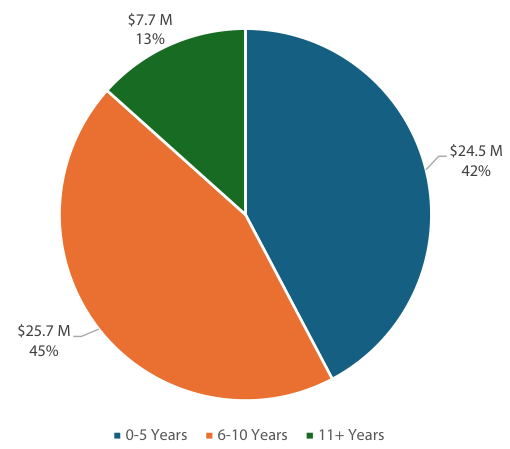
Improvements were budgeted/allocated in five-year blocks, providing clarity to those necessary in the short-, medium-, and long-term.
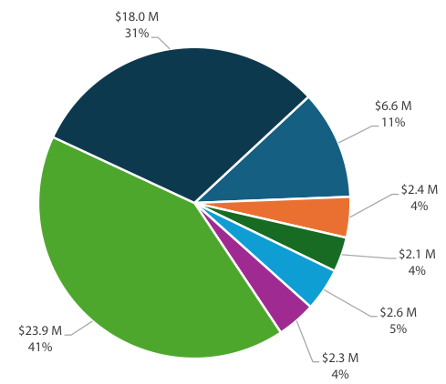
Figure 6: Investment by Park/Facility Type
Parks with more amenities and infrastructure (also those that typically receive the most visits) often require more maintenance and investment.
Figure 5: Investment Prioritization
Regional Trail Special Use Park/Facility Nature Preserve Marina Wildlife Area Recreation Park County Wide
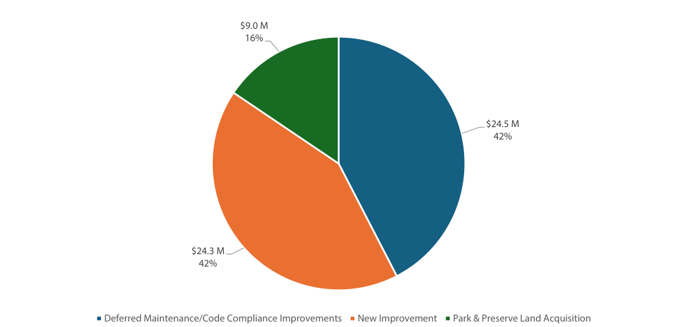
Maintaining the current assets and investing in new amenities are proposed to be nearly equal.
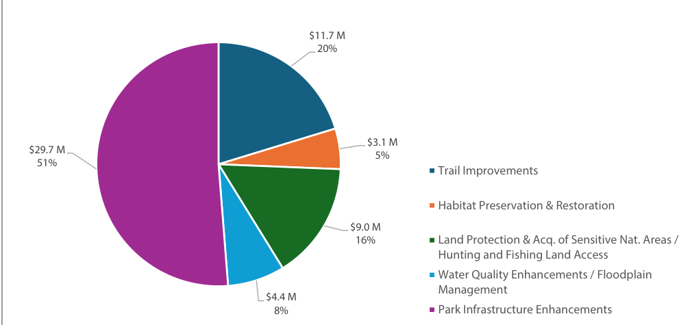
Given the age of many parks, along with the condition and amenity location, investing in infrastructure to support use is the largest category.
FIGURE 7: INVESTMENT BY PROJECT TYPE.
FIGURE 8: INVESTMENT BY IMPROVEMENT CATEGORY.
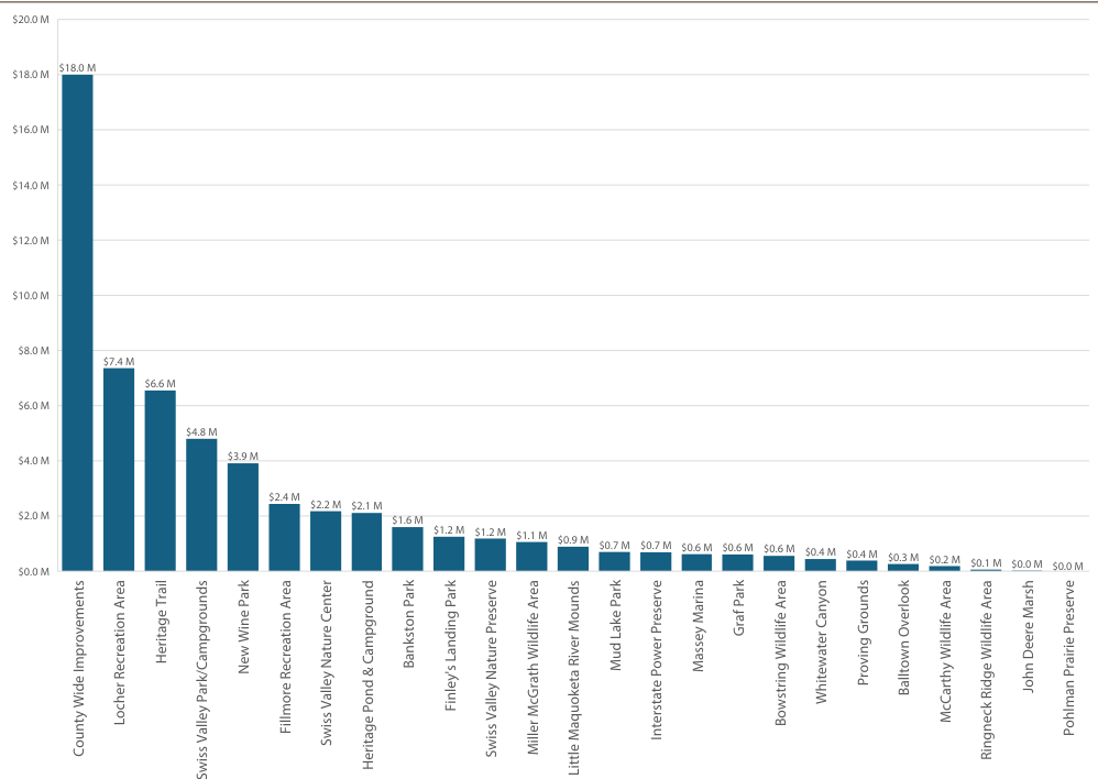
Investments across the county, followed by Locher Recreation Area (a new park) and the Heritage Trail (including trailheads and Heritage Pond/Campground), have been allocated the largest portion of the budget.
Figure 9: Investment by Park.
APPENDIX
- Visitation Analysis
- Public Input Survey Results
- Open House Boards
- Maintenance Building Existing Conditions
VISITATION ANALYSIS
VISITATION ANALYSIS PROCESS
Step 1:
RDG uses GIS software to geofence the park locations and sends them as shapefiles to Placer.ai.
Step 2: Placer.ai returns visitation data on the geofenced park locations.
Step 3:
RDG reviewed and projected the visitation data.
Step 4:
High-level conclusions were distilled from the data for consideration in park improvement planning.
WHAT IS PLACER.AI?
- Placer.ai
- An AI-powered location analytics platform that uses anonymized mobile location data
- Apps in partnership with Placer.ai pick up users' locations and send them to nearby cell towers
- Helps businesses and entities make informed decisions based on things like visitation trends and visitor demographics
- Example: Target could use Placer.ai to determine which stores need more marketing and investment or which areas are prime locations for new store openings.
VISITOR VS. VISITATION: HOW ARE THEY DEFINED?
RDG used Placer.ai to analyze total
visitation to Dubuque County Parks.
Visitor:
- The number of people who travel to a destination.
- 1 visitor
Total Visitation (over 10 minutes):
- The number of times people travel to a destination. Visits that lasted over 10 minutes were counted.
- 3 visits
Example: A single visitor who goes to a park 3 times made 3 visits - 3 is the total visitation.
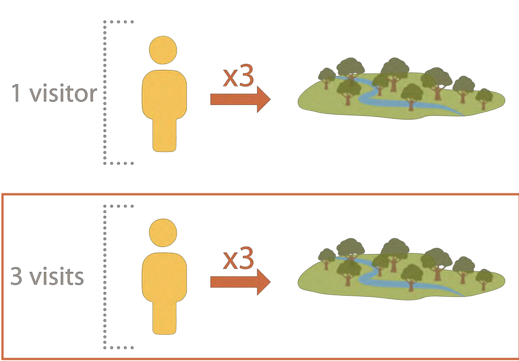
All Parks, Yearly Visitation
Since 2019, park usage has increased 50%.
$79K
66%
Household Median Income
of visitors come from family households
31.9%
of visitors have a Bachelor's degree or higher
Total Park System Visitation
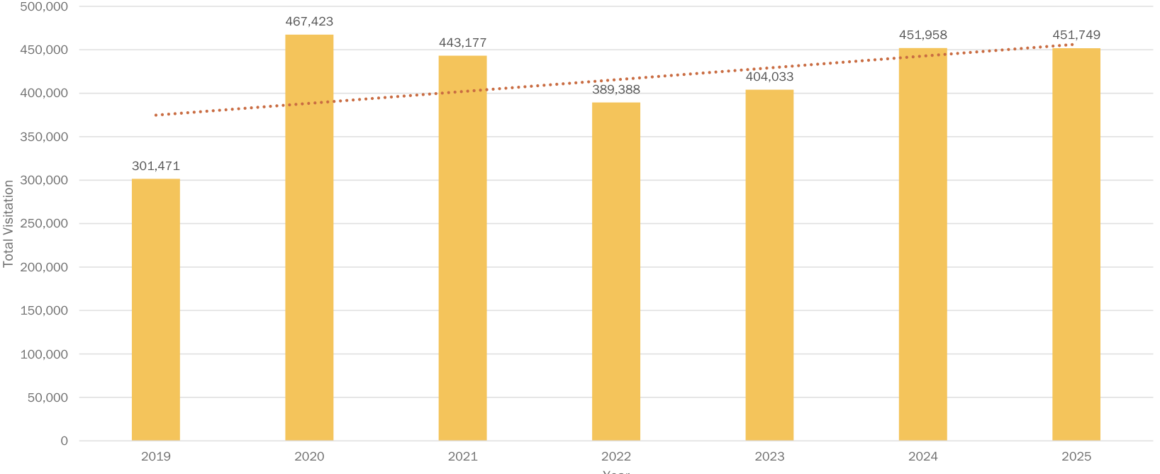
2025 PARK VISITATION RANKINGS
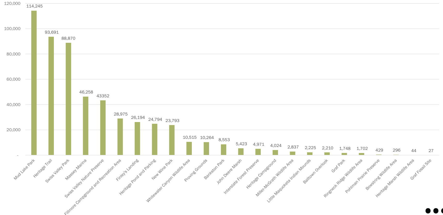
TOP 9 VISITED PARKS YEAR-OVER-YEAR
Notable Observations:
- Swiss Valley Nature Preserve
visitation has decreased in recent years
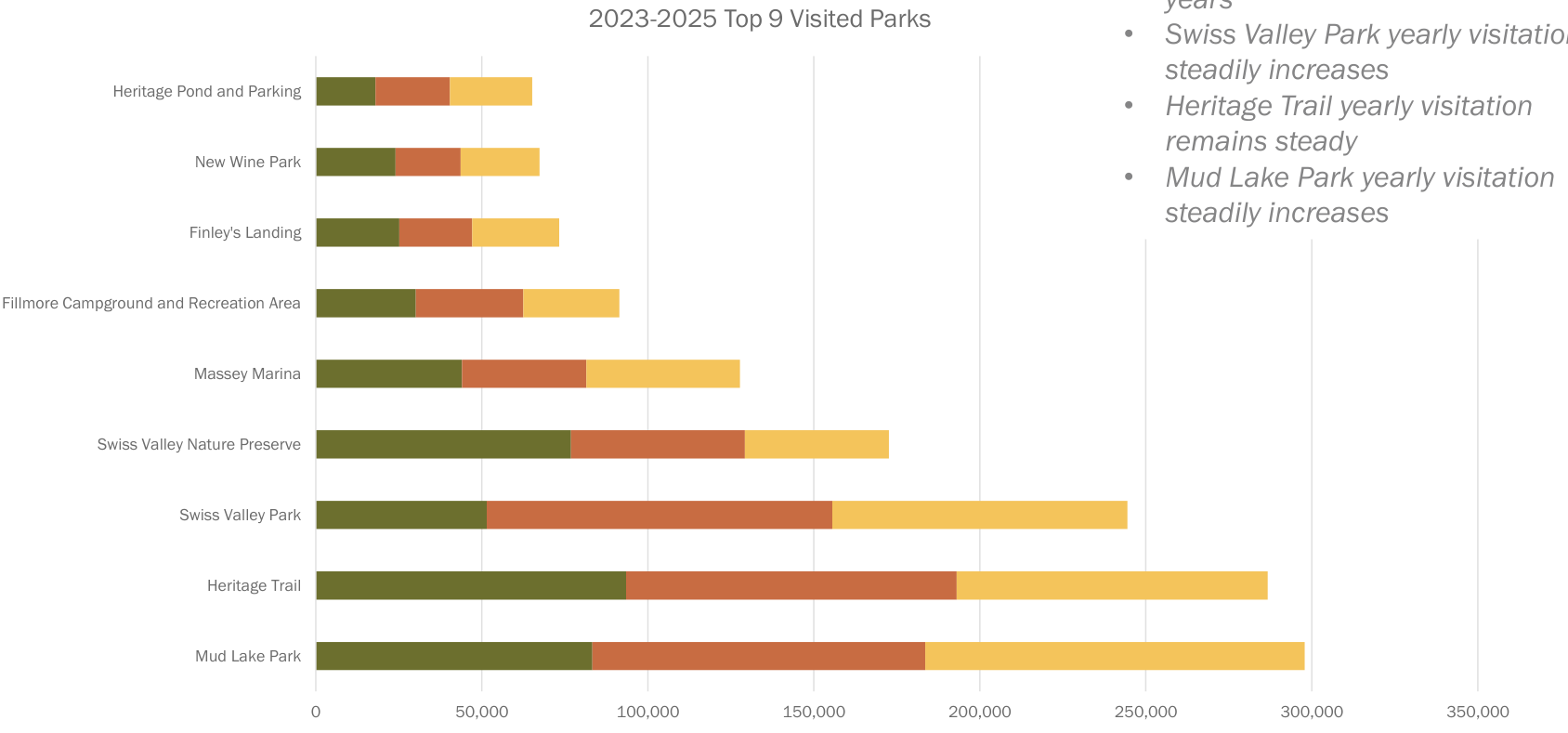
2023 2024 2025
VISITS PER ACRE
Park Visits Per Acre
Visits per acre provides insight into park use intensity, related to size and potentially amenity demand.
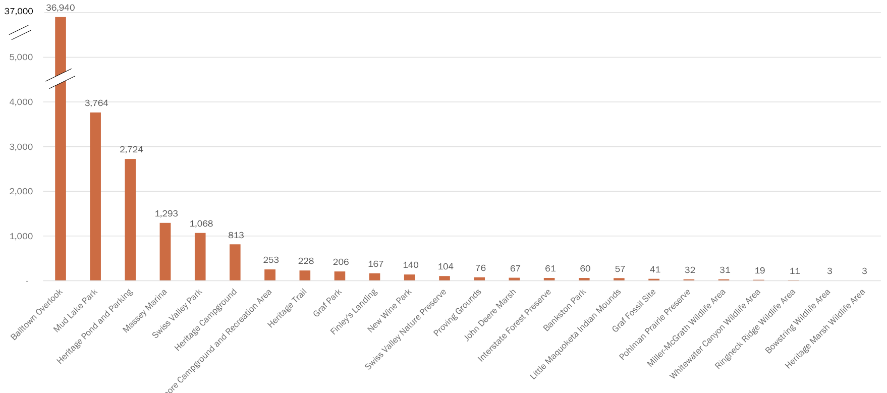
YEAR-OVER-YEAR CHANGE PARK VISITATION
Parks with campgrounds and access to the Mississippi River are showing increasing usage.
2024-2025 Park Visitation Trends
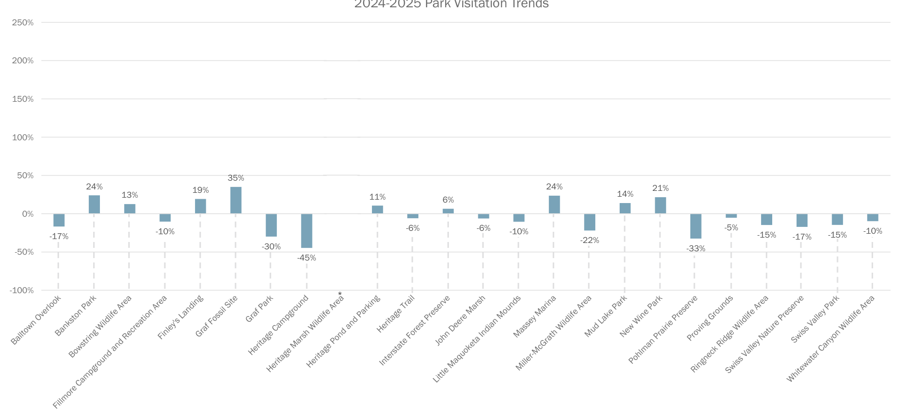
YEAR-OVER-YEAR CHANGE PARK VISITATION
Visit duration over the past couple of years has remained relatively steady.
2024-2025 Average Visit Duration
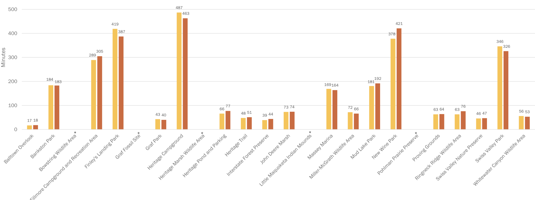
2024 2025
TRADE AREA MAP
Trade Area:
A Trade Area refers to the geographic region or zone from which properties or businesses draw their visitors.
Most visitors traveled to Dubuque County Parks from within Dubuque County.
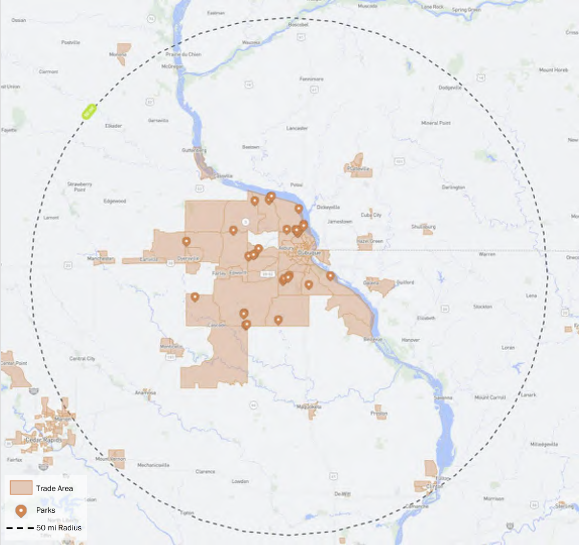
Local vs. Non-Local Visits
Evaluating local versus non-local visits shows that parks with campgrounds and marinas have the greatest demand from non-local users.
2025 Local vs. Non-Local Park Visits
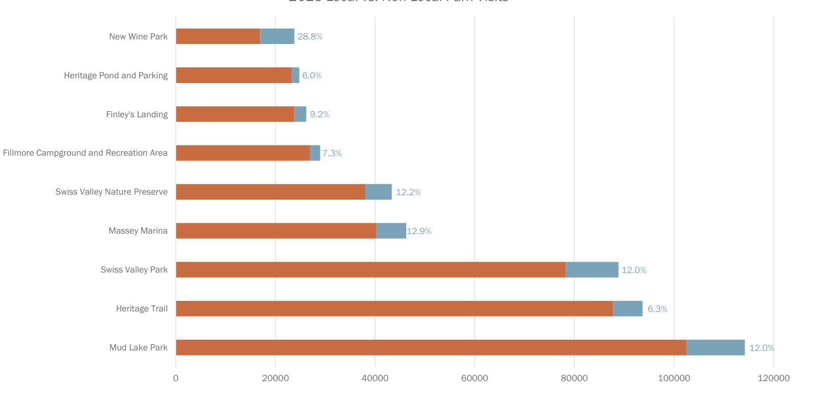
Local Visits Non-Local Visits
CONCLUSION & TAKEAWAYS
- The Dubuque County Park System has seen a steady rise in usage over the past 6 years with visitation increasing over 50%!
- Most park users come from Dubuque County and specifically Dubuque.
- Parks that contain campgrounds and provide waterfront access tended to have higher visitation overall along with more non-local visitation.
- Most non-overnight visits last about an hour.
PUBLIC INPUT SURVEY RESULTS
Overview
- 586 survey respondents in 2024
- ~170% increase from 2020
- 219 survey respondents in 2020
- 86% of respondents rated the quality of Dubuque County parks "Excellent" or "Good"
Total Park System Visitation
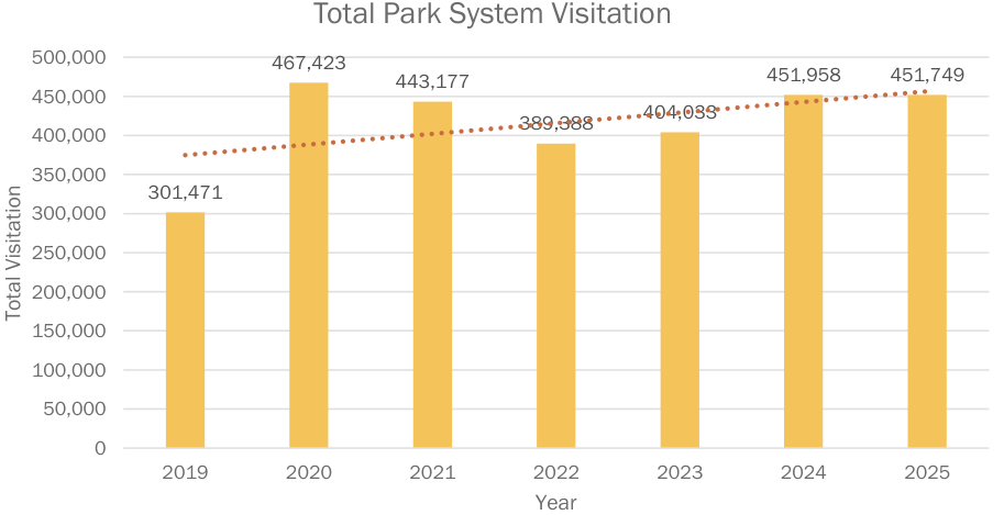
1a. How would you rate the overall quality of Dubuque County parks (that you have visited)?
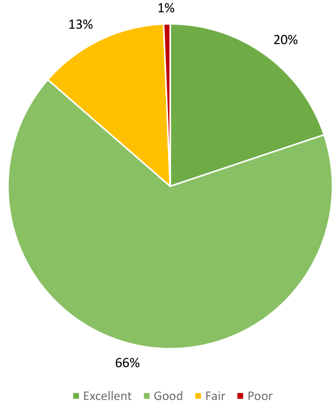
[p102.8.1] Percentages on the following graphs represent those who answered the survey question; it omits those who skipped the question from the total count.
Visitation Comparison 2020 vs. 2026
- Percentage of respondents who visit daily and weekly has remained the same (38% vs. 38%).
- There was a slightly lower percentage of 2026 respondents who visit monthly (43% vs. 55%).
- There was an increase in respondents who visit a few times a year (18% vs. 5%).
1. How often do you visit Dubuque County's park system?
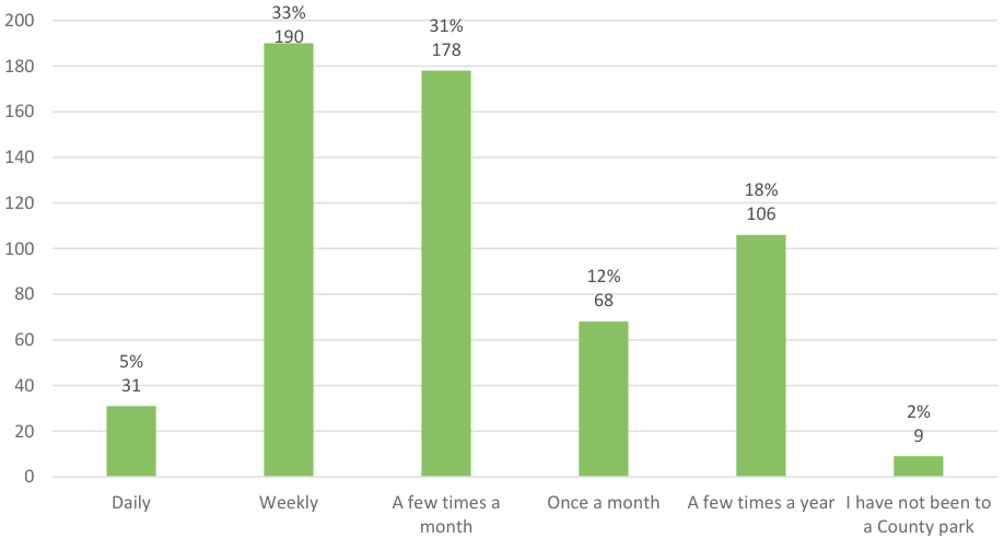
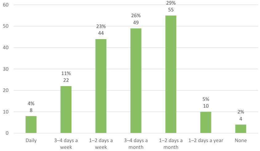
2026
2020
Barriers to Visitation
- Top factors for those who visit parks once per month or less are using other outdoor spaces, lack of desired features, lack of awareness, and 'other' reasons.
- Park maintenance and parking availability were not top barriers to visitation.
- Distance to parks, outdated facilities, lack of programs, and restrooms were medium barriers to visitation.
BARRIERS TO VISITATION
- Other factors that prevent people from visiting are:
- Time constraints
- Distance/location of parks
- Awareness & information gaps
- Lack of specific amenities/activities (climbing, paved trails)
"When hunting is allowed within the park system, it doesn't feel like a safe place to 'get out in nature'. I don't know when the different types of hunting seasons begin and end. That information isn't readily posted."
"Would use Heritage often if it was paved."
"I am 80 years old... I am reluctant to drive 25 miles to Mines of Spain or another venue unless I have a carful of people."
"Afraid to get lost - would love to see more signage."
"I work a lot of hours so I don't get a lot of time to visit as often as I would like."
DEMOGRAPHICS COMPARISON 2020 VS. 2026
- Most survey takers in 2026 and 2020 live in Dubuque County, meaning that audience is still primarily local
9. What is your home zip code?
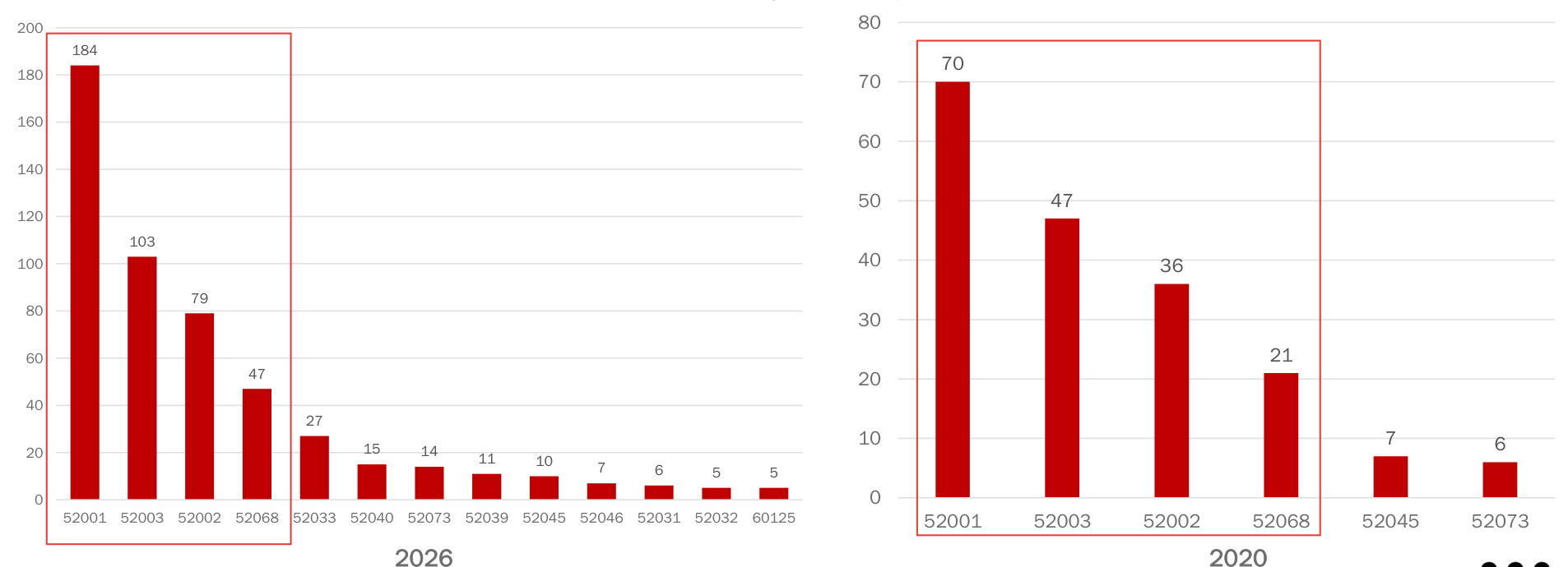
TRADE AREA MAP
Trade Area:
A Trade Area refers to the geographic region or zone from which properties or businesses draw their visitors.
Most visitors traveled to Dubuque County Parks from within Dubuque County.
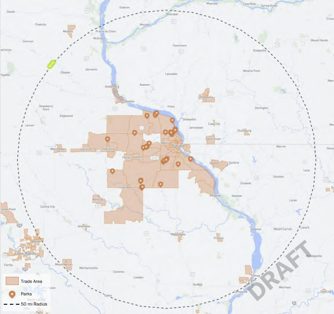
Demographics Comparison 2020 vs. 2026
- Most survey takers in 2026 and 2020 are ages 35-44.
- There was a 14% increase in respondents ages 55-64, and a slight decrease in ages 0-24.
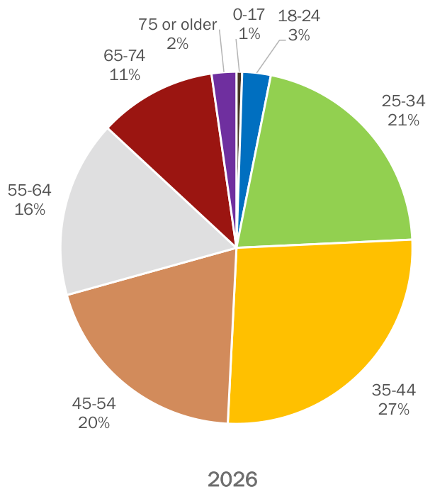
10. What is your age?
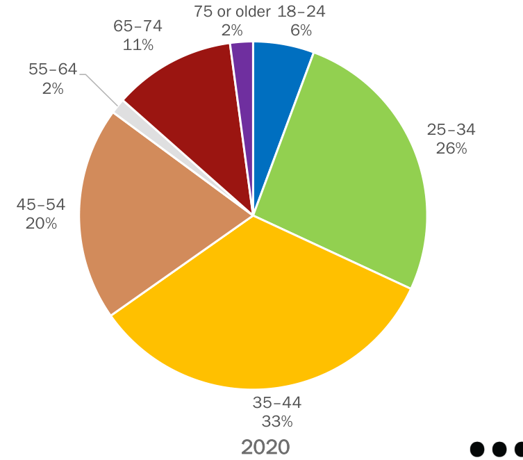
Demographics
- 97% of respondents are White, compared to 91.4% of Dubuque County residents.
- Survey respondents were mostly representative of Dubuque County's racial makeup.
11. Which of the following best describes your race/ethnicity?
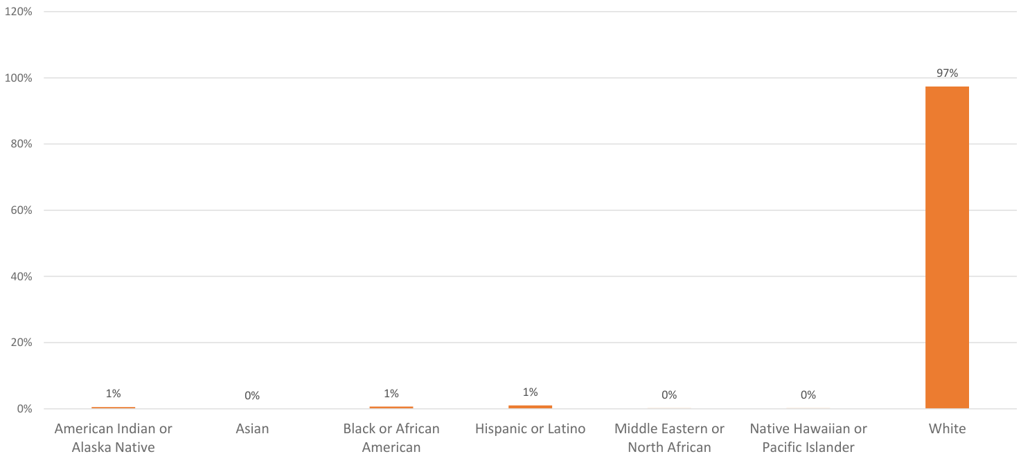
Demographics
- Most respondents earn more than the median household income for Dubuque County ($77,630).
- Respondent demographics are not representative of the average Dubuque County resident.
12. Which of the following best describes your total annual household income?
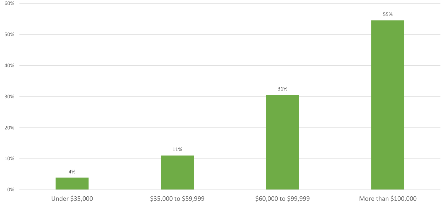
Demographics
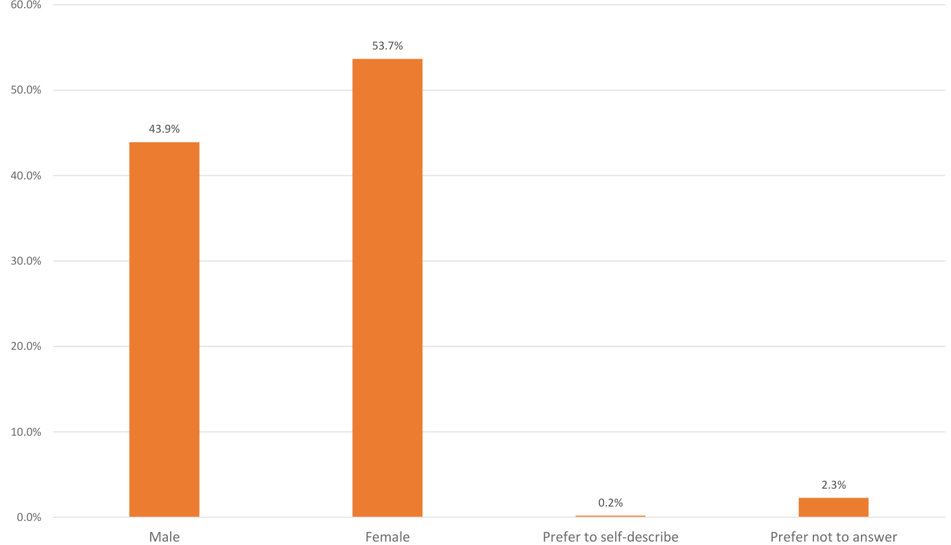
Demographics
- 389 age responses indicate children 19 and under are present in households, with a majority of these children being 14 and under.
14. Including yourself, which age groups are represented in your household?
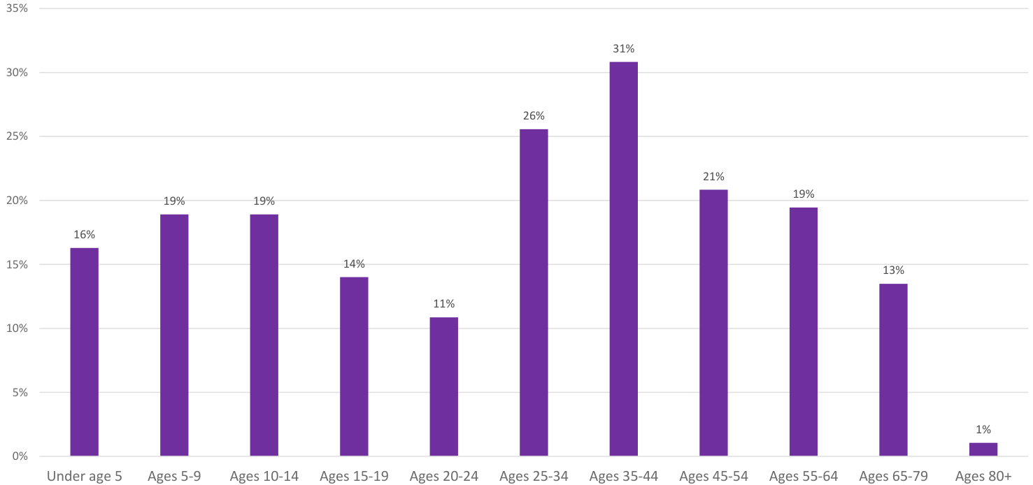
FACILITY/AMENITY NEEDS
- Open lawn spaces and unpaved gravel trails are most fully met, while rock climbing, cabins, and archery facilities are least met
Please indicate how well your needs for each facility/amenity are met on a scale of "Fully Met" to "Not Met", or Select "No Need"
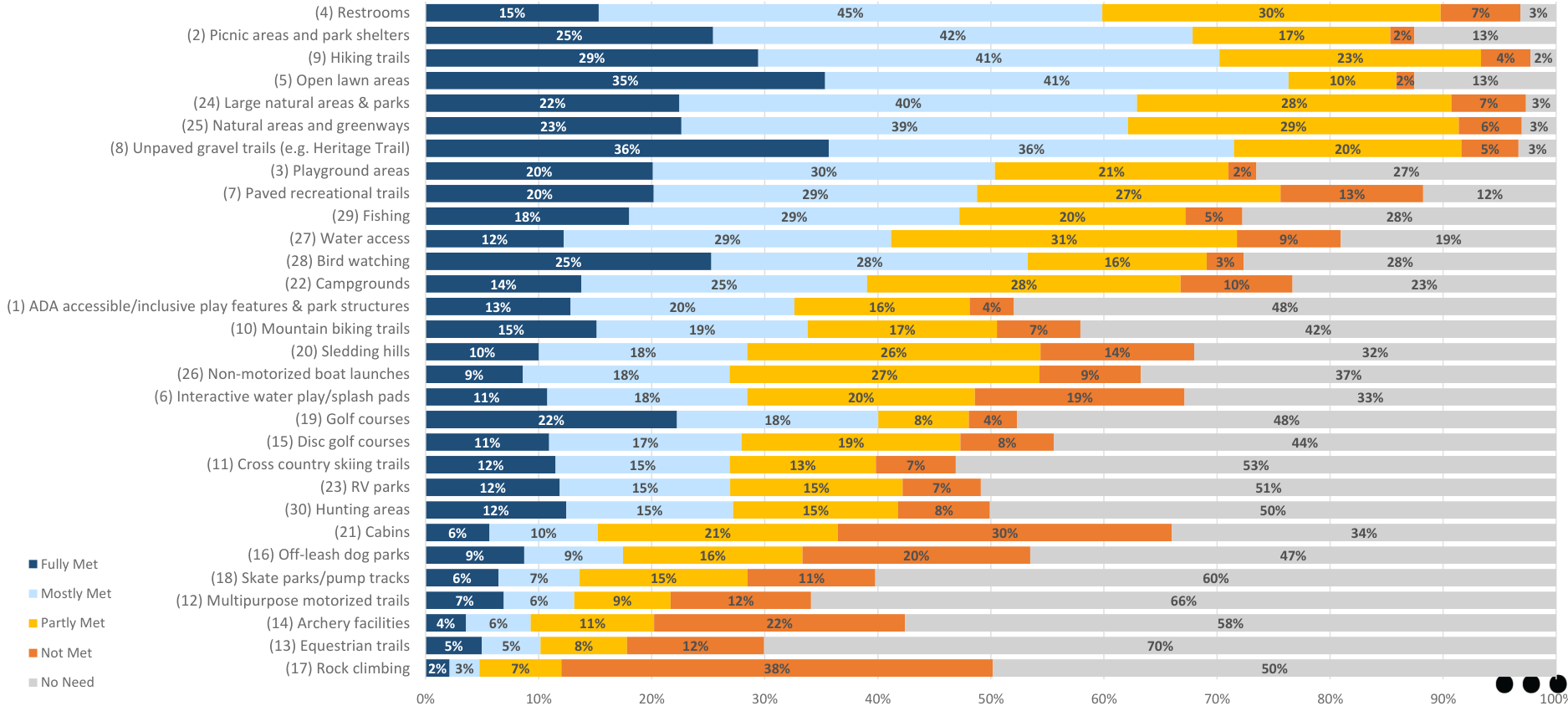
TOP MOST IMPORTANT FACILITIES/AMENITIES
- 59% of respondents selected Hiking Trails as the most important amenity to their households
- Top choices are for supporting park amenities like restrooms and shelters, while middle choices are primarily active recreation/activities
Which FOUR of the facilities/amenities from the list in Question #2 are MOST IMPORTANT to your household?
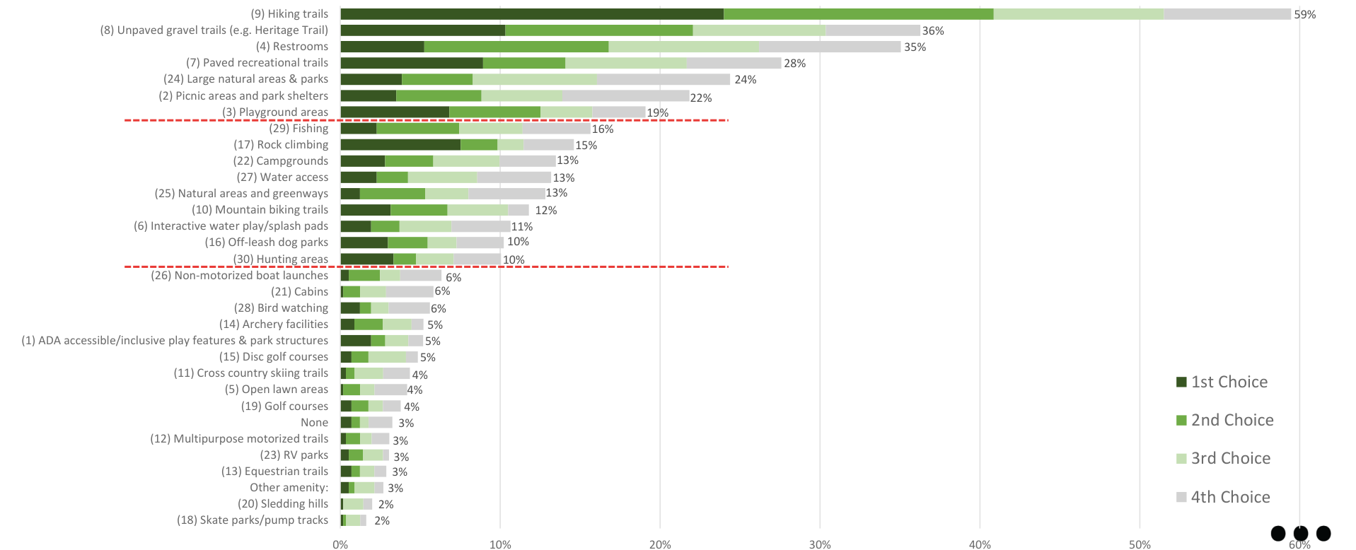
Priorities Comparison 2026 vs. 2020
- Top three priorities remained the same for both 2026 and 2020 (Trail Improvements, Habitat Preservation, Land Protection/Acquisition).
- There has been an increase in 2026 respondents who prioritize environmental protection (Water Quality, Land Protection, and Floodplain Management).
- What are your priorities for the future? Please rank the following from 1–7, with 1 being the MOST important and 7 being the LEAST important.
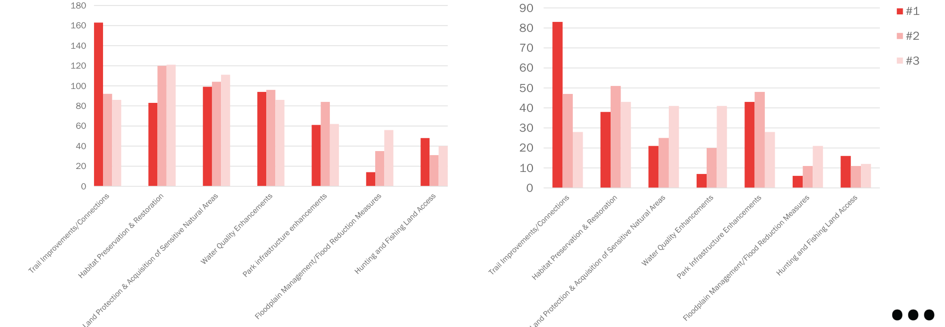
FUNDING SUPPORT
Funding County parks is a good use of my tax dollars
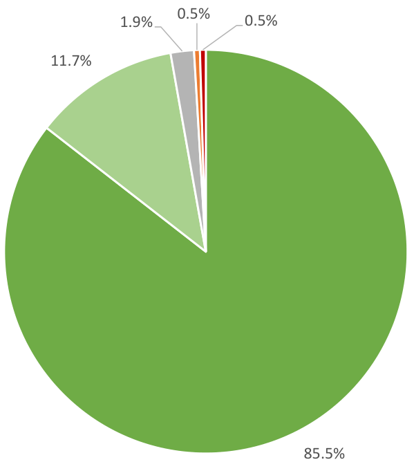
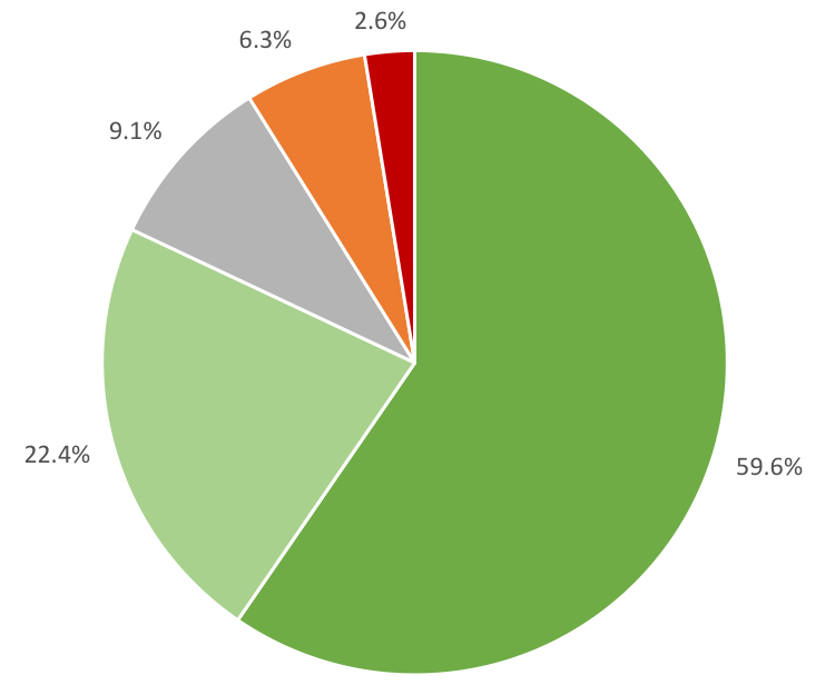
I would rather see increased taxes to support parks than see services reduced
ADDITIONAL COMMENTS
"If there was more climbing access in Dubuque county I would regularly use the park system. I think it's a beautiful part of the state but as I think is the case with most climbers in the area I know little about where / whether climbing is allowed within the county."
"Hire more staff to give the team the resources they need to do more programming and environmental stewardship. Better publicize events and programming."
"More summer sessions for children. I completely understand small group sizes to ensure safety and engagement. Maybe two sessions a month instead of one?"
"Keep the off leash dog park cleaner... people don't clean up after themselves... And maybe offer another one closer to the west end."
"I would love to see more signage when walking the trails. Every time I go, I feel like if I make a wrong turn, I will get lost."
"More programming for families and children. You do a great job and I love it so much that I want more of it."
ADDITIONAL COMMENTS
Main takeaways from comments:
- Heritage Trail paving is the most divisive topic — strong opinions on both sides; supporters cite tourism, safety, and accessibility while opponents value its use for snowmobiling, fat biking, cross-country skiing, and running on soft surfaces
- Rock climbing access is a major unmet need — a large, organized group of respondents advocate for climbing at Whitewater Canyon and other areas
- Trail connectivity is a top priority — residents want trail connections between parks, communities, and downtown Dubuque
- Facility improvements needed — more restrooms, better signage, updated infrastructure at Swiss Valley and EB Lyons
- Dog policy — both sides represented; some want more off-leash areas, others want stronger leash law enforcement
- Staffing, programming, and awareness — residents want more family/youth programming, better marketing, and more staff
OPEN HOUSE BOARDS
Dubuque County
Conservation
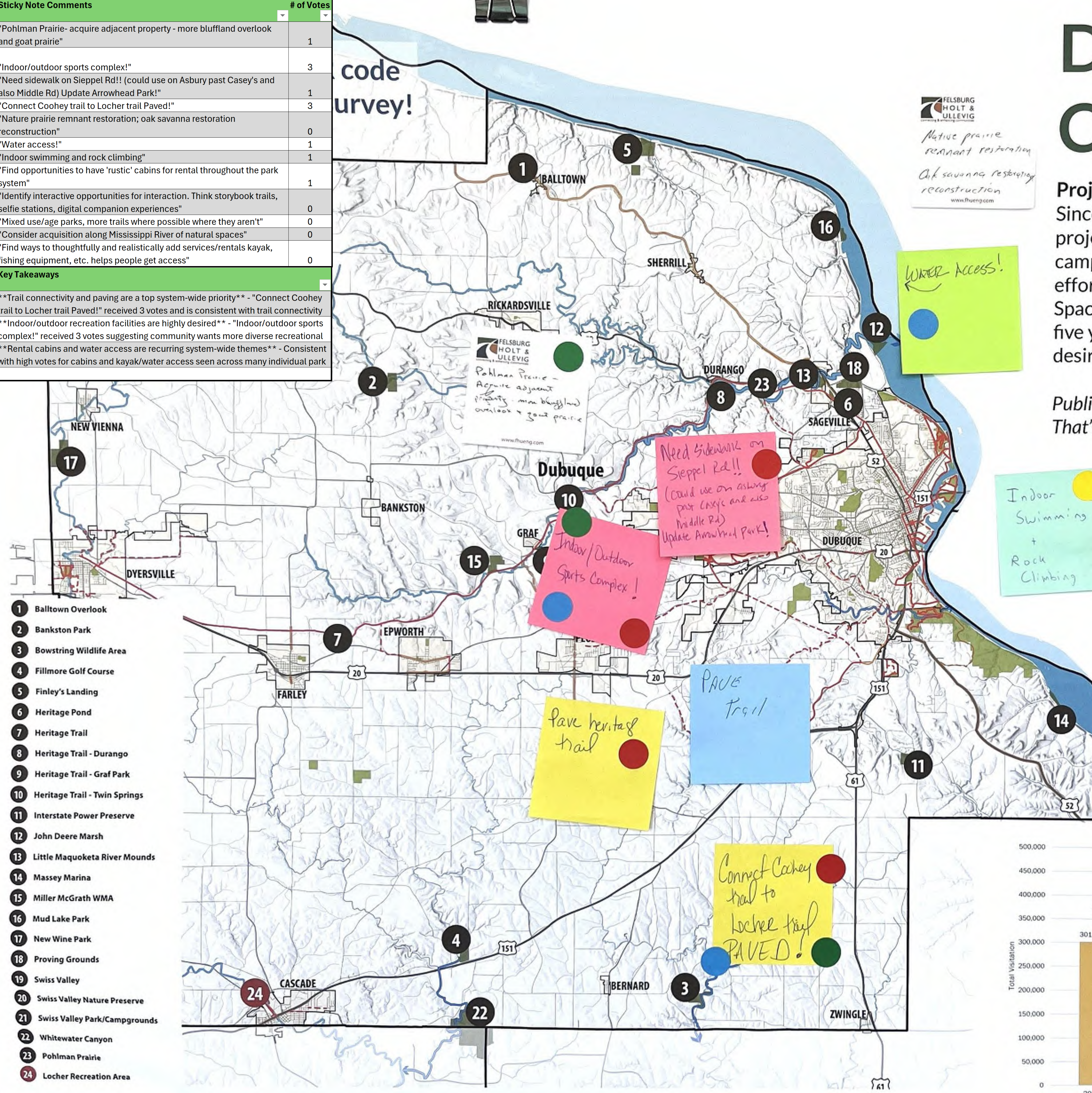
Project Overview
Since 2020, Dubuque County Conservation has completed numerous projects—ranging from improving fishing access and enhancing campgrounds to restoring streams and expanding natural areas. These efforts have been guided by the Comprehensive Parks, Trails, and Open Spaces Plan. As the County Conservation Board looks ahead to the next five years, your feedback on the priorities, improvements, and actions is desired.
Public engagement is an important part of any community. That's why we need to hear from you!
Public engagement is an important part of any community.
That's why we need to hear from you!
Vision
A network of high quality parks,
habitats, trails, and waters
supported by communities
passionate about nature.
Mission
To engage the community's stewardship and enjoyment of its natural resources.
Identifying interactive opportunities for interaction.
Think storybook trails, self stations, digital companion experiences.
What Is Placer.ai?
An AI-powered location analytics platform that utilizes location data. It helps businesses and entities make decisions based on things like visitation trends and visitor demographics.
Since 2019, park system usage has increased 50%.
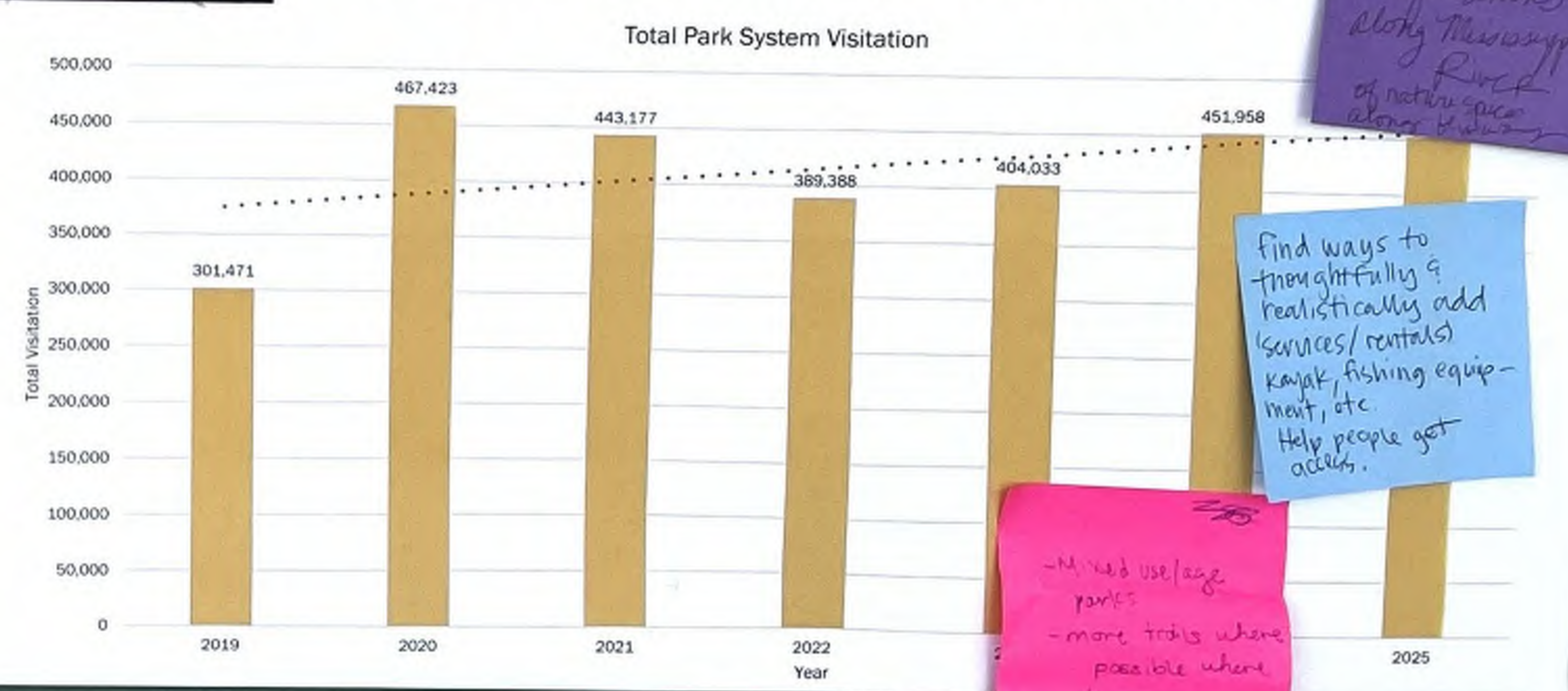
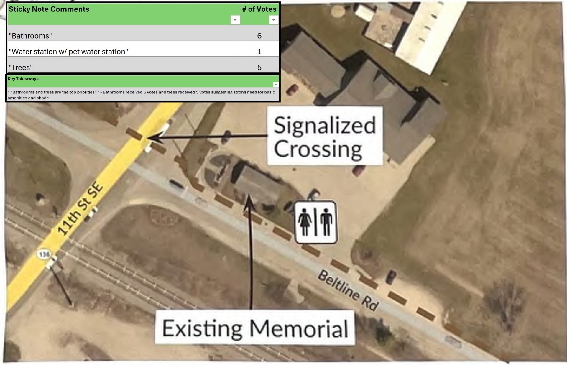
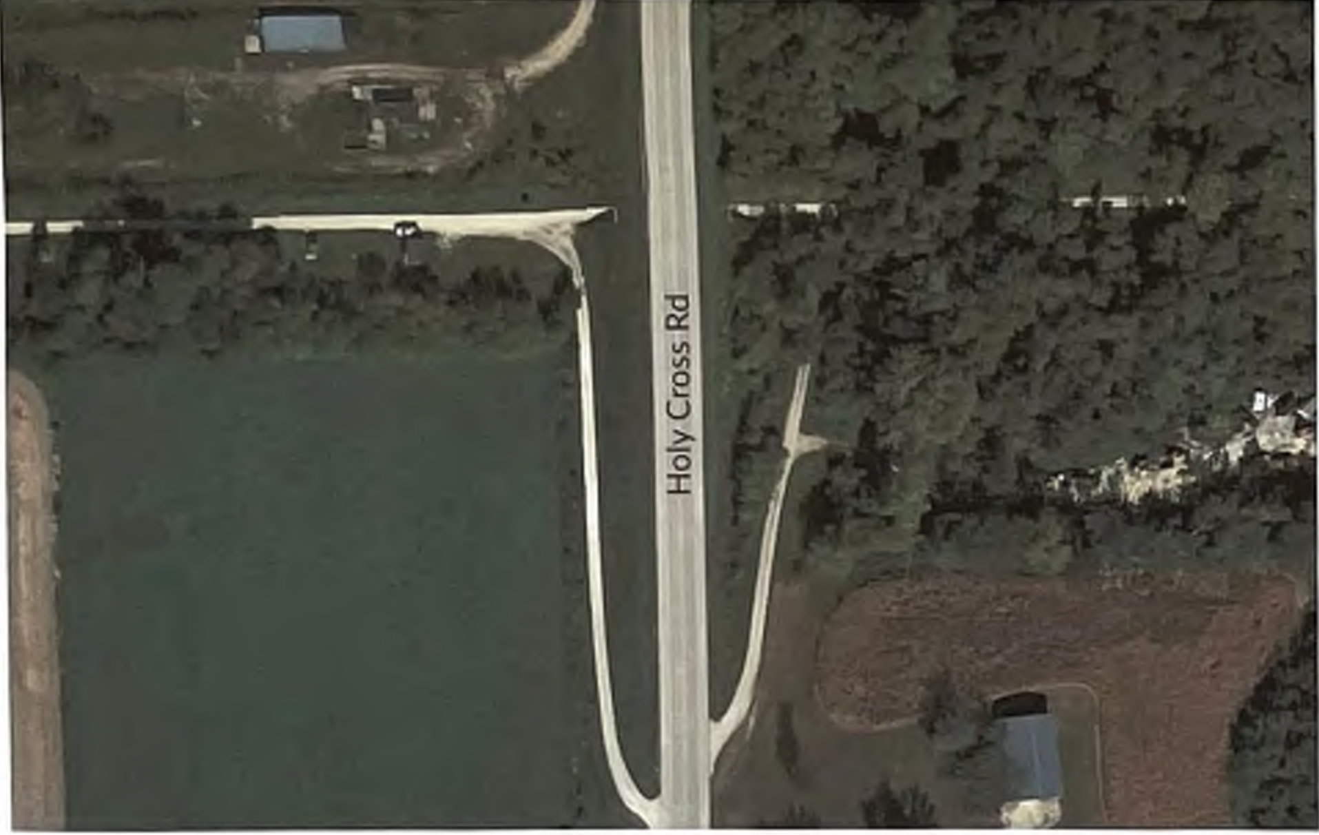
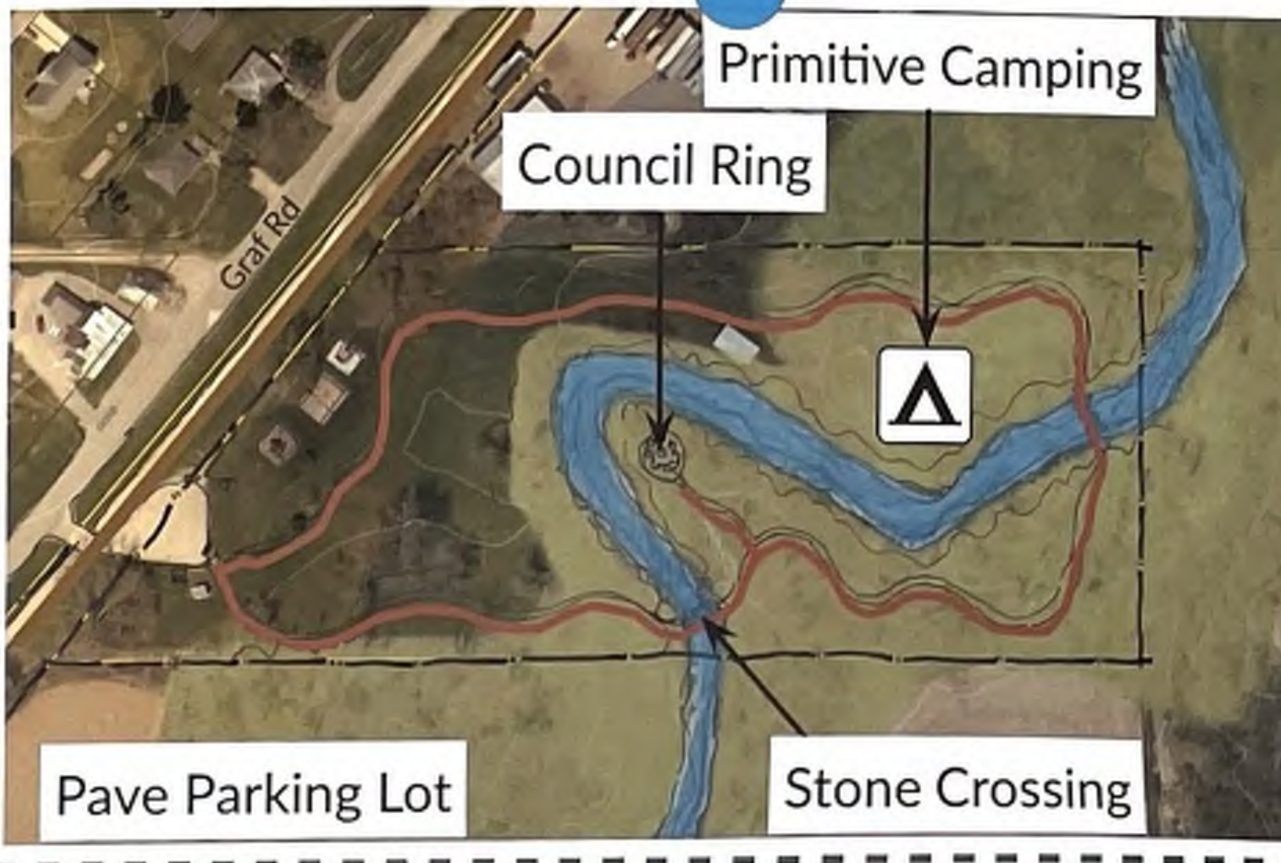
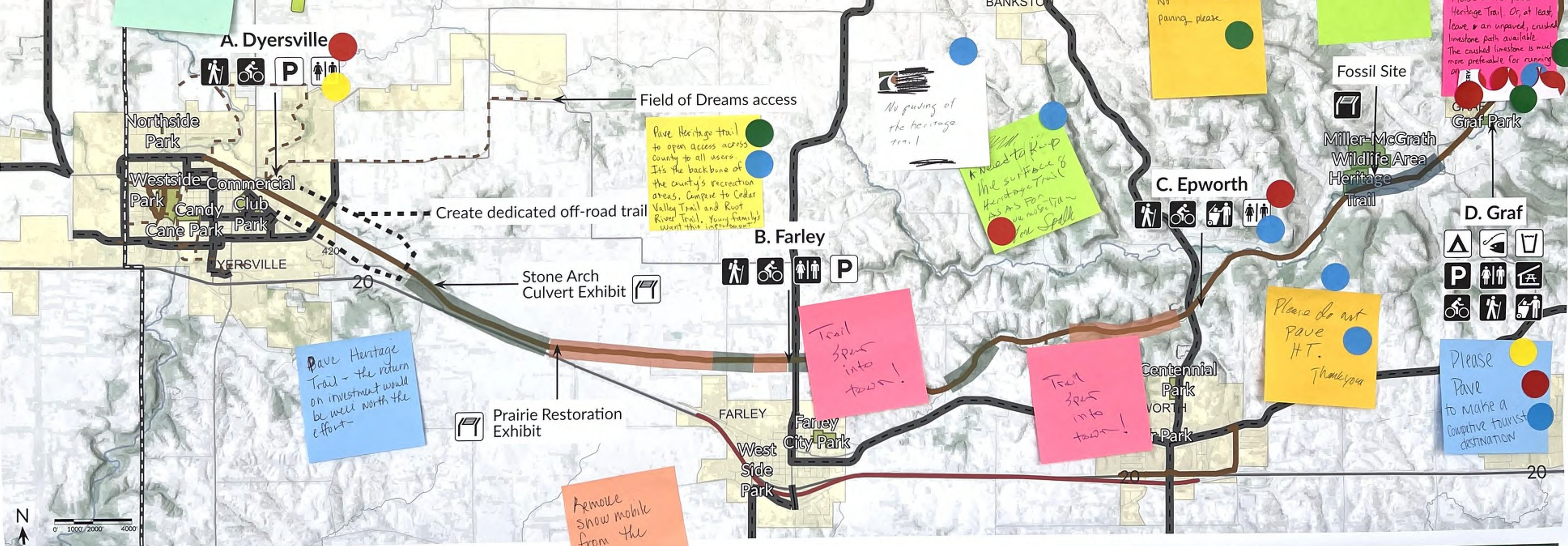

What would you like to see at this trailhead?
What would you like to see at this access point?
What would you like to see at this access point?
What would you like to see at this trailhead?
Field of Dreams access
| Heritage Trail - Overall Sticky Note Comments | # of Votes |
| "Water along trail" | 0 |
| "Clean up remnant prairies" | 1 |
| Pave | 30 |
| Do Not Pave | 30 |
| Combination | 13 |
| "Remove snowmobile from the trail" | 0 |
| Key Takeaways | |
| Paving the trail is the most divisive system-wide issue - Pave and Do Not Pave each received 30 votes, showing the community is equally split, with Combination receiving 13 votes as a compromise. | |
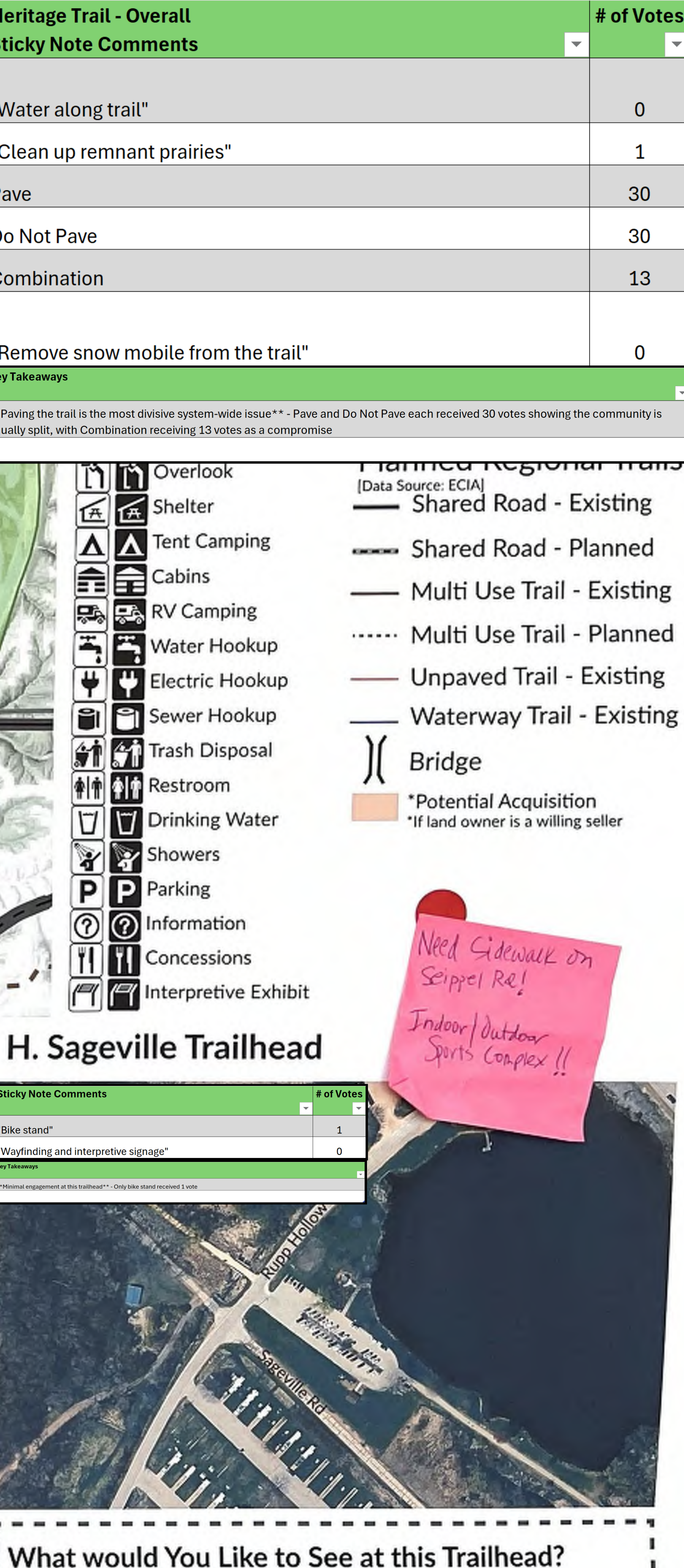
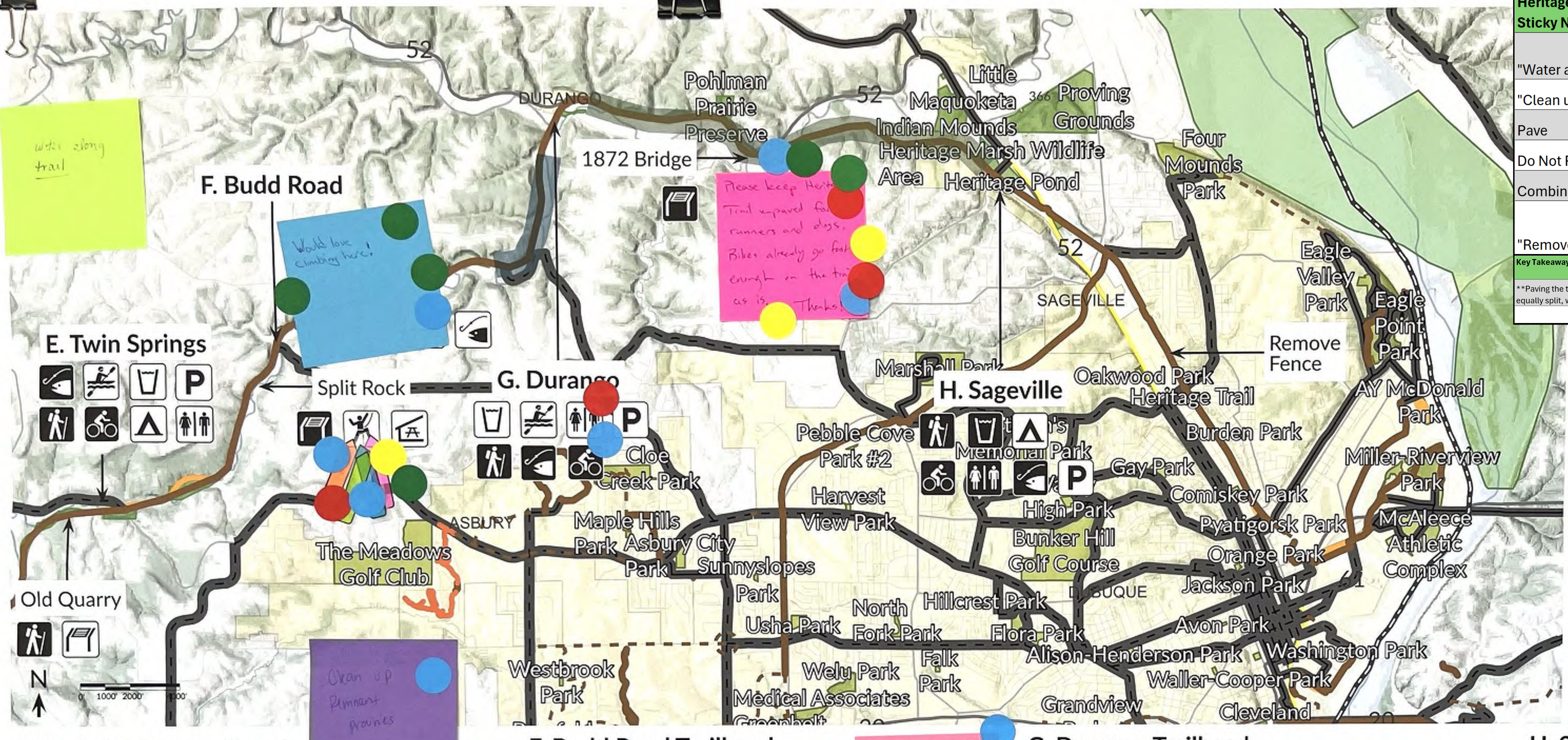
G. Durango Trailhead
F. Budd Road Trailhead
E. Twin Springs Trailhead
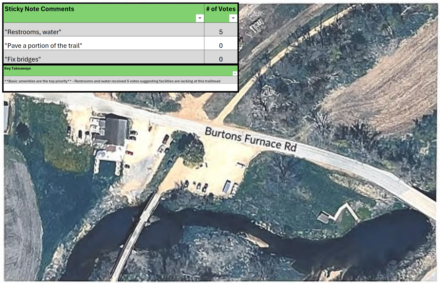
What would you like to see at this trailhead?
What would you like to see at this trailhead?
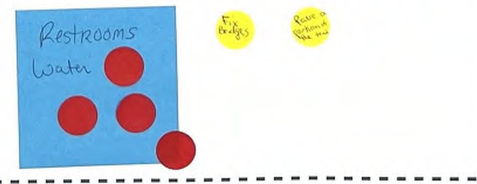
What would you like to see at this trailhead?
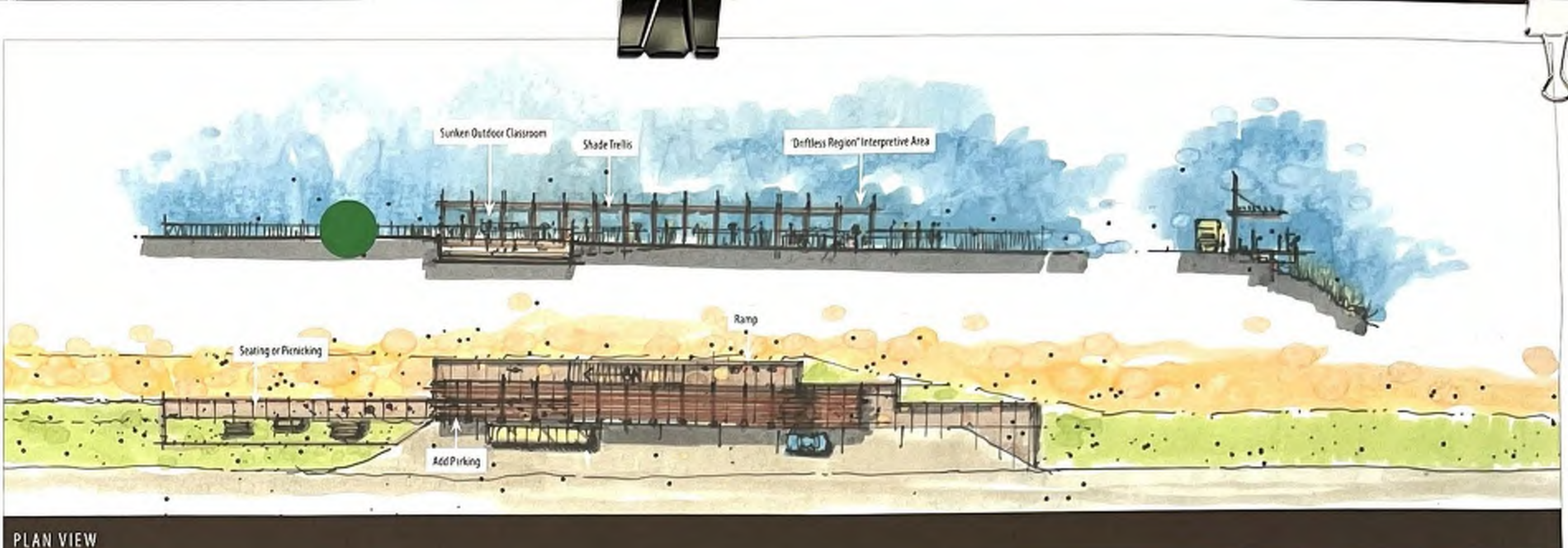
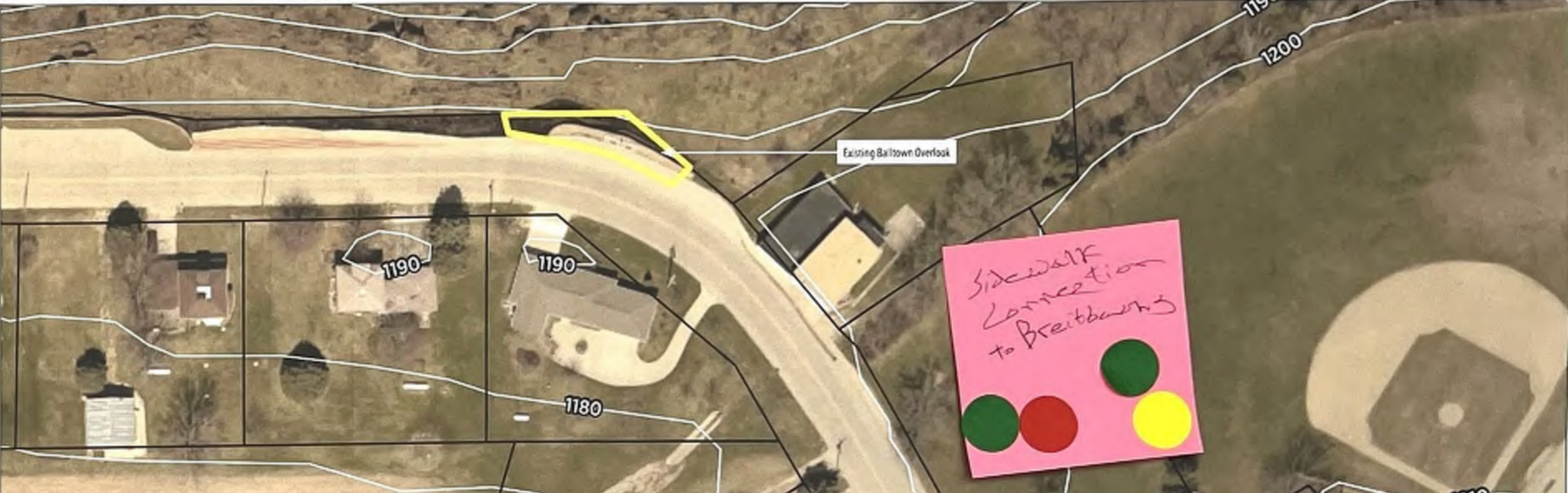
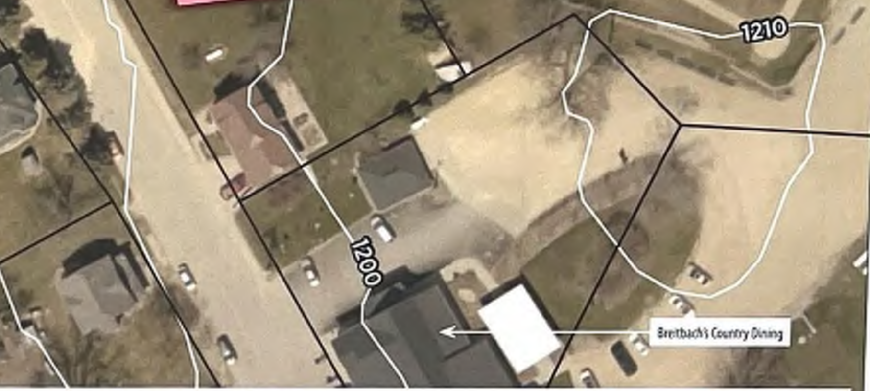
| Sticky Note Comments | # of Votes | Potential Projects | # of Votes2 |
|---|---|---|---|
| "Sidewalk connection to Breitbach's" | 4 | Create interpretive exhibit(s) about the Driftless region | 6 |
| "Outdoor classroom not needed it's on the side of the road. What groups would go here for a lesson?" | 3 | Improve ADA-compliant accessibility, improve parking | 2 |
| "Do a classroom at the second pullover spot for the buses" | 0 | ||
| "Shade would be nice" | 1 | ||
| Key Takeaways | |||
Recently Completed Park Improvements
- Completed railing maintenance and sidewalk leveling
Potential Projects


- Improve outdoor classroom/seating and add shade structures

- Improve ADA-compliant accessibility, improve parking
What Would You Like to See at This Park? Leave Your Comments Below:
……
PLAN VIEW
Interpretive exhibits are the top priority - Creating exhibits about the Driftless region received 6 votes, the highest of any project
Sidewalk connectivity and accessibility are desired - Sidewalk connection to Breitbach's received 4 votes and ADA improvements received 2 votes
Currently exist. Symbols in white represent amenities that were proposed in 2020.
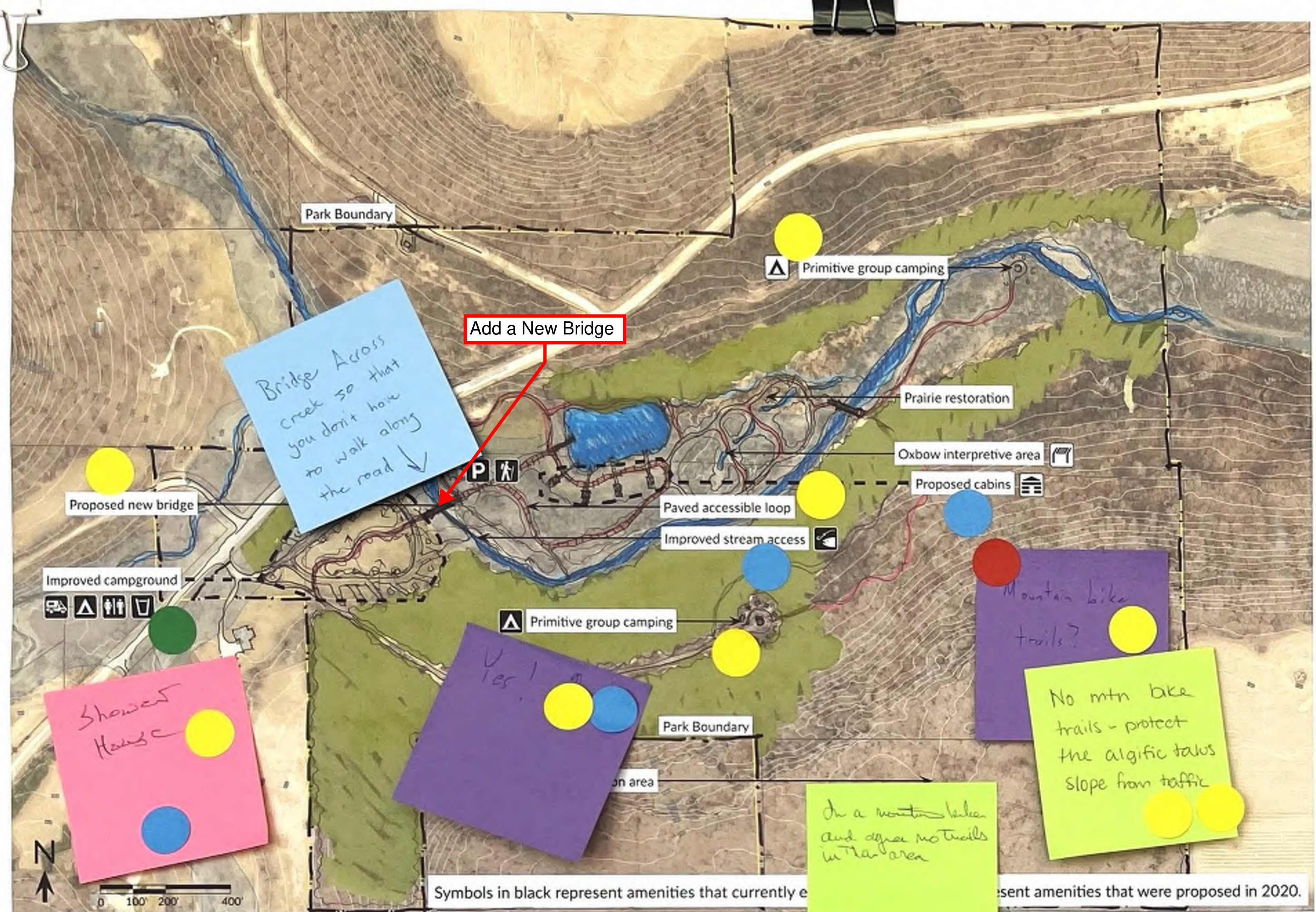
Recently Completed Park Improvements
Potential
- Trails are currently being constructed
- Installed a group campfire at the north of the park
- Raised outlet structure to improve pond
- Add a new bridge
- Improve campground, add a group camping area, and consider adding cabins
- Add ADA-compliant walking route to provide access to fishing for all people
- Vegetation management in flood plain, meadow and woodland
- Stream and prairie restoration
- No. 1.

- Add interpretive displays about Karst Depressions
- Acquire surrounding properties to protect drinking water and preserve sensitive ecological areas, including Karst Depressions
What Would You Like to See at This Park? Leave Your Comments Below:
| Sticky Note Comments | # of Votes | Potential Projects | # of Votes |
|---|---|---|---|
| "Bridge across creek so that you don't have to walk along the road" | 0 | Add a new bridge | 3 |
| "Yes!" [primitive group camping] | 2 | Vegetation management in flood plain, meadow and woodland | 2 |
| "Shower House" | 2 | Stream and prairie restoration | 2 |
| "No mtn bike trails - protect the algific talus slope from traffic" | 2 | Add interpretive displays about Karst Depressions | 1 |
| "I'm a mountain biker and agree no trails in this area" | 0 | Acquire surrounding properties to protect drinking water and preserve sensitive ecological areas, including Karst Depressions | 2 |
| "Mountain bike trails?" | 2 | Improve campground, add a group camping area, and consider adding cabins | 1 |
| Primitive group camping | 2 | ||
| Proposed cabins | 1 | ||
| Paved accessible loop | 1 | ||
| Improved stream access | 1 | ||
| Key Takeaways | |||
| Bridge and vegetation management are top priorities – Both received 3 and 2 votes respectively | |||
| Protection of sensitive ecological areas is valued – Acquiring surrounding properties to protect Karst Depressions received 2 votes | |||
| Mountain biking is controversial – Two sticky notes oppose mountain bike trails while one supports them, suggesting a divided community | |||
Bankston Park
Represents amenities that were proposed in 2020.
Symbols in black represent amenities that currently exist.
| Sticky Note Comments | # of Votes | Potential Projects | # of Votes |
|---|---|---|---|
| "Remove trash & junk" | 5 | Repair the historic bridge for pedestrian access | 3 |
| "Improve kayak launch area" | 2 | Install a bridge for pedestrians and staff UTV access | 1 |
| "More wildlife support - bird & bat houses" | 1 | Develop and maintain soft trail system | 2 |
| "Pit toilet & small shelter" | 2 | Improve parking, add a kayak launch site | 3 |
| "Camping" | 1 | ||
| "Some benches or picnic tables along the trails would be helpful. When hiking w/ kids we need places to stop for breaks." | 0 | ||
Key Takeaways | |||
| Trail development and kayak access are top priorities – Improve parking/kayak launch received 3 votes and develop soft trail system received 2 votes. | |||
| Trash removal is a concern – Remove trash & junk received 5 votes, the highest of any sticky note. | |||
| Other amenities that support recreation area desired here | |||
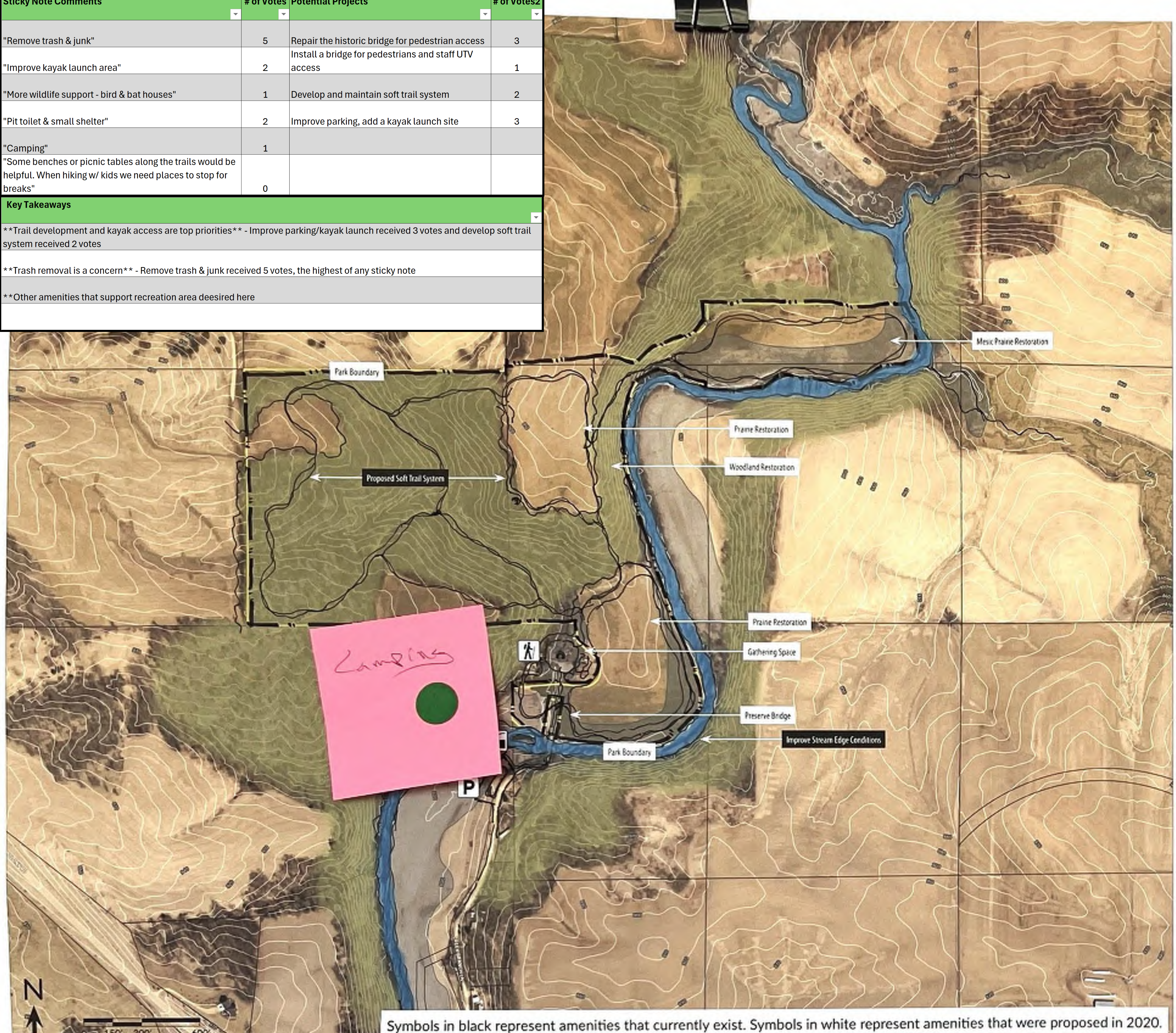
Potential Projects
What would you like to see at this park? Leave your comments below:

- Repair the historic bridge for pedestrian access
Bowstring Wildlife Area
Symbols in black represent amenities that currently exist. Symbols in white represent amenities that were proposed in 2020.
——
| Sticky Note Comments | # of Votes | Potential Projects | # of Votes |
|---|---|---|---|
| "Blacktop the gravel loop for kids' bikes" | 2 | Create a water trail | 2 |
| "More native plantings and wetland management" | 3 | ||
| "Kayak launch" | 8 | ||
| "Real bathrooms" | 1 | ||
| "Blacktop loop for bikes" | 1 | ||
| Key Takeaways | |||
| Kayak launch is overwhelmingly the top priority – received 8 votes on sticky note, the highest of any comment at this park | |||
| Native plantings and wetland management are highly valued – received 3 votes, suggesting strong interest in ecological improvements | |||
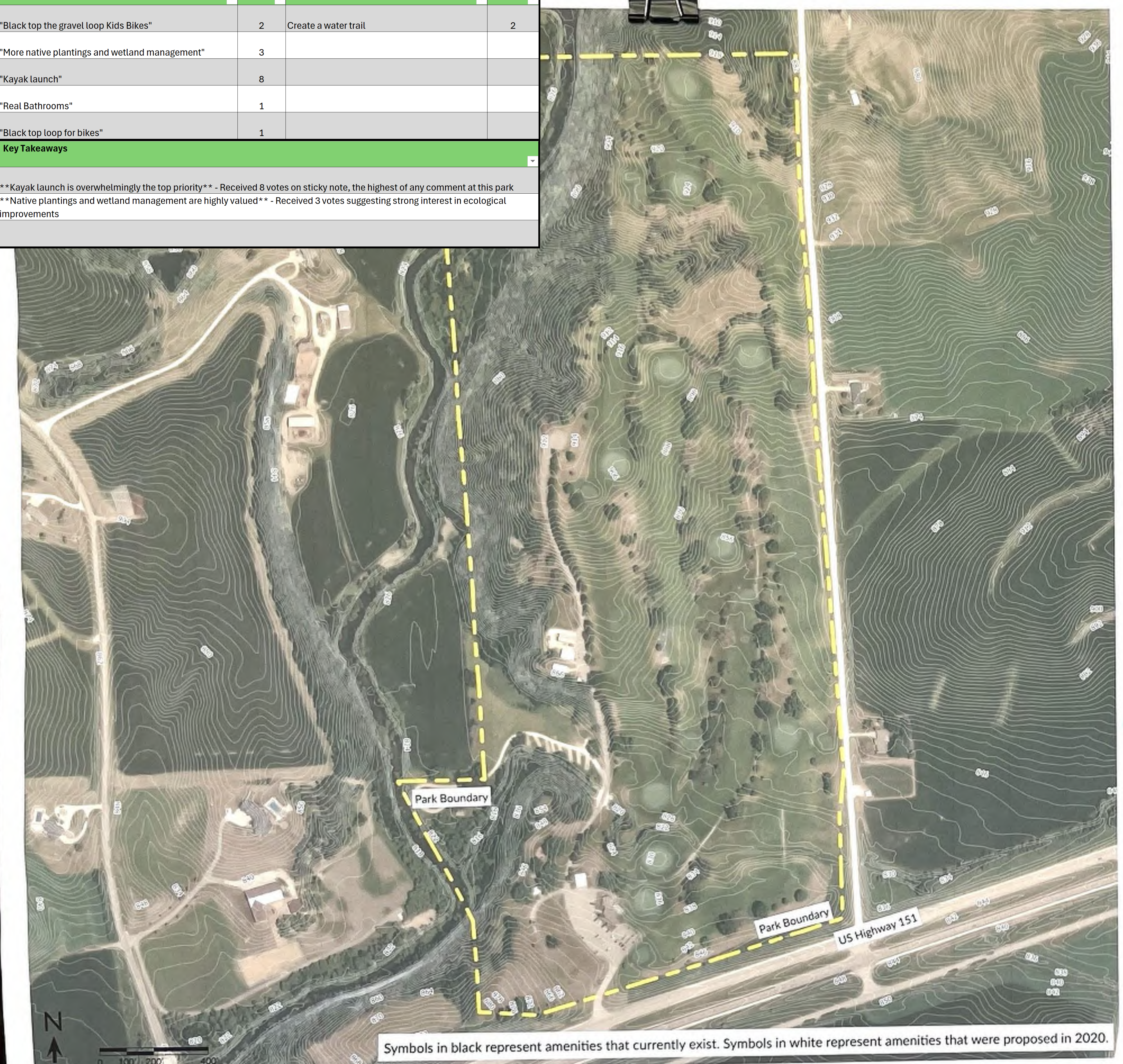
Potential Projects
What Would You Like to See at This Park?
Leave Your Comments Below:
- Upgrade electric lines to 50A
Symbols in black represent amenities that currently exist. Symbols in white represent amenities that were proposed in 2020.
1
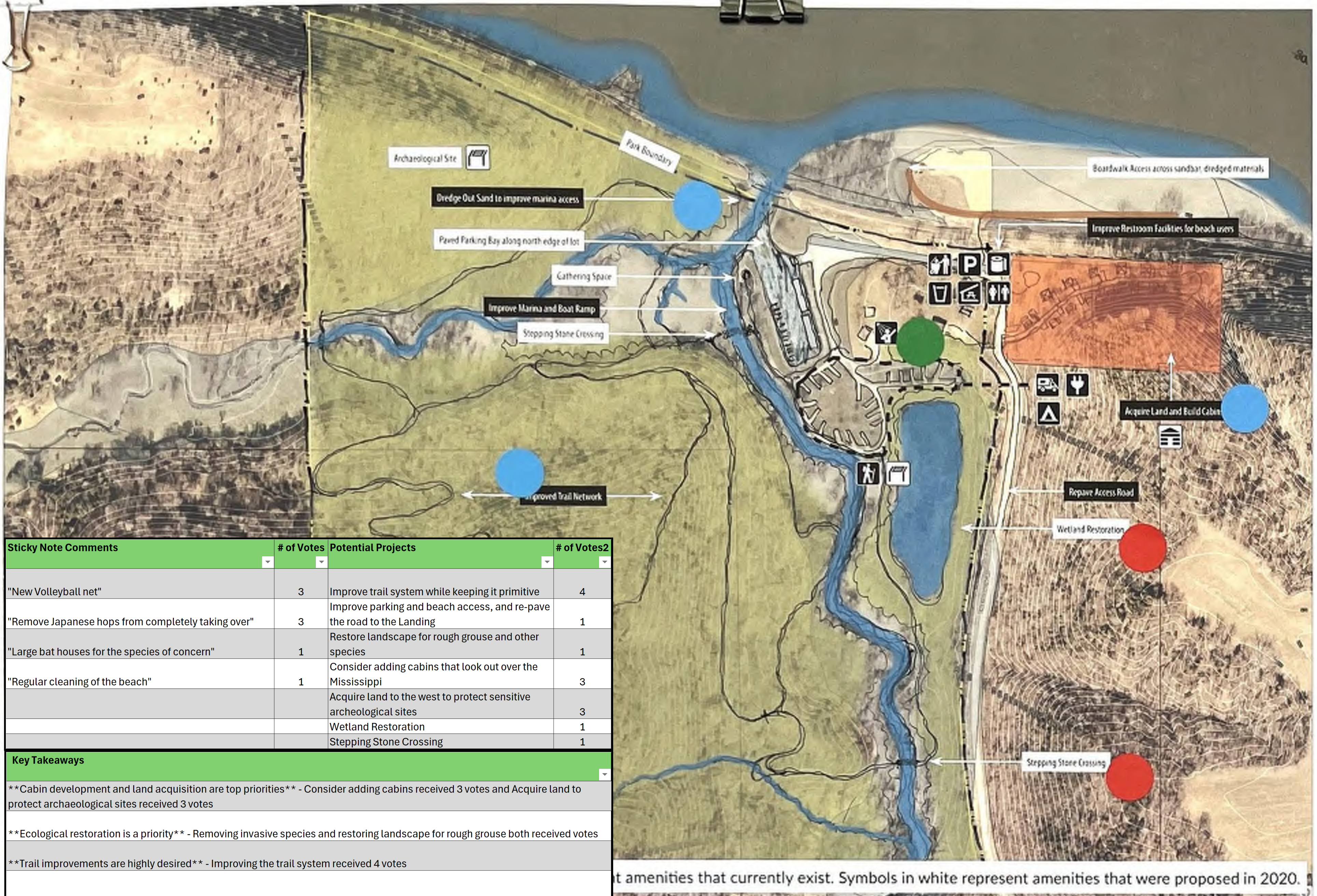
| Sticky Note Comments | # of Votes | Potential Projects | # of Votes |
|---|---|---|---|
| "New Volleyball net" | 3 | Improve trail system while keeping it primitive | 4 |
| "Remove Japanese hops from completely taking over" | 3 | Improve parking and beach access, and re-pave the road to the Landing | 1 |
| "Large bat houses for the species of concern" | 1 | Restore landscape for rough grouse and other species | 1 |
| "Regular cleaning of the beach" | 1 | Consider adding cabins that look out over the Mississippi | 3 |
| Acquire land to the west to protect sensitive archaeological sites | 3 | ||
| Wetland Restoration | 1 | ||
| Stepping Stone Crossing | 1 | ||
| Key Takeaways | |||
| Cabin development and land acquisition are top priorities - Consider adding cabins received 3 votes and Acquire land to protect archaeological sites received 3 votes | |||
Ecological restoration is a priority - Removing invasive species and restoring landscape for rough grouse both received votes | |||
| Trail improvements are highly desired - Improving the trail system received 4 votes GA | |||
Recently Completed Park Improvements
- Bridge has been installed and lit
- Electric lines have been updated
Potential Projects

- Improve trail system while keeping it primitive
- Improve parking and beach access, and re-pave the road to the Landing
- Restore landscape for rough grouse and other species
- Acquire land to the west to protect sensitive archaeological sites
- Consider adding cabins that look out over the Mississippi
What Would You Like to See at This Park? Leave Your Comments Below:
Finley's Landing
Amenities that currently exist. Symbols in white represent amenities that were proposed in 2020.
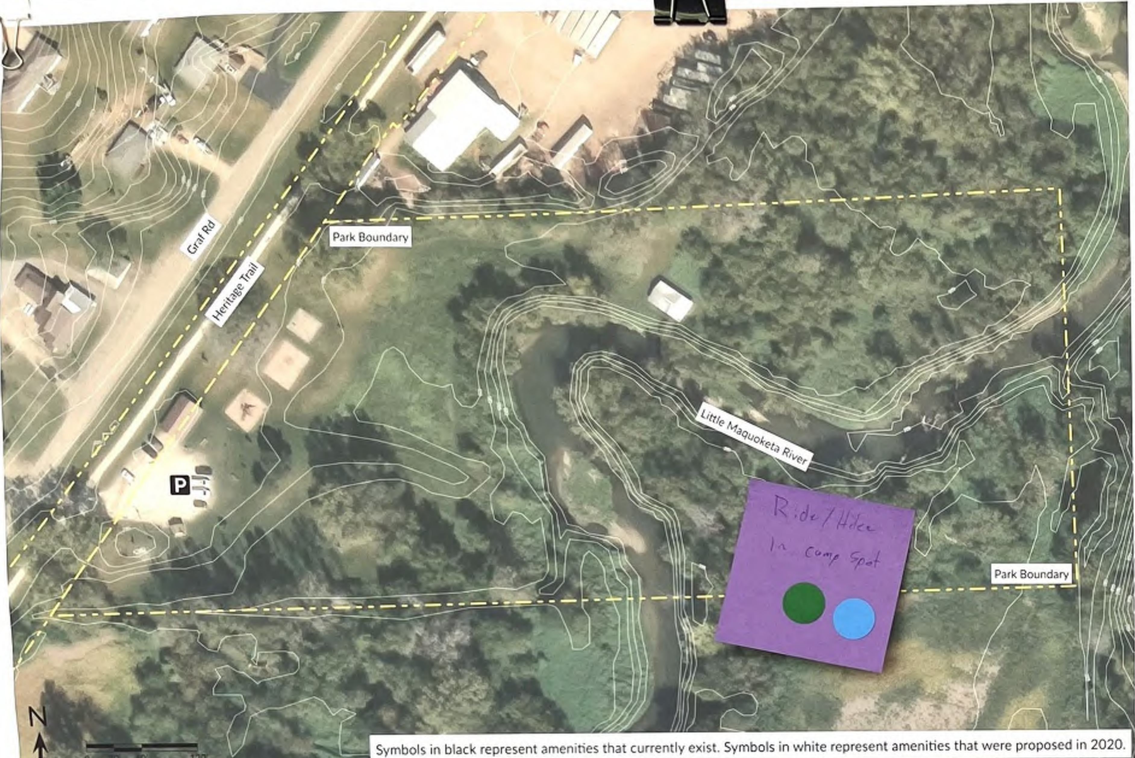
What Would You Like to See at This Park? Leave Your Comments Below:
| Sticky Note Comments | # of Votes | Potential Projects | # of Votes |
|---|---|---|---|
| "Ride/Hike in - Camp Spot" | 2 | Improve stream access for fishing | 4 |
| "Water please" | 3 | Expanding permanent camping facilities | 1 |
| "Didn't know this park was so big!" | 1 | ||
| "Access to entire property - trails?" | 5 | ||
| "Hiking trails" | 1 | ||
| Key Takeaways | |||
| Stream access for fishing is the top priority - Received 4 votes, the highest of any project | |||
| Trail access to entire property is highly desired - Access to entire property - trails! received 5 votes, the highest sticky note | |||
| Water availability is a concern - Water please received 3 votes, suggesting lack of water access at the park | |||
Potential Projects
- Remove the old pavilion
- Add a council ring
- Pave the parking lot

Symbols in black represent amenities that currently exist. Symbols in white represent amenities that were proposed in 2020.
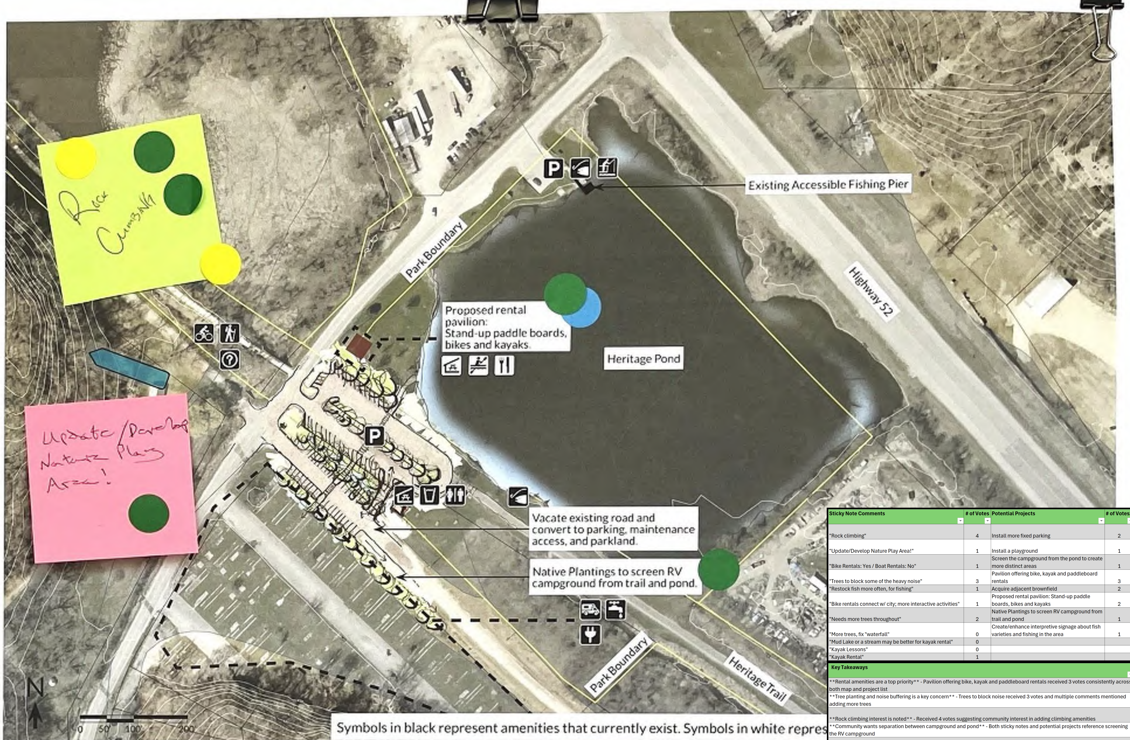
| Sticky Note Comments | # of Votes | Potential Projects | # of Votes |
|---|---|---|---|
| "Rock climbing" | 4 | Install more fixed parking | 2 |
| "Update/Develop Nature Play Area!" | 1 | Install a playground | 1 |
| "Bike Rentals: Yes / Boat Rentals: No" | 1 | Screen the campground from the pond to create more distinct areas | 1 |
| "Trees to block some of the heavy noise" | 3 | Pavilion offering bike, kayak and paddleboard rentals | 3 |
| "Restock fish more often, for fishing" | 1 | Acquire adjacent brownfield | 2 |
| "Bike rentals connect w/ city; more interactive activities" | 1 | Proposed rental pavilion: Stand-up paddle boards, bikes and kayaks | 2 |
| "Needs more trees throughout" | 2 | Native Plantings to screen RV campground from trail and pond | 1 |
| "More trees, fix 'waterfall'" | 0 | Create/enhance interpretive signage about fish varieties and fishing in the area | 1 |
| "Mud Lake or a stream may be better for kayak rental" | 0 | ||
| "Kayak Lessons" | 0 | ||
| "Kayak Rental" | 1 | ||
| Key Takeaways | |||
| Rental amenities are a top priority - Pavilion offering bike, kayak and paddleboard rentals received 3 votes consistently across both map and project list | |||
| Tree planting and noise buffering is a key concern - Trees to block noise received 3 votes and multiple comments mentioned adding more trees | |||
| Rock climbing interest is noted - Received 4 votes suggesting community interest in adding climbing amenities | |||
| Community wants separation between campground and pond - Both sticky notes and potential projects reference screening the RV campground | |||
What Would You Like to See at This Park? Leave Your Comments Below:
Potential Projects
Kayak
Lessons
- Repair the south side of the pond bank
- Install a playground
• Install a playground
• Add a maintenance facility
⚫️ 🔍 📞 📊 📊 📊 📊 📉 📉
- Create/enhance interpretive signage about fish varieties and fishing in the area
- Pavilion offering bike, kayak and paddleboard rentals
- In-stream restoration
- Acquire adjacent brownfield

Symbols in black represent amenities that currently exist. Symbols in white represent amenities proposed or planned.
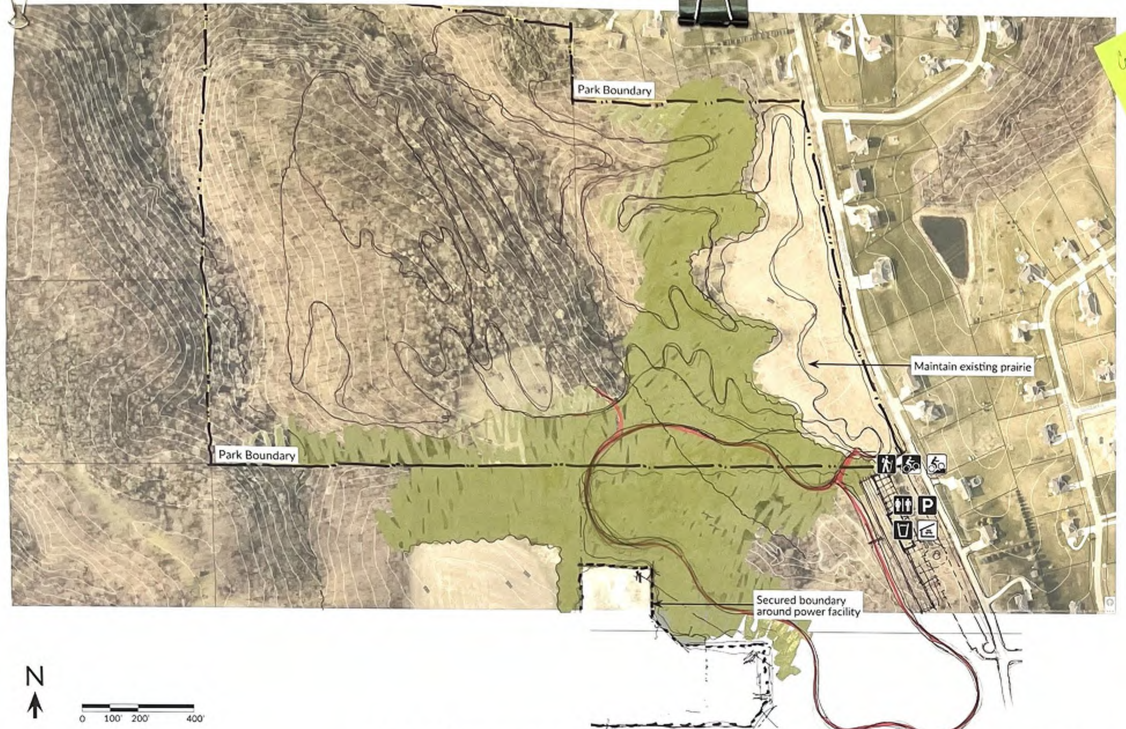
Recently Completed Park Improvements
- Added a restroom
Potential Projects
- Add more mountain bike trails
What Would You Like to See at This Park? Leave Your Comments Below:
| Sticky Note Comments | # of Votes | Potential Projects | # of Votes |
|---|---|---|---|
| "This is one of my favorite parks, let's get more property from ITC and add more trails!" | 3 | Add more mountain bike trails | 5 |
| "Wildlife support such as bird and bat houses" | 3 | ||
| "Create open grass space – this is what prevents our youth MTN Bike team from practicing here" | 0 | ||
| "Overflow parking area; more access; green/pavilions for other use" | 0 | ||
| Key Takeaways | |||
| Mountain biking is the clear top priority – Adding more mountain bike trails received 5 votes, the only potential project listed | |||
| Wildlife habitat support is valued – Bird and bat houses received 3 votes | |||
| Open grass space is desired – Community notes lack of open space prevents youth mountain bike team from practicing | |||
Interstate Power Preserve
Symbols in black represent amenities that currently exist. Symbols in white represent amenities that were proposed in 2020.
| Sticky Note Comments | # of Votes | Potential Projects | # of Votes |
|---|---|---|---|
| Remove invasives | 1 | Install a bird blind or other bird observation areas | 4 |
| Acquire land on the other side of the trail and protect from boats | 0 | ||
| Lights from John Deere to turn off; impacts migration | 4 | ||
| As one of the only walk-in hunting (duck) spots in DBQ Co - Can we pump water into the NE end of the marsh on dry years? Would open 1-2 more for people | 1 | ||
| No more duck decoys | 0 | ||
| Add bathroom | 0 | ||
| If this [bird blind] becomes a reality - need to be cautious on placement as to not impact any of the best hunting spots at the property | 1 | ||
| Thanks for the new Kayak launch! | 0 | ||
| Key Takeaways | |||
| Bird observation is the top priority - Installing a bird blind received 4 votes, the highest of any project | |||
| Lights from John Deere impacting migration is a top concern - Received 4 votes, the highest of any sticky note | |||
| Hunting access is valued - Comments reference importance of maintaining walk-in duck hunting spots | |||
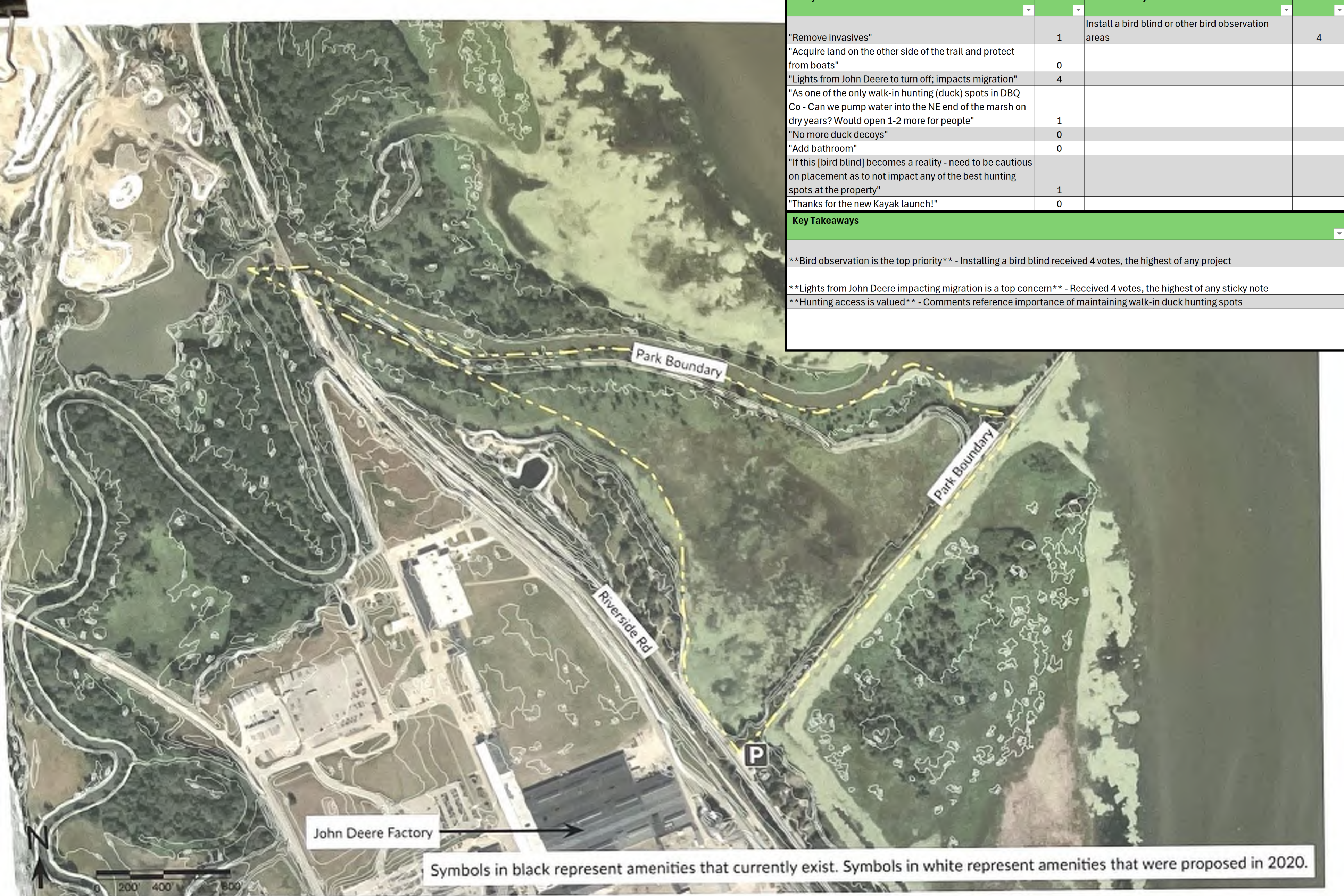
Potential Projects
What Would You Like to See at This Park? Leave Your Comments Below:
- Install a bird blind or other bird observation areas
John Deere Marsh
2
Symbols in black represent amenities that currently exist. Symbols in white represent amenities that were proposed in 2020.
| Sticky Note Comments | # of Votes | Potential Projects | # of Votes |
|---|---|---|---|
| "Remove woody vegetation from mounds. Establish native prairie on mounds." | 4 | Perform trail maintenance | 1 |
| "New signs & education about the cultural significance. Wetland protection. Remove fence." | 6 | ||
| "Clean up mounds area. Remove/replace/repair fencing." | 2 | ||
| "Connect bike trail to Heritage Trail." | 1 | ||
| "Remove fence." | 2 | ||
| "Stream access." | 0 | ||
| "Connect to trail." | 0 | ||
| "Repair fence." | 0 | ||
| Key Takeaways | |||
| Cultural significance and education is the top priority – New signs & education about cultural significance received 6 votes, the highest of any comment. | |||
| Vegetation management and ecological restoration is highly valued – Removing woody vegetation and establishing native prairie received 4 votes. | |||
| Fencing is a major concern – Multiple sticky notes reference removing, repairing, or replacing fencing. | |||
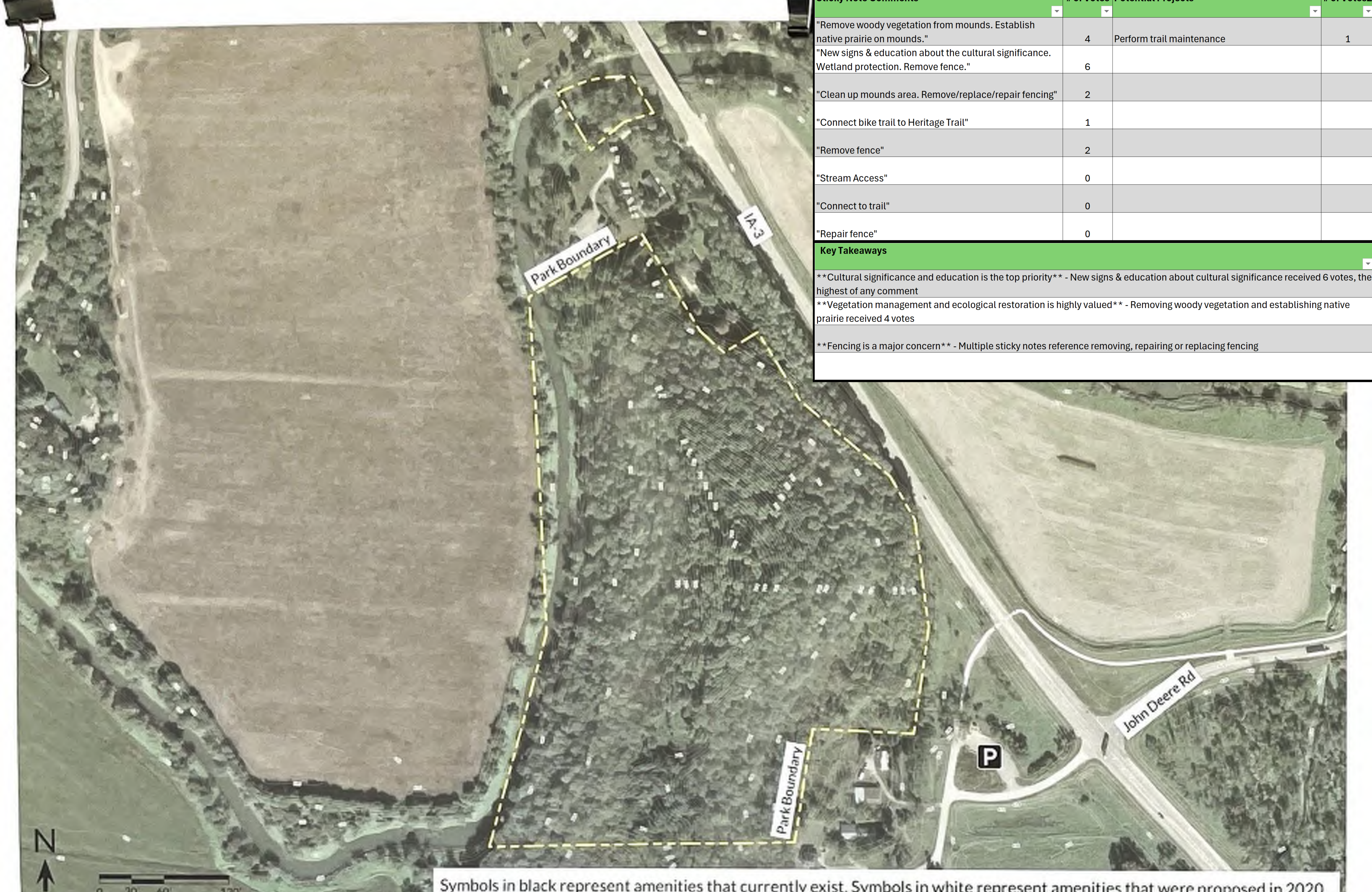
What Would You Like to See at This Park? Leave Your Comments Below:
Potential Projects
Little Maquoketa River Mounds
Symbols in black represent amenities that currently exist. Symbols in white represent amenities that were proposed in 2020.
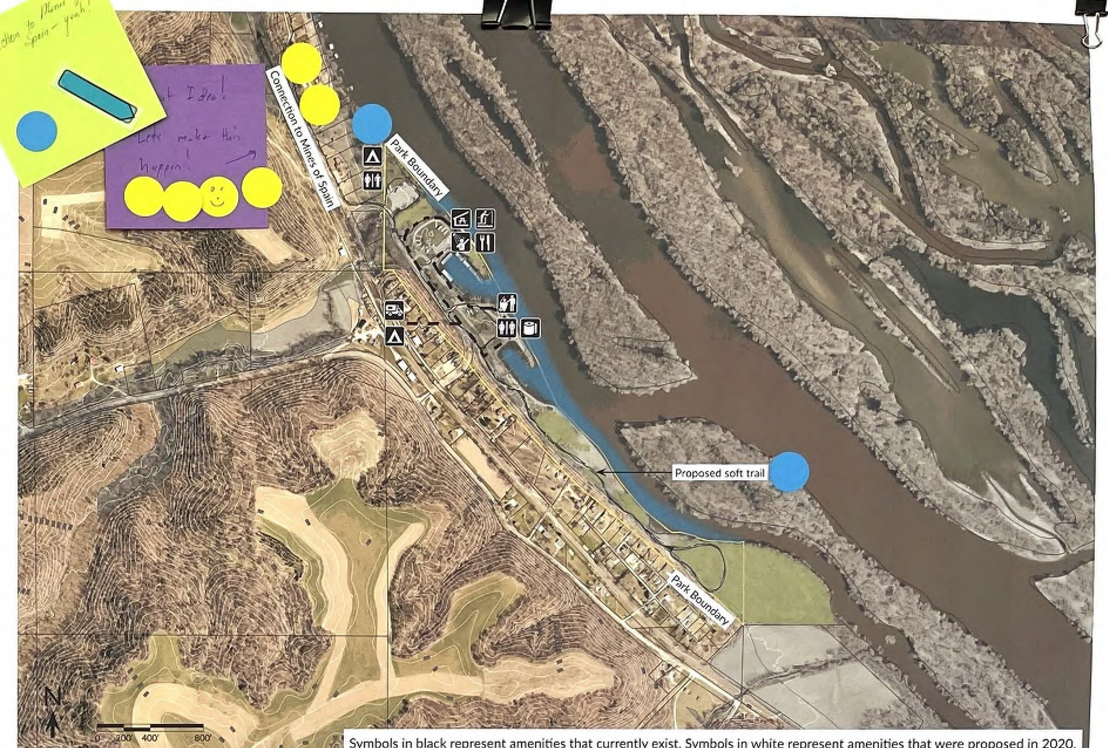
What Would You Like to See at This Park? Leave Your Comments Below:
| Sticky Note Comments | # of Votes | Potential Projects | # of Votes |
|---|---|---|---|
| "Connection to Mines of Spain - yeah!" | 2 | Pave camping sites | 1 |
| "Great idea [connection to Mines of Spain] - let's make this happen!" | 7 | Update RV electrical service lines to 50 Amps | 1 |
| "Prairie rather than turf, more education on wildlife for the recreation-focused people" | 0 | Reconfigure the dump station | 1 |
| "Include more showers" | 0 | Plant trees | 2 |
| Long term: collaborate with State of Iowa to connect park with trails to Mines of Spain | 8 | ||
| Add hiking trails toward inland areas of park | 2 | ||
| Add tent platforms to keep campers in the floodplain dry | 1 | ||
| Proposed soft trail | 1 | ||
| Key Takeaways | |||
| Trail connection to Mines of Spain is overwhelmingly the top priority – Received 8 votes on potential projects list and 7 votes on sticky note | |||
| Planting trees is moderately desired – Received 2 votes suggesting community wants more greenery | |||
| Campground improvements are moderately desired – Multiple campground upgrades received votes | |||
Potential Projects
- Pave camping sites
- Update RV electrical service lines to 50 Amps
- Reconfigure the dump station
- Restore the land along the southeast bank
- Plant trees
- Install fishing access and trail at southeast bank
- Add a new boat ramp
Long term: collaborate with State of Iowa to connect park with trails to Mines of Spain
- Improvements to marina
Symbols in black represent amenities that currently exist. Symbols in white represent amenities that were proposed in 2020.
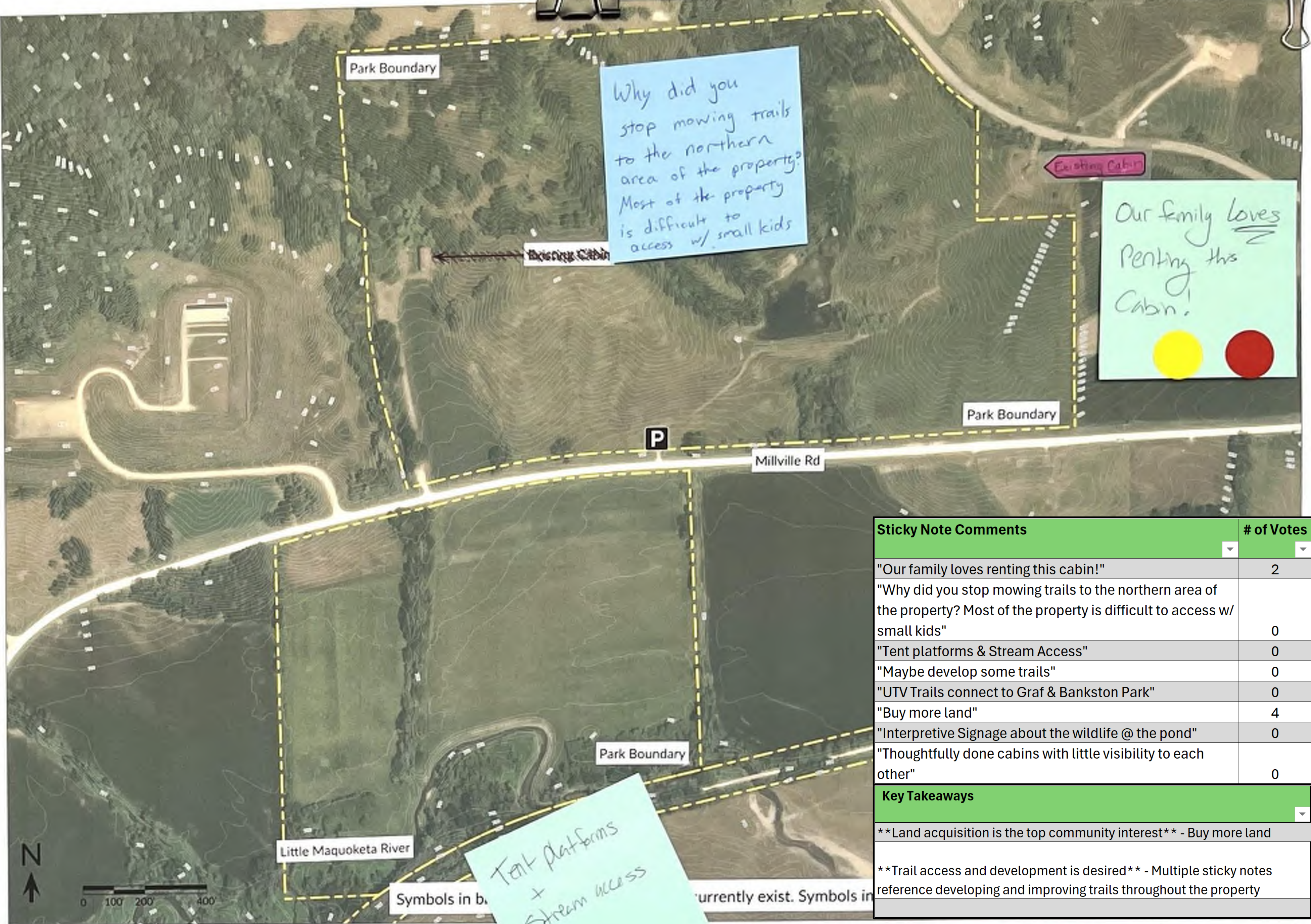
| Sticky Note Comments | # of Votes |
|---|---|
| "Our family loves renting this cabin!" | 2 |
| "Why did you stop mowing trails to the northern area of the property? Most of the property is difficult to access w/ small kids" | 0 |
| "Tent platforms & Stream Access" | 0 |
| "Maybe develop some trails" | 0 |
| "UTV Trails connect to Graf & Bankston Park" | 0 |
| "Buy more land" | 4 |
| "Interpretive Signage about the wildlife @ the pond" | 0 |
| "Thoughtfully done cabins with little visibility to each other" | 0 |
| Key Takeaways | |
| Land acquisition is the top community interest - Buy more land | |
| Trail access and development is desired - Multiple sticky notes reference developing and improving trails throughout the property | |
Recently Completed Park Improvements
Potential Projects
- Installed ADA accessible path to the cabin
- Build more cabins
- Dig a well for water access
- Tear down the house
What Would You Like to See at This Park? Leave Your Comments Below:
| Sticky Note Comments | # of Votes | Potential Projects | # of Votes |
|---|---|---|---|
| "Fishing pier is unusable by about mid/late June due to weeds & lily pads today" | 0 | Expand parking lot | 1 |
| "Improve canoe/kayak launch area" | 0 | Establish a network of hiking trails around Mud Lake and along the Mississippi River dike | 13 |
| "Maintain or tear down rickety tower. Add bike/bike trail" | 0 | ||
| "Yes, access kayak [refer to map]" | 0 | ||
| "Dig it deeper - not able to use [water, refer to map]" | 0 |
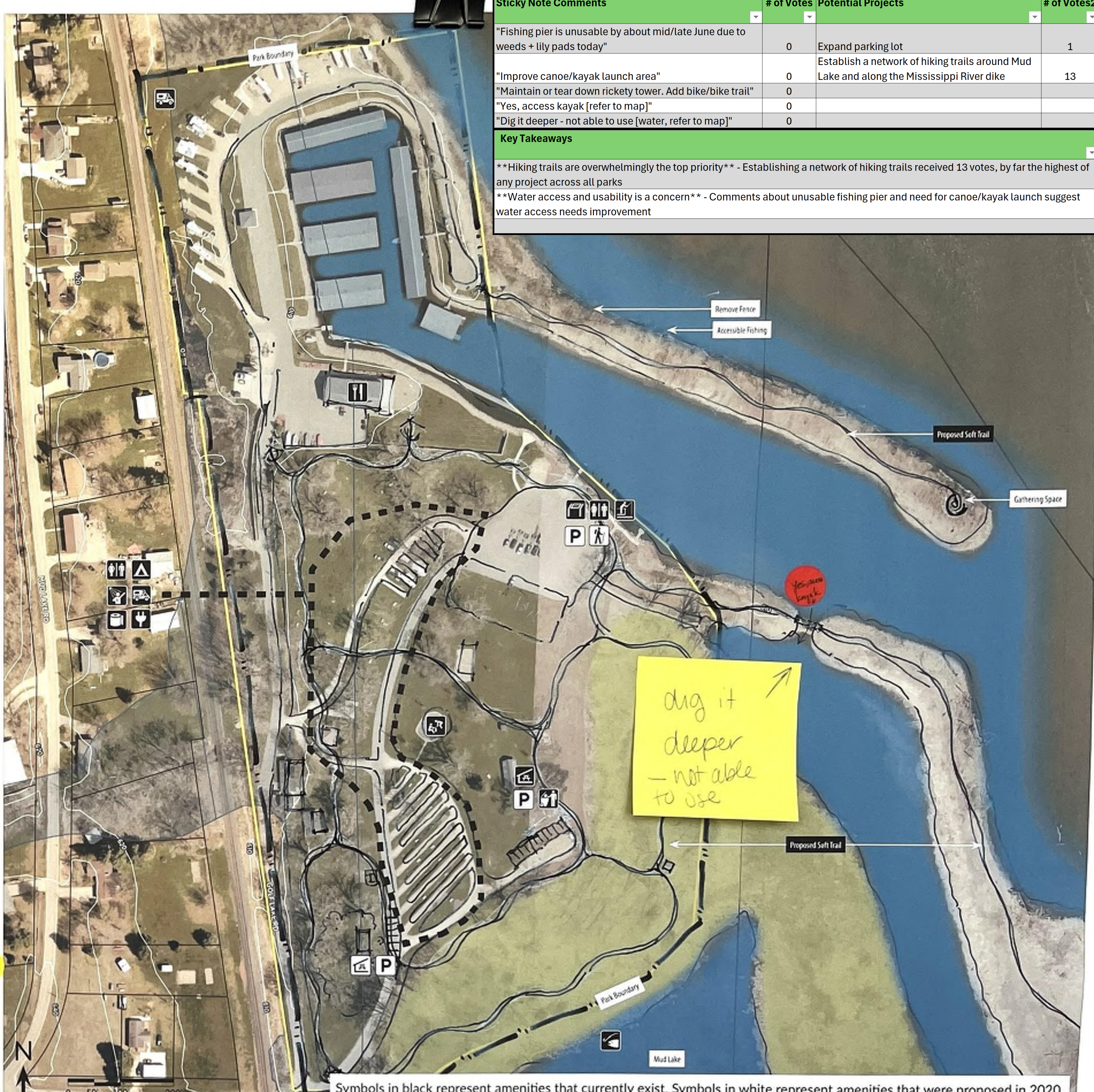
What Would You Like To See At This Park? Leave Your Comments Below:
Potential Projects

- Expand parking lot
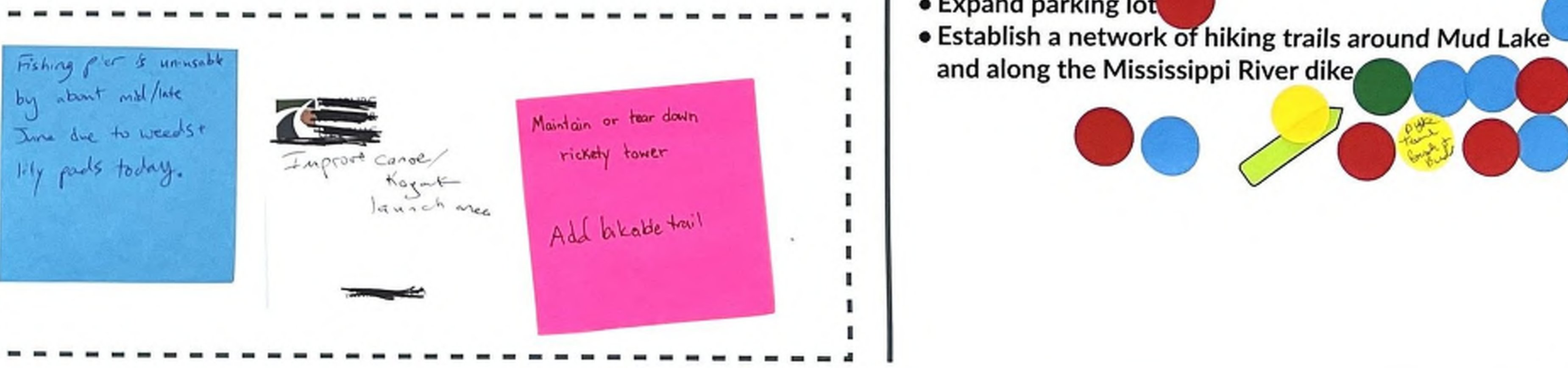
Hiking trails are overwhelmingly the top priority - Establishing a network of hiking trails received 13 votes, by far the highest of any project across all parks.
Water access and usability is a concern - Comments about unusable fishing pier and need for canoe/kayak launch suggest water access needs improvement.
Symbols in black represent amenities that currently exist. Symbols in white represent amenities that were proposed in 2020.
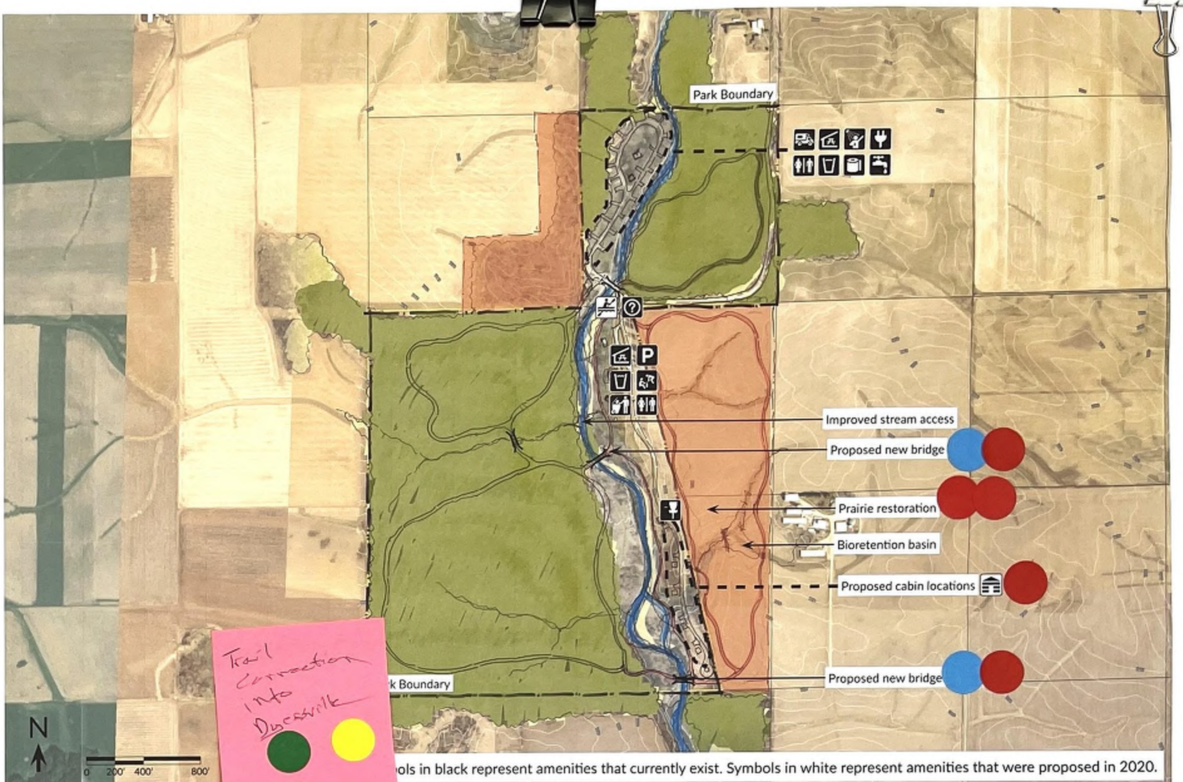
Recently Completed Park Improvements
- Installed additional campsites
- New road paving is underway
- Added an ADA-accessible pavilion
Potential Projects
- Shelter needs to be replaced/removed
- Evaluate need to fix the shower house
- Fix the stream banks at the south side of the park
- Add a new bridge at the south side of the park
- Evaluate the park as a possible location for cabins
- Add access to the stream for water trails
- Create as a trailhead for hiking and paddling
- Manage flood plain vegetation with riverbank cleanup
What Would You Like to See at This Park? Leave Your Comments Below:
| Sticky Note Comments | # of Votes | Potential Projects | # of Votes |
|---|---|---|---|
| "Trail connection into Dyersville" | 2 | Create as a trailhead for hiking and paddling | 3 |
| "Trail to Dyersville" | 0 | Proposed new bridges | 4 |
| "Plant more native ground cover instead of turf" | 3 | Prairie restoration | 2 |
| "Make property larger. Too much corn around" | 0 | Proposed cabin locations | 1 |
| Key Takeaways | |||
| Water trail and trailhead development are top priorities - Create as a trailhead for hiking and paddling received 3 votes and proposed new bridges received 4 votes | |||
| Trail connectivity to Dyersville is desired - Multiple sticky notes reference connecting to Dyersville via trail | |||
| Native ground cover is preferred over turf - Received 3 votes suggesting strong interest in ecological improvements | |||
Symbols in black represent amenities that currently exist. Symbols in white represent amenities that were proposed in 2020.
| Sticky Note Comments | # of Votes | Potential Projects | # of Votes |
|---|---|---|---|
| "Connect to Heritage Pond" | 1 | Add running water | 1 |
| "Add hike/ride in camping!" | 1 | Create mountain biking trails – connect to Heritage Trail via West John Deere Road instead of current path | 2 |
| "Add a pump track" | 2 | Add a dog park, rock climbing program and disc golf | 3 |
| "Climbing/Bouldering!" | 0 | Establish trail connection with John Deere Marsh and Heritage Pond | 2 |
| "Rock Climbing!" | 11 | Heritage trail connector options | 6 |
| "Clearer signs for difficulty levels of bike trails. More medium level at bottom of hill" | 0 | Proposed Dog Park | 5 |
| "No disc golf" | 1 | Future wetland | 3 |
| "Clean up remnant prairies" | 1 | Prairie | 2 |
| "Hard to mobilize at top up in prairies" | 0 | Prairie restoration | 1 |
| "Add camping in parking lot" | 0 | ||
| "Add water" | 1 | ||
| Key Takeaways | |||
| Rock climbing and bouldering is the top community interest – Rock Climbing!! received 11 votes, the highest of any sticky note at this park | |||
| Dog park is highly desired – Proposed Dog Park received 5 votes, the highest of any map project | |||
| Heritage Trail connectivity is valued – Heritage trail connector options received 6 votes | |||
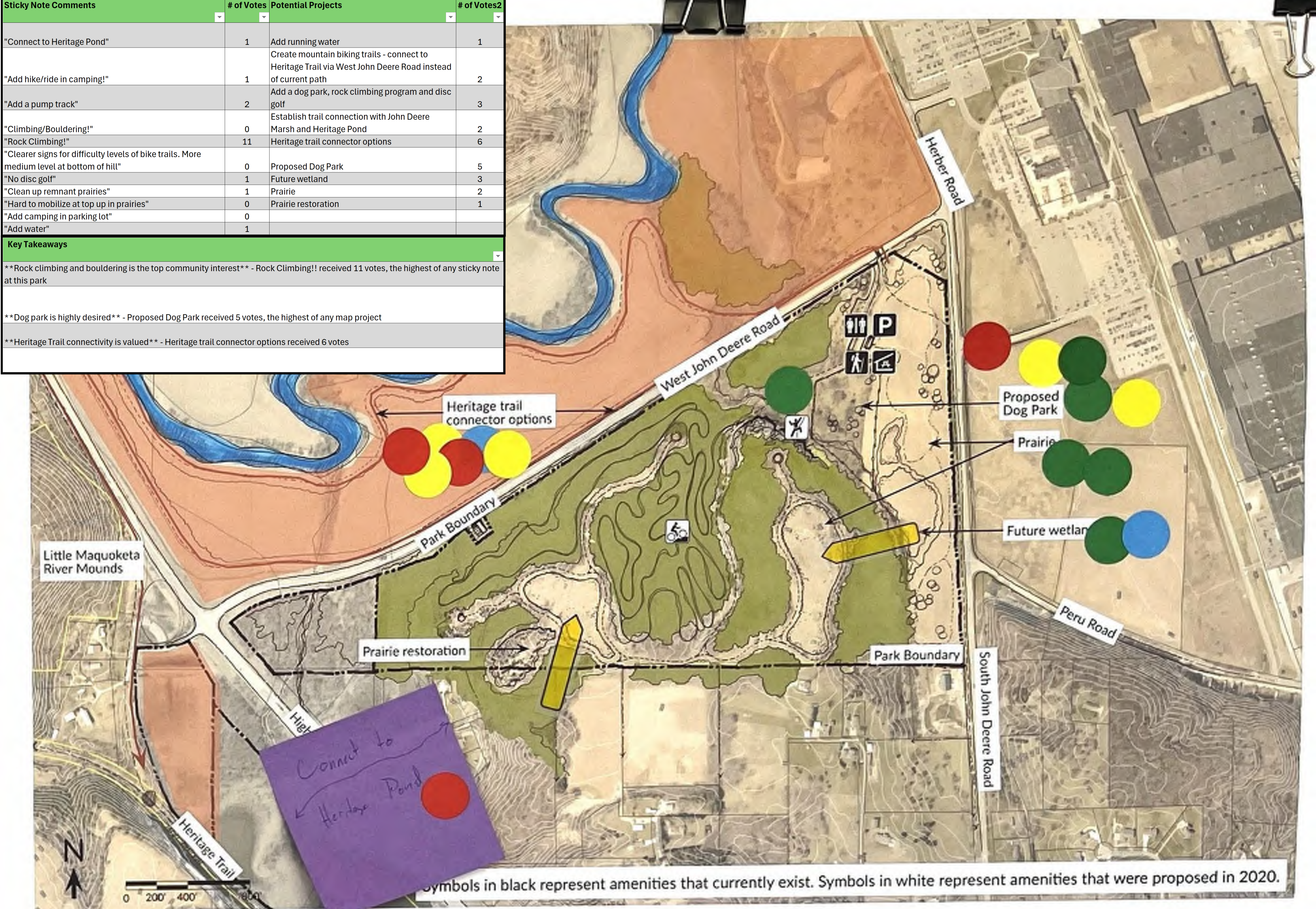
Recently Completed Park Improvements
- Installed a park shelter
- Expand parking lot
Potential Projects
- Add running water
- Create mountain biking trails – connect to Heritage Trail via West John Deere Road instead of current path
- Add a dog park, rock climbing program and disc golf
- Establish trail connection with John Deere Marsh and Heritage Pond

What Would You Like to See at This Park? Leave Your Comments Below:
Symbols in black represent amenities that currently exist. Symbols in white represent amenities that were proposed in 2020.
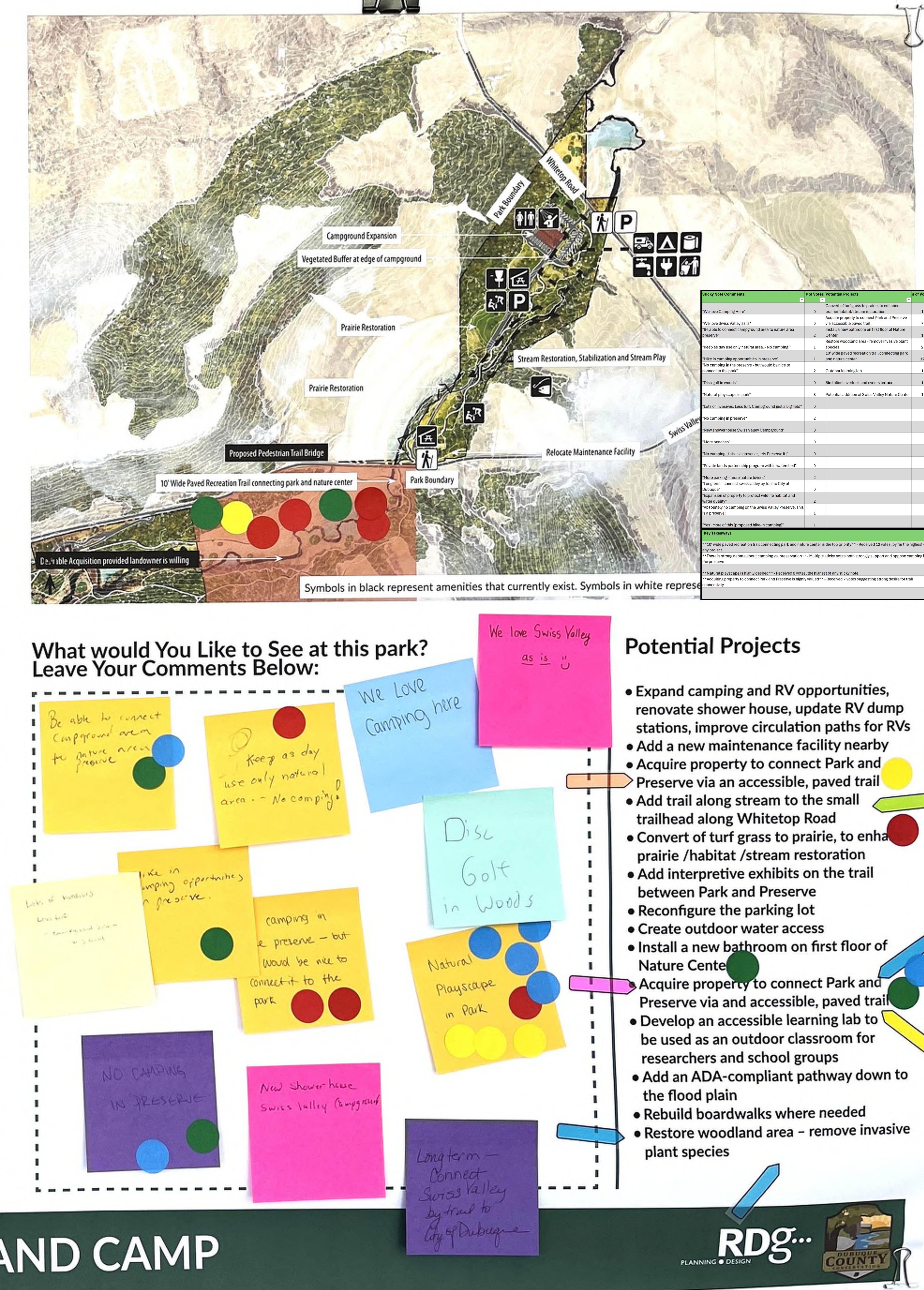
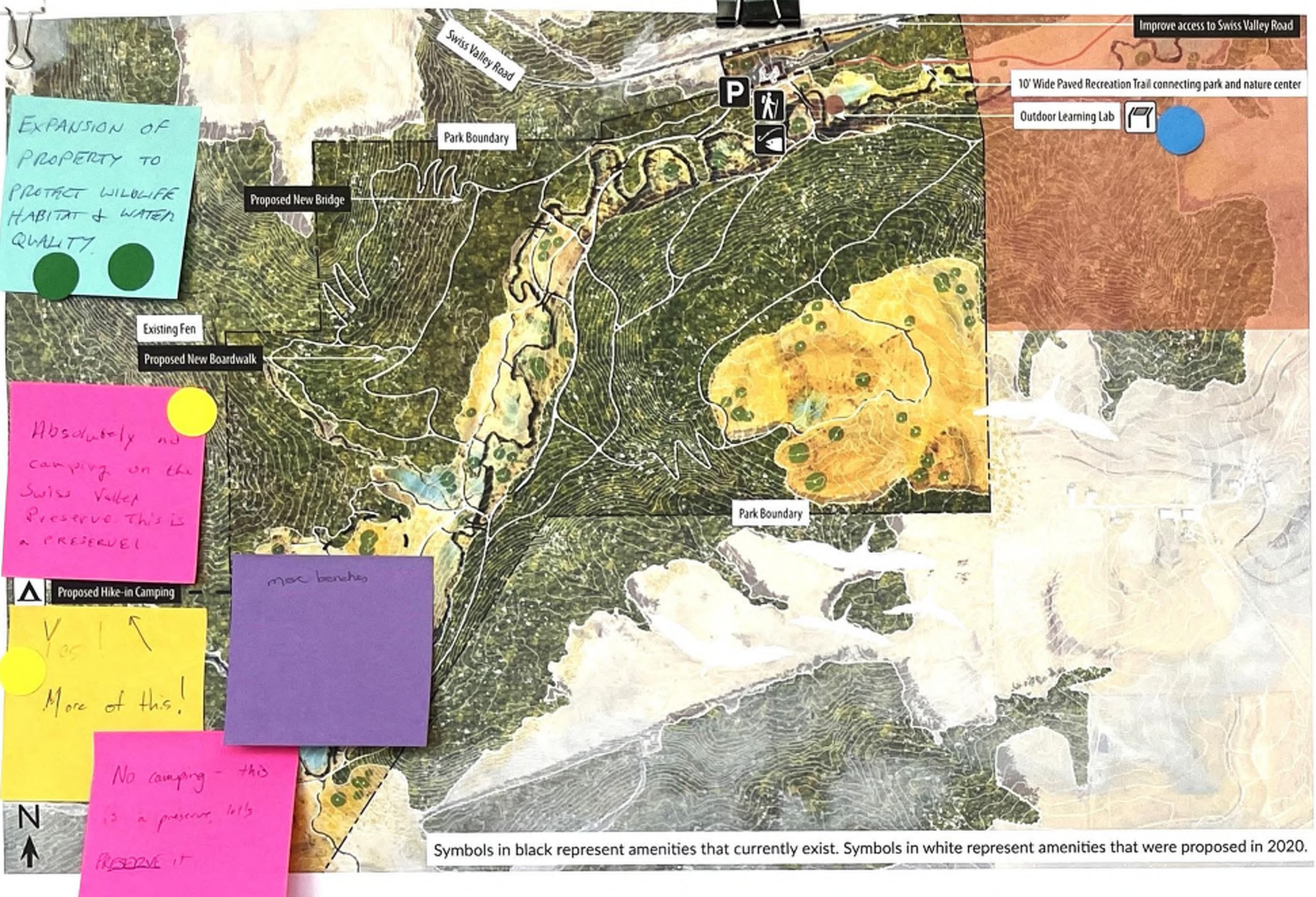
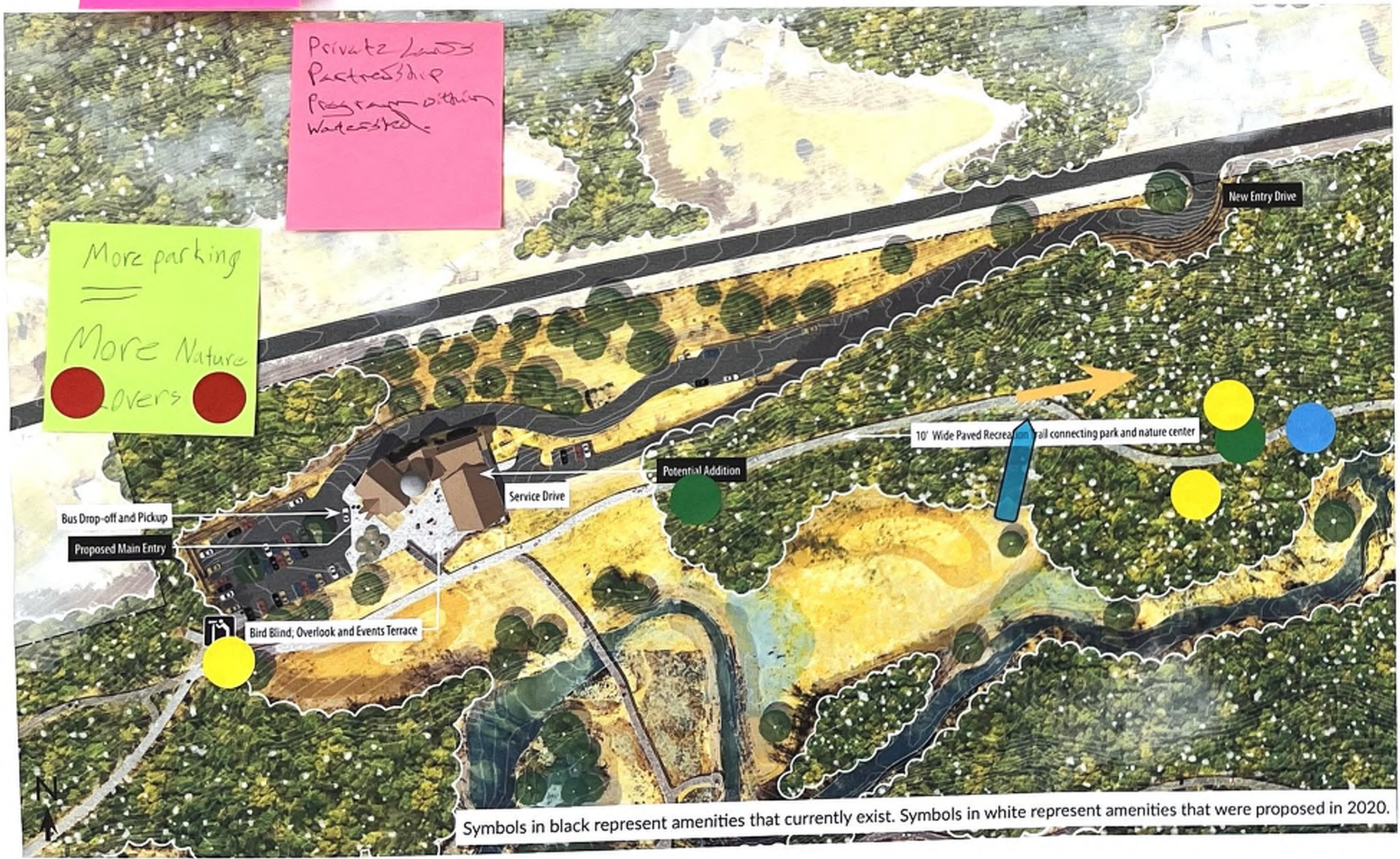
SWISS VALLEY NATURE PRESERVE, PARK, AND CAMP
Symbols in black represent amenities that currently exist. Symbols in white represent
..
Symbols in black represent amenities that currently exist. Symbols in white represent amenities that were proposed in 2020.
| Sticky Note Comments | # of Votes | Potential Projects | # of Votes |
|---|---|---|---|
| "Rock Climbing" | 5 | Perform trail maintenance | 1 |
| "Improve road and entry signage" | 3 | Acquire land if feasible | 6 |
| "Kestrel boxes accessible to volunteer citizen scientists" | 1 | Fix the drainage at the entry road to prevent washing out | 1 |
| "Outdoor classroom/small stone amphitheater" | 0 | Evaluate feasibility of rock climbing | 2 |
| "Picnic tables yes! Selfie stations no" | 4 | Add basic amenities: pit latrines, potable water, park shelter(s) for school/group visits | 3 |
| "Keep Whitewater Wild/primitive please!" | 6 | Include a drop from Whitewater Creek Water Trail | 3 |
| "More benches" | 0 | Potential interpretive exhibits | 1 |
| "Improve road for winter driving to encourage winter hiking and cross-country skiing" | 0 | Some restoration of the canyon area | 3 |
| "CLIMBING! BOULDERING!" | 2 | Woodland savanna restoration and trail connection | 2 |
| "Rock Climbing" | 0 | Rock climbing [see map] | 8 |
| "Printable map with trails & attractions caves" | 0 | ||
| "Is this area possible to climb @? Topography looks great [see map, SW of park]" | 0 | ||
| Key Takeaways | |||
| Acquiring land and rock climbing are the top priorities – Acquire land if feasible received 6 votes and rock climbing on map received 8 votes | |||
| Keeping the canyon wild and natural is important – Keep Whitewater Wild/primitive please! received 6 votes | |||
| Basic amenities are desired – Add basic amenities received 3 votes suggesting facilities are lacking | |||
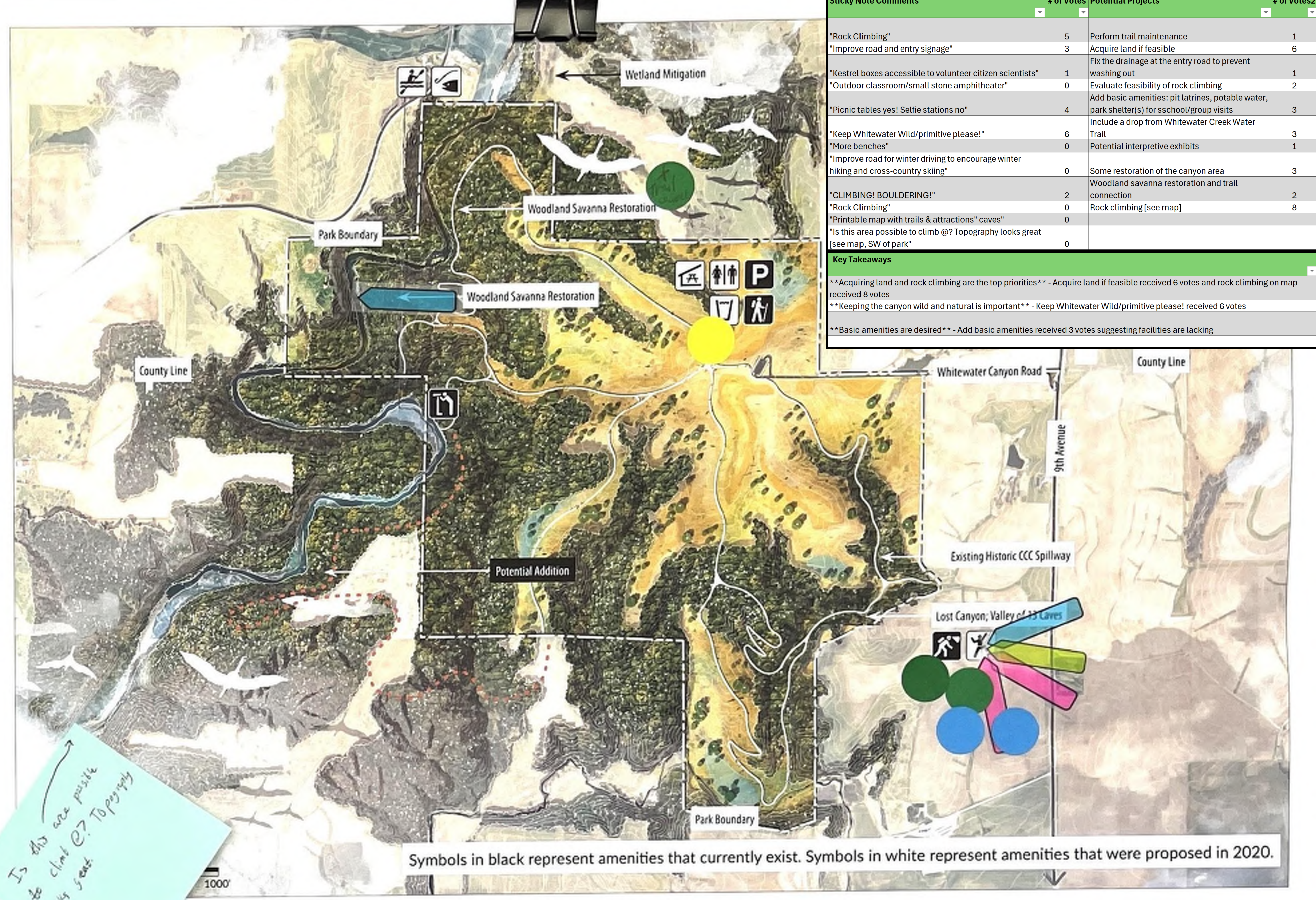
Recently Completed Park Improvements
Potential Projects
• Installed a restroom
- Perform trail maintenance
- Acquire land if feasible
- Fix the drainage at the entry road to prevent washing out
• Evaluate feasibility of rock climbing
Add basic amenities: pit latrines, potable water, park shelter(s) for school/group visits
- Some restoration of the canyon area
- Add a series of Selfie Stations
What Would You Like to See at This Park? Leave Your Comments Below:
……
Symbols in black represent amenities that currently exist. Symbols in white represent amenities that were proposed in 2020.
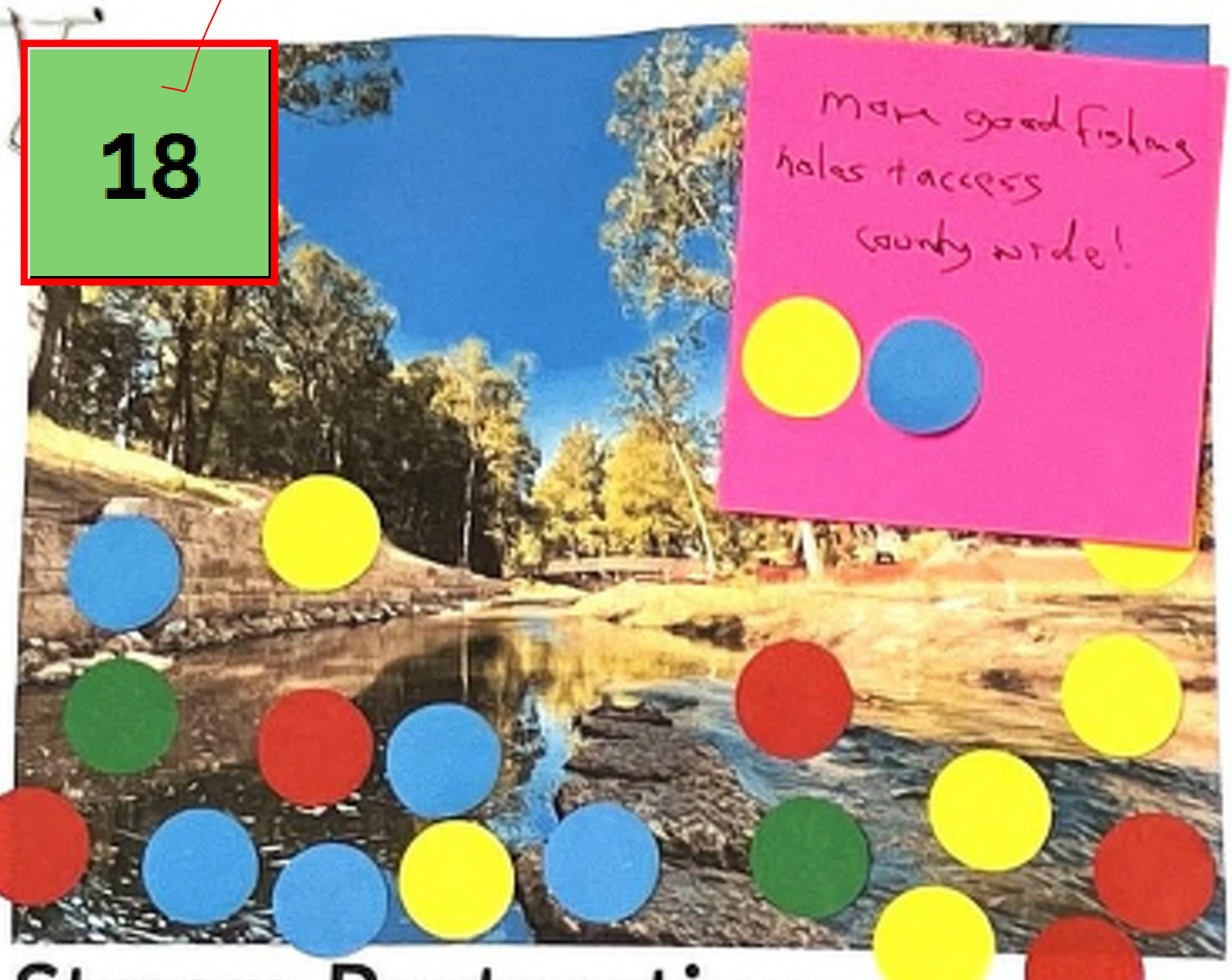
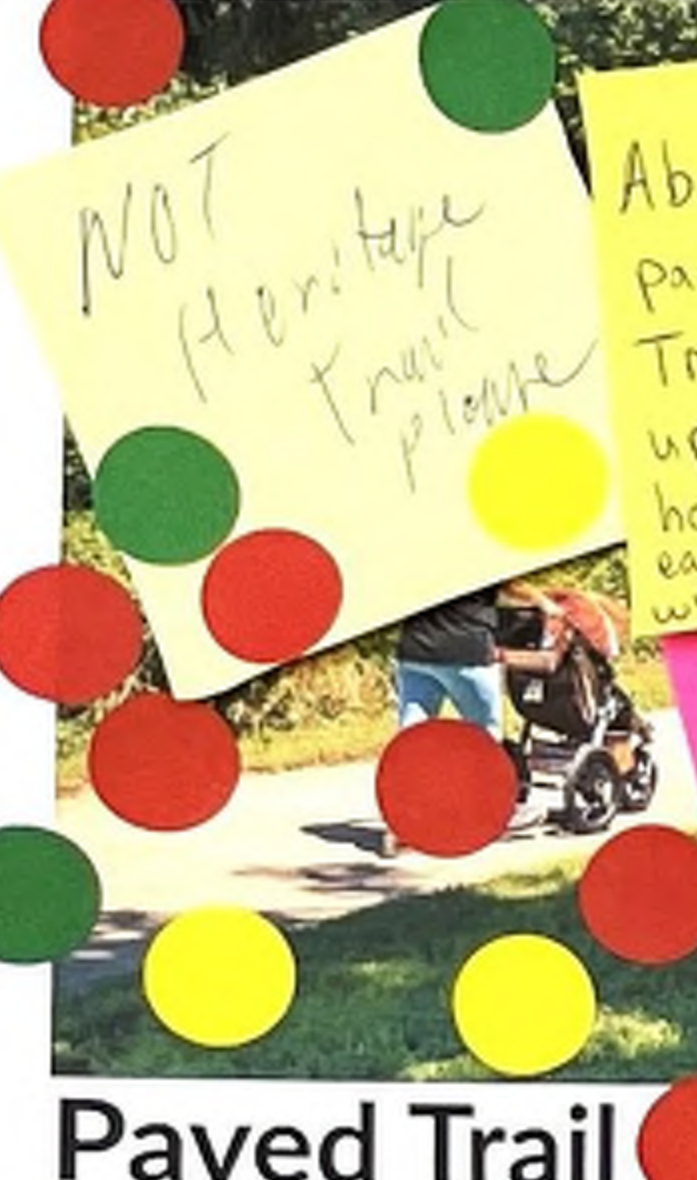
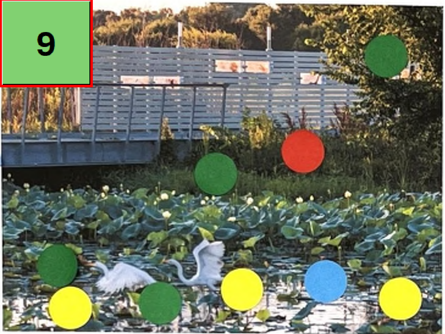
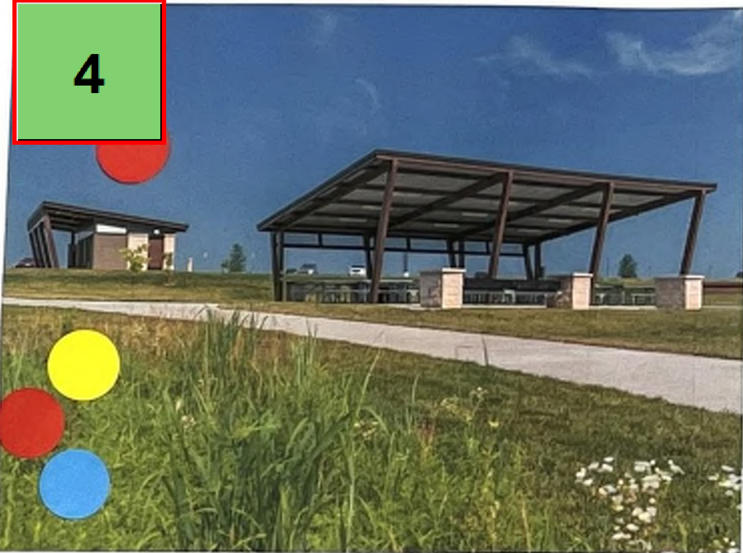
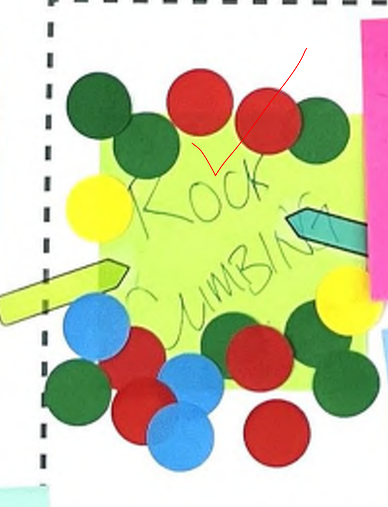
| Sticky Note Comments | # of Votes |
|---|---|
| "Rock Climbing!" | 20 |
| "Climbing/Bouldering!" | 1 |
| "Encourage wildlife viewing/appreciation with bird + bat houses, fish hides, undeveloped shoreline" | 2 |
| "Maintain hunting/fishing at existing sites" | |
| "Spaced out camping/group camping/more electric tent camping. More woodsy camping but can still drive to" | |
| "Focus more on conservation than recreation" | 4 |
| "Restrooms! Everywhere - easier to go with kids" | |
| "Private land access partnerships! Park watershed partnerships" | |
| "More places with day-use fire pits for picnics. Mines of Spain? Swiss Valley Park?" | |
| "More good fishing holes and access county wide!" | 2 |
| "All wildlife habitat" | |
| "[small boat launch] with inner tubing" | 9 |
| "Mississippi River! [fishing pier]" | |
| "Natural dog park i.e wooded or prairie grass area with trails that is fenced in. Janesville, WI or Bloomington MN have great examples 15+ acres" | |
| "No dog parks on DCCB areas" | |
| "Please more fenced dog parks, close to Dbq City" | 2 |
| "Single track MTB trails" | 1 |
Stream Restoration
Prairie Restoration
Shoreline Restoration
Fish Habitat
Small Boat Launch
Paved Trail
Bird Watching
Hiking Trails
Fire Pits
Large Shelter
Kayak Launch
Small Shelter
Fishing Pier
Disc Golf
Stream Play
Encourage wildlife viewing opportunities with bird + bat houses, fish hides, undeveloped shoreline
Fenced Dog Park
Write Your Own
Mountain Bike Trails

| Baseball/Softball Fields | 3 |
|---|---|
| Please monitor water quality wherever fishing or swimming is allowed - thanks | 1 |
| Walk bridge from town to get there over river | 4 |
| A trail loop around park | 0 |
| Bathroom water fountain | 1 |
| Trails, prairie restoration, camping! | 2 |
| Limit development and alteration as much as possible | 4 |
| Kayak launch, beach for kids, fishing | 13 |
| Swim access | 4 |
| Beverages/edible landscape | 0 |
| Single track trails, hike and potentially bike | 6 |
| City/county trail connection | 11 |
| Keep as natural as possible - add handicap access for fishing - plant remainder of crop land in prairie | 3 |
| Mountain bike trails w/ master plan to connect various areas - check out Bentonville, Arkansas | 0 |
| A great area to include ATV riding | 5 |
| Boat ramp and dock, trees, lots out here | 3 |
| Cut across? W/ kayaks [see map] | 1 |
| Kayak launch | 0 |
| Key Takeaways | |
| Stream Play and Prairie Restoration are the top precedent votes - Stream Play received 28 votes and Prairie Restoration received 24 votes, the highest of any precedents | |
| Hiking Trails and Mountain Bike Trails are highly desired - Hiking Trails received 25 votes and Mountain Bike Trails received 21 votes | |
| Kayak launch is a top priority - Kayak Launch received 16 votes on precedents and 13 votes on sticky note | |
| City/county trail connection is highly desired - Received 11 votes, the highest of any write-in sticky note | |
About Locher Recreation Area
Locher Recreation Area is a 117-acre parcel of land that has recently been acquired by Dubuque County Conservation, who was the benefactor of Eastern Iowa Conservation Foundation's efforts, as well as Pheasants Forever and the Department of Natural Resources. The area will become a new park space for the public, featuring more nature-based recreation and activities. Please leave any ideas you have on a sticky note, and use sticky dots to share your preference on elements that you would like to see in this new park space!
Location
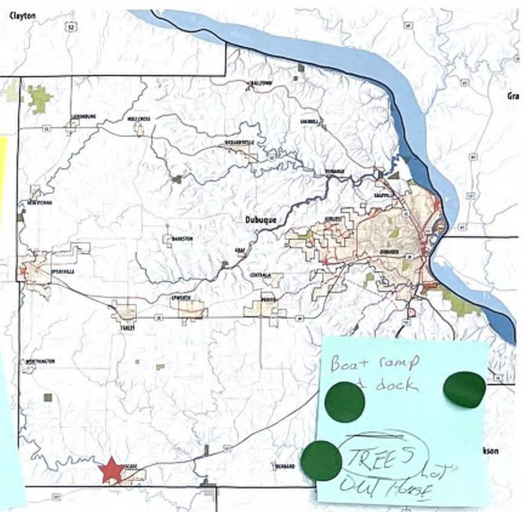
What Would You Like to See at This Park?
Leave Your Comments Below:
…
ཁེ་ཐི
Prawn
ཚང་མ་ཤི་རྒྱལ
A great area to include RTV riding
Bathroom water fountain
Limit development
Ⅰ
Ⅰ
Ⅰ
MAINTENANCE BUILDING EXISTING CONDITIONS
Maintenance Building
The existing facility does not adequately support current operational needs of the Dubuque County Conservation Board. Limited heating, no air conditioning, and insufficient on-site storage require materials and equipment to be housed at multiple locations throughout the county. In addition, the narrow driveway creates circulation issues and makes maneuvering multiple trailers difficult. The following images document these existing conditions and demonstrate the need for a new, centrally located county maintenance building.
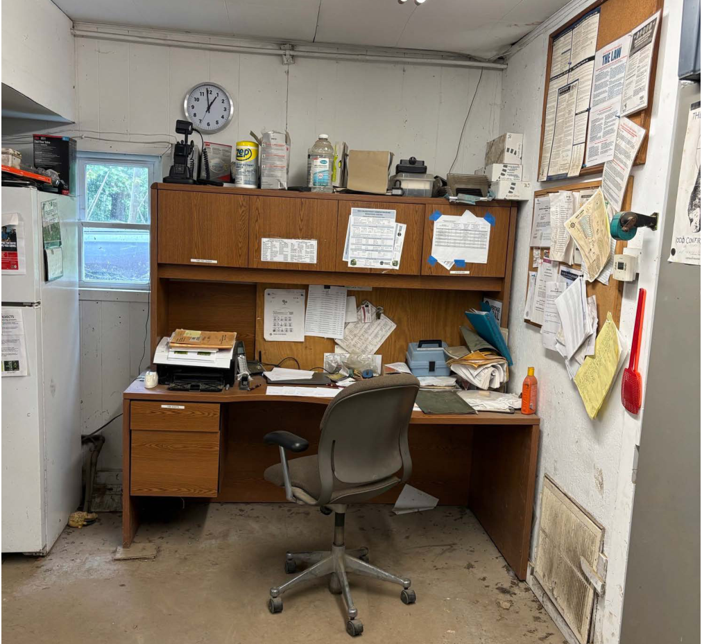
Current office space consists of one desk shared by nine employees, with inadequate room for paperwork. Future improvements should provide separate workstations or offices for park ranger and maintenance staff with appropriate storage.
THE RESTROOM CONTAINS THE ONLY EYEWASH STATION, HANDWASHING STATION, AND CHEMICAL WASH AREA. THIS PRESENTS AN EMERGENCY ACCESS CONCERN IF THE RESTROOM IS OCCUPIED. THIS IS ALSO THE ONLY TOILET SERVING NINE FULL-TIME EMPLOYEES AND UP TO FIVE SEASONAL EMPLOYEES DURING THE SUMMER.
VEHICLES ARE PARKED END-TO-END, WHICH CREATES OPERATIONAL CHALLENGES WHEN A VEHICLE OR PIECE OF EQUIPMENT IS NEEDED. THE FACILITY ALSO HAS NO FLOOR DRAINS OR DESIGNATED WASH BAY, WHICH SHOULD BE INCLUDED IN A FUTURE FACILITY.
A single picnic table within the facility serves as the staff break area; however, vehicles and equipment are parked tightly end to end, which leaves little room for employees to comfortably sit or take lunch breaks.
EXISTING STORAGE SPACE IS INSUFFICIENT FOR STAFF EQUIPMENT, WITH GEAR STORED ON TOP OF LOCKERS DUE TO LIMITED CAPACITY. THERE IS NO SPACE AVAILABLE FOR PART-TIME OR SEASONAL EMPLOYEES.
THIS PAGE INTENTIONALLY LEFT BLANK
THIS PAGE INTENTIONALLY LEFT BLANK
RDG... PLANNING DESIGN